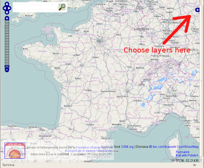
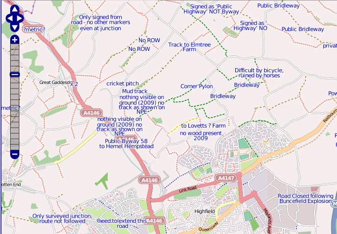
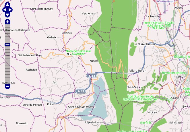
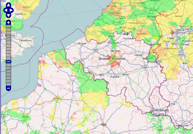
Servers/layers.openstreetmap.fr
layers.openstreetmap.fr is a tile rendering server providing map layers showing Quality Assurance information for mappers world wide and other French mapping related maps.
Maps can be seen at layers.openstreetmap.fr (OpenLayers based) or osmose.openstreetmap.fr (Leaflet based).
It is provided by the French "association" (fondation).
Key functionalities
- Provides a slippy map with image layers to help people find possible errors in the data (Quality Assurance)
- Provides layers with roads having no name, no ref, no oneway; Drawing fixmes and notes texts; and layers showing administrative surface by admin_level.
- Coverage: world
- The database is updated almost in real time (the db's date is written at the bottom), and tiles should also be mostly live thanks to osm2pgsql's dirty tile list feature.
Where to find it or information about it?
* The tool is located on layers.openstreetmap.fr
- Main information page is the page you are reading now
- Ask questions on the talk page
- Bugs/evolutions can also be submitted to github
- See the proposal to enhance validation tools based on the osm data itself that is partially supported by this tool
Base layers
- There is a less and less basic Openlayers showing you the map
- Base layer is changing every now and then
- overlays are generated from the database's copy and can be up to 24h late
- Database is updated from minutes diff so it shouldn't be too old (check the last DB update date at the bottom of the tool's page)
Overlays layers (mostly about highway=*)
no name overlay
This layer shows a red line on those features without a name=* tag.
- red line on highway=unclassified/highway=tertiary/highway=residential/highway=pedestrian/highway=living_street
- orange circle on highway=unclassified/highway=tertiary/highway=residential/highway=pedestrian/highway=living_street + junction=roundabout
This tool take advantage of the Proposed features/Internal quality adding validate:no_name=no_sign and validate:no_name=yes will stop displaying the colored line.
no oneway overlay
There is a purple line on :
- unclassified/residential/minor/road
When there are no oneway=yes or no oneway=no tag to the highway. (Keep in mind that it does not mean there is an error, it is here to help survey cities for oneway streets)
no ref overlay
There is a blue line on :
- tertiary/secondary/primary/motorway
When there are no ref=* tag on the highway
To avoid false positive this tool take advantage of the Proposed features/Internal quality validate:no_ref=no_sign or validate:no_ref=yes value
fixme/notes overlay
- An overlay is available to display the text of the fixmes and notes
my_own overlay
There is a purple line on :
- unclassified/residential/minor/road
When there are a validate:my_own=yes (should be extended later to work with any other ways )
BANO overlay
See WikiProject France/WikiProject Base Adresses Nationale Ouverte (BANO)#Rendu BANO
Administrative overlays layers
Note : If you are not aware of OSM Inspector I do recommend to give it a try as it is much better though of for geometries detections errors (with direct edit link and much more)
There is a representation of correct (as it imports well with osm2pgsql) relations boundaries. Not colored area have a problem :
- Not closed
- missing a tag
- missing a name
It should respect the proposed : Boundary relations with the use of type=multipolygon OR type=boundary (both are considered correct)
Note however that this tool is only good as an overview of an area, it doesn't tells you where the problem is and what exactly the problem is. If you want a better analysis of a relation you can use :
admin_level=4/5/6/7/10
Filled with one color when the relation is complete and okay.
admin_level=8
Shown in red/orange/yellow or green when the relation is good.
Due to data size restrictions, color based on last modifications are not shown anymore, the 4 colors choice is now only based on the OSM ID number and an arbitrary formula to simulate the creation age (see styles)
Also, areas are shown in gray when there is a topology error : singularity like self intersecting, backward ... (Only active on zoom 12 and more for server load reasons)
Ways with admin boundary
- A layer displays ways tagged with boundary=administrative with some fancy/random colors for some admin_level values, and black for all others, this helps find orphan ways (not member of a relation, or not member of a valid relation)
TODO
Support for "super-relation" (relations having relations as members ) (I hope that osm2pgsql will support it one day)
Download styles
All my mapnik styles are available to anyone for any purpose. (They might not be optimal at all, feel free to send me back patch if you find ways to improve them)
Just ask me
DISCLAIMER : Don't blame me if, using it, any form of life surrounding your house is brought to an end after your computer has melt.
| Name | Description | Stylesheet | Data sources |
|---|---|---|---|
| Cadastre | |||
| Voies sans noms | |||
| Pas de oneway | |||
| Pas de ref | |||
| Fixme tags | |||
| admin2 (Pays) | |||
| admin3 | |||
| admin4 (Régions) | |||
| admin5 | |||
| admin6 (Départements) | |||
| admin7 | |||
| admin8 (Communes) | |||
| admin9 | |||
| admin10 (Quartier) | |||
| boundary_local_authority | |||
| boundary_political | |||
| Cantons et politique | |||
| boundary_election | |||
| Ways with admin boundary | |||
| IGN Route 500© - routes | |||
| BD Carthage (IGN/ONEMO) | https://github.com/cquest/bdcarthage-cartocss/blob/master/style.mss | https://geo.data.gouv.fr/fr/datasets/54917fd94fb1cd2fcb6f5d3295dbf33acaf1847ehttps://geoservices.ign.fr/bdtopo | |
| Hillshade @ wikimedia | |||
| qa - zones à mapper (zoom>=10) | https://github.com/cquest/osmfr-qa-cartocss/blob/master/style.mss | OpenStreetMap, insee_menages,
OpenStreetMap, insee_menages, r500_communes_noeuds : données issues du Route500 de l'IGN pour l'emplacement des centres administratifs de communes (recherche de bâti) OpenStreetMap, insee_menages, r500_communes_noeuds, cadastre. | |
| brocas | |||
| cyclosm-lite |
Comments / questions / bugs
You can use github to open a ticket
You can also use the FR talk:Servers/layers.openstreetmap.fr
Those pages are in my watch list, so I will receive an e-mail if you write something in it and if you remove the "minor" flag of your edit, which is set by default when someone edit the page, and no e-mail are sent.


