So that is what inaccessible road is!
This QA tool is nowadays (2022) dead and inactive.
This article explains the typical routing problems validated with the routing validator based on OSRM data, and also contains the guidelines how to fix these problems.
Warning!
Please note that this is an automated test. There can be false-positives. Some of the cases are not currently fixable due to OSRM lack of features (There are some known issues in OSRM routing). Also, not every problem can be fixed without local knowledge. Surveying can be necessary to fix some problems properly. Please make only changes in which you are absolutely sure.
Whole world vs. your local area
OpenStreetMap is the map of the whole world, and everybody can edit it. However, it is preferable to fix problems in areas in which you know the community, conventions, language and have local knowledge.
It is possible to get routing problems for a particular area. URL should be modified in the following way:
http://peirce.gis-lab.ru/fixme/p0/<latitude>,<longitude>
Examples:
- London - http://peirce.gis-lab.ru/fixme/p0/51.51,-0.13
- Moscow - http://peirce.gis-lab.ru/fixme/p0/55.7,37.6
Typical problems
1. Single isolated way
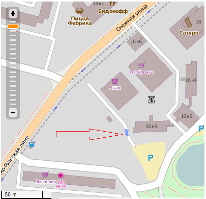
This happens often and is and a very simple problem. The way is not connected to any other way. On the related example it is the service way. Owing to coding issues, the validator only flags the part of the unconnected way, where the pointer is located.
How to fix: Connect to other ways by mapping the missing roads. If surveying is not possible, available imagery or GPS-tracks should help. On the related example the service way would be connected either to the secondary way named Snezhnaya ulitsa at the north-west end or to the unnamed residential street at the south-east end.
2. Complex of isolated ways
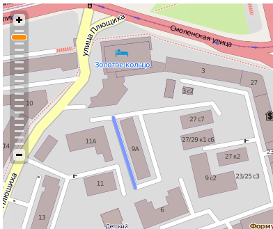
A bit more difficult. A few ways are connected together but this connection has no links to other highways around.
How to fix: Like the previous problem. Make the connection to other ways by mapping the missing roads. This might require surveying if the connections are not obvious from aerial imagery or traces. Make sure the roads have proper tags.
3. Аrea
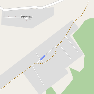
On this example, the roads appear to be connected but the square area in the middle is tagged with highway=* + area=yes. Most of the routing services, including OSRM, don't route the areas tagged this manner, and the service ways have consequently become isolated.
How to fix: Add the linear road through the area to connect the isolated ways to other roads (on the example it would be the way from residential street to service ways, tagged with highway=service). In JOSM you can easily filter out objects having area=yes and see if roads do connect properly. Alternatively, you can use area:highway=<type_of_road> on the square area.
4. Potlatched!
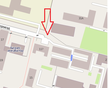
Seems okay, but only at the first look. The nodes marked with the pointer are very close to each other but are technically not connected. Such kind of problem is hard to detect visually but validation tools (including the JOSM validator) will catch them.
How to fix: Connect the nodes together, using the hotkey "M" (or "Menu" -> "Tools" -> "Merge nodes") in JOSM.
5. No way?
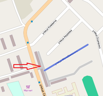
There are few ways tagged with highway=service (or highway=residential) connected together with one highway=track, which is not routable for some vehicles (depending on the rules applied in every country). The problem takes place when a mapper confuses tracks with unpaved roads.
How to fix: Change the highway=* tag, e.g. highway=unclassified and surface=unpaved.
6. Oneway road to nowhere
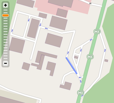
This road allows to drive in, but there is no way out. Of course, there is something wrong with the map.
How to fix: Map the missing ways, if any, or remove oneway tags that prevent to reach some parts of the grid. Of course, this requires local knowledge.
7. Access denied
This way is publicly accessible but is trapped between private roads. It should probably be tagged with access=private too. Such problem is easy to detect visually by using Mapnik, which renders private ways in a different colour.
How to fix: Add the access=private tag (or remove it on other roads). As always, this requires local knowledge.
8. Ferry
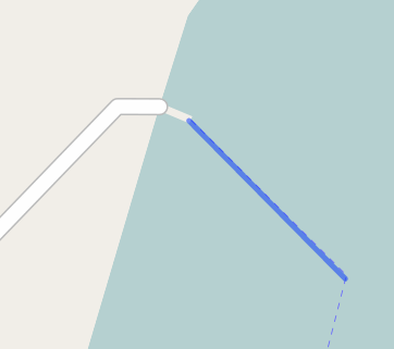
On this example the ferry is drawn as a way (route=ferry + ferry=trunk … unclassified) and is connected to the pier, which is itself connected to roads on land. As piers are not routable, the ferry is isolated.
How to fix: Add proper highway=* on the pier way or draw a way across it, if it is drawn as an area. While you are at it, you may want to check the other end of the ferry line, which may have the same problem.
What's wrong?
In some cases the validator shows places, where situation is very questionable or it is clearly all right. It may happen when the problem has already been fixed but the cache has not updated yet.
Below are other cases which presumably do not require to be fixed.
8. Go shopping
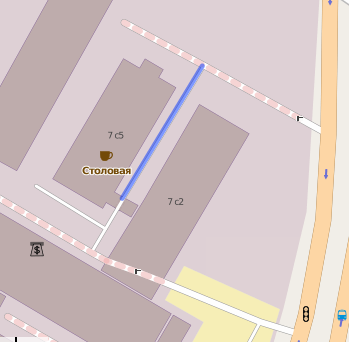
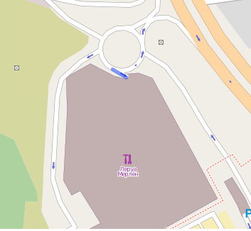
One-way road going into the building. Those situations are common, it may be an access road to a car-park inside the building or a drive-through road.
How to fix: It's not a serious problem for routing. But if you want to get rid of the issue you may want to draw roads inside the building. They may have some particular access restrictions (e.g. access=customers). Be sure to use proper tags on them (e.g. tunnel=*) to avoid creating other validation issues.
9. It's a trap!
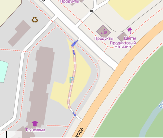
This one-way road connects a gate or lift gate with a private area/car-park, which makes it impossible to drive back.
How to fix: No need to fix, since most routers will not route through this road anyway. It may however be useful to tag the parking with access=private too, to avoid using it when the gates are open and being trapped when they close, and possibly to add opening_hours=* if still accessible sometimes (e.g. in commercial areas), and add toll information if needed.
