Software/Bada
- Reason for being historic
- Bada is discontinued.
This page will aim to collect any useful information about using a Samsung Wave phone with Bada OS for OpenStreetMap purposes.
For more general information about the operating system Bada, see Wikipedia. For information about Bada and OpenStreetMap, see also the Bada category.
Complete software list
General information
| Name | Screenshot | Display map | Navigate | Make track | Monitor | License | Price | Languages | Version | Description |
|---|---|---|---|---|---|---|---|---|---|---|
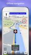
| be-on-road [1] | 
|
yes | yes | yes | ?
|
nonfreeproprietary | nonfreeFree | DE; EN; CS; NL; FR; EL; HU; IT; PL; PT; RO; RU; SK; ES; TR; UK | 2013-11-13 3.9.26385 |
Offline multi-language voice navigation app with lane-guidance assistant. Data from OSM and propietary maps. |
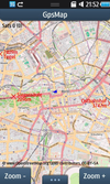
| GpsMap [2] | 
|
yes | ?
|
yes | no | nonfreeproprietary | nonfree1.99$ | DE; EN | 2011-03-01 1.1.3 |
|
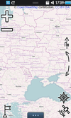
| Map-Hiker | 
|
yes | yes | no | yes | nonfreeproprietary | free | UK; EN; RU; FR; DE; PL; TR; FA | 2011-12-06 1.1.33 |
Easy to use, flexible UI, GPS, Compass, Placemarks |
| NavFree [3] | 
|
yes | yes | no | no | nonfreeproprietary | nonfreeFor Android is free. For iOS the first country is free, then €2.69. | EN; ES; DA; DE; FR; SW; IT and others | ? 1.9.8.8675 |
Free satnav app. Maps available: Andorra, Argentina, Australia, Austria, Benelux (Belgium, Netherlands, Luxembourg), Brazil, Canada, Croatia, Czech Republic, Denmark, Estonia, Finland, France, Germany, Hungary, India, Ireland, Italy, Latvia, Lithuania, Mexico, Monaco, Netherlands, New Zealand, Norway, Poland, Portugal, Slovakia, Slovenia, South Africa, Spain, Sweden, Switzerland, UK. |
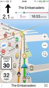
| Navitel [4] | 
|
yes | yes | yes | no | nonfreeproprietary | nonfree17€ | EN; RU | 2011-06-10 5.0.0.1620 |
Popular in Russia |
This table in the past was generated automatically by a bot. Learn more.
Map display features
| Name | Shows map as vector | Shows map as bitmap | Stores map-data on-board | Stores map-data off-board (downloads from internet) | Rotate map | 3D view |
|---|---|---|---|---|---|---|
| be-on-road | yes | no | yes | no | yes | yes |
| GpsMap | no | yes | yes | yes | no | no |
| Map-Hiker | no | yes | yes (cache) | yes | yes | no |
| NavFree | yes | no | yes (cache) | no | yes | yes |
| Navitel | yes | no | yes | no | yes | yes |
This table in the past was generated automatically by a bot. Learn more.
| Name | Navigate to point | Find location | Find nearby POIs | Navigate along predefined route | Create route manually | Calculate route | Calculate route without internet | Car routing | Bike routing | Foot routing | Turn restrictions | Navigation with voice | Keep on road | Works without GPS |
|---|---|---|---|---|---|---|---|---|---|---|---|---|---|---|
| be-on-road | yes | yes | yes | ?
|
?
|
yes | yes | yes | no | yes | yes | yes | yes;no | yes |
| Map-Hiker | no | no | yes | ?
|
?
|
?
|
?
|
yes | yes | yes | no | no | no | yes |
| NavFree | ?
|
?
|
?
|
?
|
?
|
?
|
?
|
?
|
?
|
?
|
?
|
?
|
?
|
?
|
| Navitel | yes | yes | yes | no | ?
|
yes | yes | yes | yes | yes | yes | yes | yes | yes |
This table in the past was generated automatically by a bot. Learn more.
Track making features
| Name | Customizable log interval | GPX format | KML format | NMEA format | All formats | Geo-tagged notes | Geo-tagged photos | Geo-tagged audio | Fast POI buttons |
|---|---|---|---|---|---|---|---|---|---|
| be-on-road | ?
|
?
|
?
|
?
|
?
|
?
|
?
|
?
|
?
|
| GpsMap | no | yes | no | no | gpx | ?
|
?
|
?
|
?
|
| Navitel | yes | yes | no | no | gpx | ?
|
?
|
?
|
?
|
This table in the past was generated automatically by a bot. Learn more.
Monitoring features
| Name | Show current track | Open existing track | Altitude diagram | Show DOP value | Satellite view | Show live NMEA data | Send current position via SMS | Upload current position |
|---|
This table in the past was generated automatically by a bot. Learn more.
OpenStreetMap editing features
| Name | Add POIs | Edit / Delete POIs | Edit arbitrary tags of existing OSM objects | Edit geometries | Support imagery offset DB | Upload to OSM |
|---|
This table in the past was generated automatically by a bot. Learn more.
Data Logging
A number of programs are available for collecting GPS tracks :

