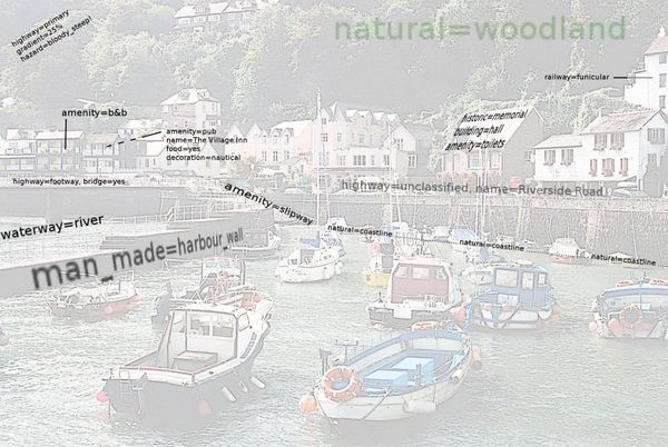
Southwest UK Mapping Party 2007
A week of Devon/North Cornwall exploration in the weekend of 31 August - 3rd September 2007, based in Bideford
Why visit?
The southwest of England has long been a white area on the OSM map of England, and anyone wishing to criticise OSM finds it very easy to say "just look at Devon/Cornwall" when illustrating our lack of completeness.
It's also rather a lovely area to explore, with enough small hills for a good workout on the bike, and plenty of good pubs and tea shops to keep you going.
Places to map
Based in Bideford, a coastal town in North Devon (near to Braunston). Right next to Exmoor, and to other North-coast villages.
For anyone in the http://geograph.org.uk/ website there are many of your "green squares" in that area, places with fewer than one Creative Commons photo per square kilometer.
Yahoo imagery now covers Plymouth, Torpoint and the Rame peninsula.
Map links
Discussion
I still have some tracks to use and tag up round the Bude area, will try and do that before this event. I don't drive and have a pda that lasts 2 hours, but it was great fun mapping footpaths and stuff in such a blank area. I could possibly be convinced to come. - LastGrape
Stuff done
(areas touched - not necessarily covered!)
| Coverage | Uploaded
| |
|---|---|---|
| Tiverton (map) | Walked around town | Yes |
| Bideford (map) | Walked around town | Some |
| Barnstaple (map) | Through roads only | - |
| Appledore (map) | - | |
| Clovelly (map) | All features | Yes |
| Hartland point (map) | Lots of country lanes | Yes |
| Westward Ho! (map) | through road only | - |
| Woolacombe (map) | Walked around | Yes |
| Ilfracombe (map) | Through roads only | - |
| Watermouth (map) | - | |
| Combe Martin (map) | Some detail | |
| Martinhoe (map) | - | |
| Lynton (map) | All roads | Yes |
| Lynmouth (map) | All features | Yes |
| Simonsbath (map) | - | |
| Exmoor (map) | Two routes across (NS and EW, including the cycle route) | Yes |
| Dulverton (map) | Touched | - |
| Exebridge (map) | Through road only | - |
| Filleigh (map) | Through road only | - |
Tagging
New tags required, or tags to check
- Funicular railway (using railway=rail just between 2 stations)
- Gradient of roads
- Cost of parking (and mark free car-parks in different colour please!)
- food=yes (on pubs)
- accommodation=yes (on pubs)
- bowling green
- I've been using leisure=pitch and sport=bowls TomChance 12:46, 6 September 2007 (BST)
- cattle grids (highway=cattle_grid)
- toll booth (with honesty box)
- place=junction (named road junctions)
- lay-by (roadside parking for 2-3 cars)
- skate park (sport=skateboard?)
- ticket office (location you need to visit before travelling a particular route - see proposed Tag:office=travel_agent?)
- public internet access (internet cafe, public library, etc)
Accommodation
- Tauntons Hotel has £40/night available for Friday/Saturday
- Knapp House camp site seems to be the closest to Bideford (about a mile or two). £6 for a tent.
Who's coming
Grant Slater - Driving from London, anyone need a lift?- Unable to make it- Ojw - With car, will have laptop (with garmin serial cable) and Geko GPS
- Robneild - Probably down Thurday to Tuesday. Staying at Knapp House camp site, Bideford. My mobile 07941122449.
- Eleanor (OJW's sister) with Geko GPS


