Spanish Cadastre/Buildings Import/Corrections
| Import guide | Projects management | Results | Documentation | |||||||||||||||||
|
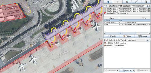
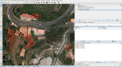
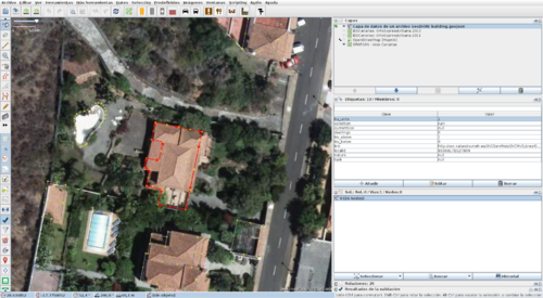
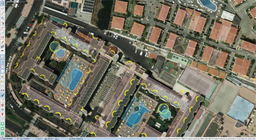
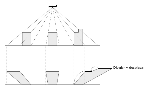
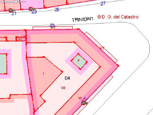
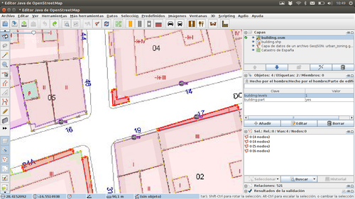
Corrections details the problems detected in the buildings import that need manual editing before uploading the data. False buildingsAmong the correct data appears a small percentage of buildings that do not correspond to any construction in reality. These geometries appear to come from the parcel data set. It is usually found in almost all airports and ports (identified by a area too big fixme during the conversion). Others are smaller, in this case we must be aware if it is a real recent building not present in the background image because it did not exist when the aerial photo was taken. Correction: If the geometry refers to an element that is not mapped in OSM, you can take advantage of it by replacing the labels with the appropriate ones. If the element is already mapped in OSM but the new geometry is more accurate, you can remove its labels and replace it ([[JOSM/Plugins/utilsplugin2#Replace geometry (Ctrl+Shift+G)|Replace geometry (Ctrl+Shift+G) option in JOSM), otherwise deleted it. We can also find a false building corresponding to a parcel with several real buildings inside. In these cases, we will find a multipolygon relation with the parcel with the outer role and the real buildings with the inner role. Eliminate this relation and do with the outer contour what you consider appropriate according to the previous paragraph: reconvert it into the appropriate feature or eliminate it. Wrong taggingSome buildings may have tag values that contradicts what you can check using other sources. The building marked in this image has a value of 'ruin' in the field 'condition'. Nevertheless, in the aerial view and in this facade image we see that it is not true. Correction: Put the correct values in the tags. Displaced geometriesIf you occasionally observe a displacement of the geometries with respect to the background image that is not due to to faults in the reference system or in the orthorectification. That is, some buildings are displaced and their neighbours are well aligned. In the image you can see buildings and swimming pools displaced with respect to the background image as opposed to other nearby buildings that do coincide. We can also see pools with incorrect shape and false buildings occupying the parcel of sports pitches. Correction: If a complete block is displaced select one of it buildings, Select all connected ways (Crtl+Shift+E) and select all inside (Alt+Shift+I). Then drag the selected objects with the mouse or with the keyboard (Shift+Arrow). If the badly positioned buildings have common walls with other correctly positioned buildings, before you move them it may be necessary to select the shared nodes and Un-Glue (G) the ways. Then you must join again the nodes using Join node to way (J) or Move node on way (N). Fix geometriesIf you find differences in the shape of an object with respect to the background image, it may be due to a constructive reform after the date in which the aerial photo was taken. If you are sure that this is not the case, but it is due an incorrect representation in Cadastre, you can make editions to correct it. At the right you can see the corrected shape of a building with the original at the left. In the building with house number 17 you can see on the right that both the shape and the position have been corrected. At the left you can see the original data. Correction: Edit using JOSM tools like lasso selection (S), align nodes in line (L), ortogonalize shape (Q), the JOSM/Plugins/BuildingsTools plugin. The building footprint must be aligned with the ground level, not with the roof as seen in perspective in the aerial image. The building parts follow a similar process, starting at the highest level, aligning with the immediate lower level until reaching ground level. See good practices to drawing of buildings (es). Tagging of multipart buildingsIf a cadastral parcel contains many buildings, all of them will share the same values in their fields, particularly for the fields conditionOfConstruction and currentUse. You have to check these cases because the values could not be the most appropriate for each building in the parcel. For example, in a detached house, the main building could be residential and it could be necessary to change some auxiliary buildings in the same parcel to garage, shed, etc. Special care must be taken with the buildings marked by Cadastre as public. You can find this, for example, in all the buildings within the parcel of a transport infrastructure (airports, train stations, ports) or in military barracks. Broadly you should check if it is possible to apply a more precise tagging to every building using the Key:building values and if there are doubts use building=yes. Addresses for multipart buildingsSimilar to the previous case, every building inside a parcel will share the same addresses in Cadastre. It has been decided to not import this address as manually editing is possible to find a more appropriate location. It could be an entrance node entrance=yes if you can locate the main entrance in the aerial image or in the facade image. If you can locate it and there is an area feature in the map (hospital, school, etc.) surrounding the buildings, you can tag the address in the street. No building:min_level attribute for building partsIn the Cadastre there is no attribute equivalent to the OSM building:min_level tag. When a part volume starts a some height (balconies, overhangs, porches, etc.) you can find two different cases. When it is digitized outside the building footprint, the conversion tool deletes the building parts outside the footprint, so they will not be in the transformed data. This image shows an example. If it is digitized within the building footprint, they will be in the transformed data, but the number of levels above ground will be incorrect. All the balconies in the previous image have building:levels=1, but in the facade images we can see that the correct value is building:levels=3, it is also necessary to add the building:min_level=* with values 1 or 2 according to the cases. See [facade image of the building with portal number 14, photo of the facade of the building with portal number 17 and [facade image of the building with portal number 21A. Correction: If we find building parts that correspond to balconies within the footprint there are two options. One is to correct the footprint and delete these parts. Another would be to visualize the facade image, check if the value of building:levels is correct and the necessary value of building:min_level and assign it. Note: It may be interesting to check the Cadastral background image and know the subparcel nomenclature codes (section 4.1 of this PDF document). |
||||||||||||||||||||

