Uploads by Qeef
Jump to navigation
Jump to search
This special page shows all uploaded files.
| Date | Name | Thumbnail | Size | Description | Versions |
|---|---|---|---|---|---|
| 19:32, 28 May 2023 | Damn.svg (file) |  |
724 bytes | Avoid style to add white background | 4 |
| 21:43, 7 April 2023 | Damn light client.png (file) |  |
173 KB | 2 | |
| 10:02, 9 February 2023 | SourceHut.svg (file) |  |
301 bytes | Yeah... well... add the (white) background | 4 |
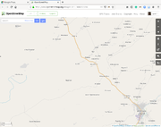
| 13:26, 17 February 2020 | Am Timan OpenStreetMap.png (file) |  |
240 KB | Screenshot of OpenStreetMap around Am Timan town. For Missing Maps presentation. Taken on Jan 23, 2020. | 1 |
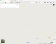
| 13:24, 17 February 2020 | Am Timan Google maps.png (file) |  |
104 KB | Screenshot of Google maps around Am Timan town. For Missing Maps presentation. Taken on Jan 23, 2020. Category: Missing Maps Project | 1 |
| 07:14, 2 July 2019 | Hand drawn MSF Map 5.png (file) |  |
2.11 MB | The MSF maps before the age of OpenStreetMap. | 1 |
| 07:14, 2 July 2019 | Hand drawn MSF map 7.jpg (file) |  |
188 KB | The MSF maps before the age of OpenStreetMap. | 1 |
| 07:13, 2 July 2019 | Hand drawn MSF map 6.jpg (file) |  |
379 KB | The MSF maps before the age of OpenStreetMap. | 1 |
| 07:13, 2 July 2019 | Hand drawn MSF map 4.jpg (file) |  |
4.89 MB | The MSF maps before the age of OpenStreetMap. | 1 |
| 07:13, 2 July 2019 | Hand drawn MSF map 3.jpg (file) |  |
181 KB | The MSF maps before the age of OpenStreetMap. | 1 |
| 07:13, 2 July 2019 | Hand drawn MSF map 2.jpg (file) |  |
67 KB | The MSF maps before the age of OpenStreetMap. | 1 |
| 07:11, 2 July 2019 | Hand drawn MSF map 1.jpg (file) |  |
113 KB | The MSF maps before the age of OpenStreetMap. | 1 |
| 21:38, 30 June 2019 | Qeef.jpg (file) |  |
81 KB | 1 |