Uploads by Segubi
Jump to navigation
Jump to search
This special page shows all uploaded files.
| Date | Name | Thumbnail | Size | Description | Versions |
|---|---|---|---|---|---|
| 16:11, 20 October 2024 | Löhne Parallelroute-Mix.jpg (file) | 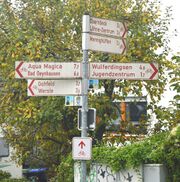 |
192 KB | {{Information | description=Unclear guideposting of a "Parallelroute" using interim signposts (route marker) for marking the parallel route. | source=Own photography | date=2024-10-19 | author=segubi }} | 1 |
| 16:08, 20 October 2024 | Löhne Parallelroute.jpg (file) | 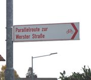 |
59 KB | {{Information | description=Misuse of dedicated destination sign as a route description | source=Own photography | date=2024-10-19 | author=segubi }} | 1 |
| 16:07, 20 October 2024 | Löhne Wegweisermix.jpg (file) | 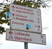 |
125 KB | {{Information | description=Mixture of different generations of guideposting system | source=Own photography | date=2024-10-19 | author=segubi }} | 1 |
| 18:18, 28 October 2023 | ID-Beispiel für Löschung.jpg (file) | 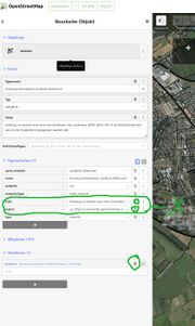 |
215 KB | {{Information | description=Beispiel für Löschung von Tags für Pathumthani | source=Own work | date=2023-10-28 | author=segubi | other_versions= }} | 1 |
| 09:21, 27 October 2023 | Zweimal Deutsche Fehnroute.jpg (file) | 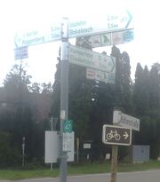 |
469 KB | {{Information | description=Zwei verschiedene Routen "Deutsche Fehnroute", einmal als Routeneinschub und ohne Logo in braun. | source=Own Photography | date=2023-10-03 | author=segubi | other_versions= }} | 1 |
| 01:03, 3 September 2023 | Pic Ziel Bahnhof (Bf).jpg (file) |  |
4 KB | {{Information | description=Zielpiktogramm Bahnhof im Radverkehrsnetz | source=Own photography | date=2023-09-03 | author=segubi | other_versions= }} | 1 |
| 01:02, 3 September 2023 | Pic Ziel Stadion.jpg (file) |  |
4 KB | {{Information | description=Zielpiktogramm Stadion im Radverkehrsnetz | source=Own photography | date=2023-09-03 | author=segubi | other_versions= }} | 1 |
| 01:02, 3 September 2023 | Pic Ziel Radstation (R).jpg (file) |  |
3 KB | {{Information | description=Zielpiktogramm Radstation im Radverkehrsnetz | source=Own photography | date=2023-09-03 | author=segubi | other_versions= }} | 1 |
| 01:02, 3 September 2023 | Pic Strecke Steigung -4% (-4%).jpg (file) |  |
3 KB | {{Information | description=Streckenpiktogramm Steigung >4% im Radverkehrsnetz | source=Own photography | date=2023-09-03 | author=segubi | other_versions= }} | 1 |
| 01:01, 3 September 2023 | Pic Ziel Touristinformation (i).jpg (file) |  |
3 KB | {{Information | description=Zielpiktogramm Touristinformation im Radverkehrsnetz | source=Own photography | date=2023-09-03 | author=segubi | other_versions= }} | 1 |
| 01:00, 3 September 2023 | Pic Strecke Freizeitstrecke (Fzs).jpg (file) |  |
3 KB | {{Information | description=Streckenpiktogramm Freizeitstrecke im Radverkehrsnetz | source=Own photography | date=2023-09-03 | author=segubi | other_versions= }} | 1 |
| 00:59, 3 September 2023 | Pic Ziel Haltepunkt.jpg (file) |  |
3 KB | {{Information | description=Zielpiktogramm Haltepunkt im Radverkehrsnetz | source=Own photography | date=2023-09-03 | author=segubi | other_versions= }} | 1 |
| 00:59, 3 September 2023 | Pic Ziel S-Bahn (S).jpg (file) |  |
4 KB | {{Information | description=Zielpiktogramm S-Bahn im Radverkehrsnetz | source=Own photography | date=2023-09-03 | author=segubi | other_versions= }} | 1 |
| 00:59, 3 September 2023 | Pic Ziel Hallenbad.jpg (file) |  |
5 KB | {{Information | description=Zielpiktogramm Hallenbad im Radverkehrsnetz | source=Own photography | date=2023-09-03 | author=segubi | other_versions= }} | 1 |
| 00:58, 3 September 2023 | Pic Ziel Freibad.jpg (file) |  |
4 KB | {{Information | description=Zielpiktogramm Freibad im Radverkehrsnetz | source=Own photography | date=2023-09-03 | author=segubi | other_versions= }} | 1 |
| 06:22, 24 July 2023 | ZIG.jpg (file) | 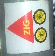 |
101 KB | {{Information | description=Route marker as sticker "ZIG" (cycling). Found as overlap with Ruhrtalradweg, but also in France near Rochefort. Exists also without letters "ZIG". | source=own photo | date=2023-07-22 | author=segubi | other_versions= }} | 1 |
| 06:09, 24 July 2023 | FIS Fietsen naar Praag.jpg (file) | 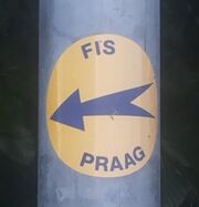 |
32 KB | {{Information | description=Route marker sticker for "Fietsen naar Praag" cycling route | source=own photo | date=2023-07-20 | author=segubi | other_versions= }} | 1 |
| 05:57, 24 July 2023 | Alt-R 47 EINSCHUB.jpg (file) | 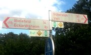 |
66 KB | {{Information | description=Altes NRW-R-Netz als Einschub (keine Fortführung), plus nicht fortgeführte Wegweisungen "Wege der Weserrenaissance" | source=own photo | date=2023-07-20 | author=segubi | other_versions= }} | 1 |
| 05:50, 24 July 2023 | Alt-R 47 Richtung Delbrück (BI).jpg (file) |  |
75 KB | {{Information | description=Remnant of R-Radwegenetz (NRW, Germany) | source=own photography | date=2023-07-20 | author=segubi | other_versions= }} | 1 |
| 17:24, 1 July 2023 | Ziegelroute Rübenroute.jpg (file) | 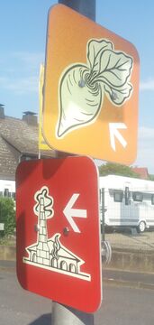 |
755 KB | {{Information | description=Route markers Ziegelroute and Rübenroute | source=own photography | date=2023-06-08 | author=segubi | other_versions= }} | 1 |
| 16:16, 1 July 2023 | Rübenroute.jpg (file) | 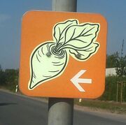 |
216 KB | {{Information | description=Rübenroute - individual route marker | source=own photography | date=2023-06-08 | author=segubi | other_versions= }} | 1 |
| 15:05, 1 July 2023 | Weser-Lippe-Abspaltung.jpg (file) | 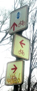 |
414 KB | {{Information | description=Routenabzweiger Weser-Lippe | source=own photography | date=2023-04-09 | author=segubi | other_versions= }} | 1 |
| 14:29, 1 July 2023 | City-Route.jpg (file) | 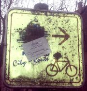 |
150 KB | {{Information | description=Remnant of "City-Route" in Herford | source=own photograph | date=2023-04-09 | author=segubi | other_versions= }} | 1 |
| 14:16, 1 July 2023 | Herford alte und neue Wegweisung im Widerspruch.jpg (file) |  |
249 KB | {{Information | description=Coexistence of old and new guidance systems with discrepancies | source=own picture | date=2023-04-09 | author=segubi | other_versions= }} | 1 |
| 04:36, 12 June 2023 | Bünde Radverkehrsnetz alt.jpg (file) | 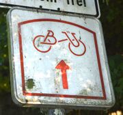 |
391 KB | {{Information | description=Old route marker of the cycling network Bünde (BÜ in the logo) | source=Own photography | date=2023-06-11 | author=segubi | other_versions= }} | 1 |
| 09:30, 1 November 2022 | Eurovelo15 Rhein (BW).jpg (file) | 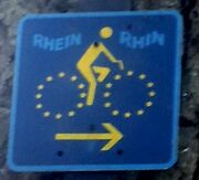 |
40 KB | {{Information | description=Alte Zwischenwegweisung Eurovelo Rhein/Rhin (Entspricht wohl heutigem Eurovelo 15) | source=own photography | date=2022-10-05 | author=segubi | permission= | other_versions= }} | 1 |
| 09:29, 1 November 2022 | BW Fernweg route marker.jpg (file) |  |
299 KB | {{Information | description=Alte Zwischenwegweisung "Fernweg", unklar welcher (Kreis Karlsruhe) | source=own photography | date=2022-10-05 | author=segubi | permission= | other_versions= }} | 1 |
| 09:27, 1 November 2022 | BW Philippsburg 1, 5 route marker.jpg (file) |  |
274 KB | {{Information | description=Routenmarkierung für Route 1 und 5 in Philippsburg (Kreis Karlsruhe) | source=own photography | date=2022-10-05 | author=segubi | permission= | other_versions= }} | 1 |
| 09:26, 1 November 2022 | BW KA Old guidepost Alt Dettenheim.jpg (file) |  |
93 KB | {{Information | description=Alter Radwegweiser Alt-Dettenheim, Kreis Karlsruhe | source=own photography | date=2022-10-05 | author=segubi | permission= | other_versions= }} | 1 |
| 09:22, 1 November 2022 | BW bruchsal route marker RadNETZ boden.jpg (file) |  |
44 KB | {{Information | description=Zwischenwegweisung durch Straßenmarkierung (Bruchsal) | source=own photography | date=2022-10-06 | author=segubi | permission= | other_versions= }} | 1 |
| 09:22, 1 November 2022 | BW KA Bruchsal old route marker.jpg (file) |  |
190 KB | {{Information | description=Alter Zwischenwegweiser in Bruchsal | source=own photography | date=2022-10-06 | author=segubi | permission= | other_versions= }} | 1 |
| 09:19, 1 November 2022 | BW route marker.jpg (file) | 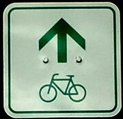 |
31 KB | {{Information | description=Grüner Zwischenwegweiser Baden-Württemberg | source=own photography | date=2022-10-06 | author=segubi | permission= | other_versions= }} | 1 |
| 09:18, 1 November 2022 | HE route marker Radfernweg.jpg (file) |  |
90 KB | {{Information | description=Zwischenwegweiser für hessischen Radfernweg (nicht konsequent eingesetzt) | source=own photography | date=2022-10-06 | author=segubi | permission= | other_versions= }} | 1 |
| 09:17, 1 November 2022 | HE Radfernweg Lageskizze.jpg (file) | 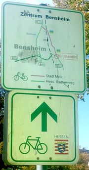 |
230 KB | {{Information | description=Routenmarkierung Hessischer Radfernweg zusammen mit Ortsübersichtskarte | source=own photography | date=2022-10-06 | author=segubi | permission= | other_versions= }} | 1 |
| 09:16, 1 November 2022 | HE HP Bensheim konkurrierende Wegweisung.jpg (file) |  |
357 KB | {{Information | description=Zum hessischen Radnetz konkurrierende Wegweisung Kreis Bergstraße/Bensheim | source=own photography | date=2022-10-06 | author=segubi | permission= | other_versions= }} | 1 |
| 09:13, 1 November 2022 | HE Radfernweg R8 Wegweiser.jpg (file) |  |
104 KB | {{Information | description=Hessischer Radfernweg R8 mit Hessischem Wappen auch auf Zielwegweisung | source=own photography | date=2022-10-06 | author=segubi | permission= | other_versions= }} | 1 |
| 09:12, 1 November 2022 | HE DA Routenaufzweigung ohne Zielwegweisung.jpg (file) |  |
148 KB | {{Information | description=Routenaufzweigung ohne Zielwegweisung, Hessicher Radfernweg 8 und Themenroute | source=own photography | date=2022-10-06 | author=segubi | permission= | other_versions= }} | 1 |
| 09:10, 1 November 2022 | HE DA route marker und Abzweig 28.jpg (file) |  |
137 KB | {{Information | description=Zwischenwegweiser im regulären hessischen Fahrradnetzwerk und Darmstädter Route 28 als Abzweig auf selbem Schild | source=own photography | date=2022-10-06 | author=segubi | permission= | other_versions= }} | 1 |
| 09:09, 1 November 2022 | HE DA Nummerierte Route 15 als Aufkleber.jpg (file) |  |
222 KB | {{Information | description=Darmstadt Fahrradroute 15 als Aufkleber auf Pfosten | source=own photography | date=2022-10-06 | author=segubi | permission= | other_versions= }} | 1 |
| 09:08, 1 November 2022 | HE DA Drei Systeme nebeneinander.jpg (file) |  |
770 KB | {{Information | description=Drei Wegweisungskonzepte an einem Knoten (Routenzwischenwegweiser, Routeneinschub an Zielwegweiser, Routenaufkleber auf Pfosten) | source=own photography | date=2022-10-06 | author=segubi | permission= | other_versions= }} | 1 |
| 09:06, 1 November 2022 | HE DA Radfernweg direkt auf Wegweiser.jpg (file) | 87 KB | {{Information | description=Hessischer Radfernweg in Zielwegweisung integriert | source=own photography | date=2022-10-06 | author=segubi | permission= | other_versions= }} | 1 | |
| 09:05, 1 November 2022 | HE DA Radfernweg als Routeneinschub.jpg (file) |  |
241 KB | {{Information | description=Hesserischer Radfernweg als Routeneinschub | source=own photography | date=2022-10-06 | author=segubi | permission= | other_versions= }} | 1 |
| 09:04, 1 November 2022 | HE DA Routeneinschub 26.jpg (file) | 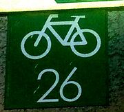 |
41 KB | {{Information | description=Darmstadt, Lokales Radroutensystem mit Routennummern als Routeneinschub | source=own photography | date=2022-10-06 | author=segubi | permission= | other_versions= }} | 1 |
| 20:54, 25 October 2022 | GT R20 Routeneinschub aktuell.jpg (file) | 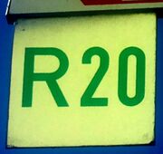 |
49 KB | {{Information | description=Aktueller Routeneinschub Gütersloher Radrundweg 20 | source=own photography | date=2022-10-09 | author=segubi | permission= | other_versions= }} | 1 |
| 20:53, 25 October 2022 | GT R21 Routeneinschub aktuell.jpg (file) | 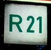 |
21 KB | {{Information | description=Aktueller Routeneinschub Gütersloher Rundweg 21 | source=own photography | date=2022-10-09 | author=segubi | permission= | other_versions= }} | 1 |
| 20:52, 25 October 2022 | GT Verl - Verler Kirchwege.jpg (file) |  |
32 KB | {{Information | description=Verler Kirchwege, außerhalb NRW-Radverkehrsnetz | source=own photography | date=2022-10-09 | author=segubi | permission= | other_versions= }} | 1 |
| 20:51, 25 October 2022 | GT Verl - St. Anna Route.jpg (file) |  |
31 KB | {{Information | description=Verler St.-Anna-Route, außerhalb NRW-Radverkehrsnetz | source=own photography | date=2022-10-09 | author=segubi | permission= | other_versions= }} | 1 |
| 20:50, 25 October 2022 | GT R21 alter Zwischenwegweiser.jpg (file) | 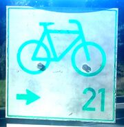 |
63 KB | {{Information | description=Zwischenwegweiser für Rundweg 21 im Kreis Gütersloh, vormals auch als GT21 getaggt, jetzt sonst R21 markiert. Nicht mit R-Netz zu verwechseln! | source=own photography | date=2022-10-09 | author=segubi | permission= | other_versions= }} | 1 |
| 20:48, 25 October 2022 | GT Rundweg Kaunitz (Rest).jpg (file) | 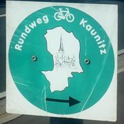 |
50 KB | {{Information | description=Rundweg Kaunitz (Kreis Gütersloh), Reste, außerhalb NRW-Radverkehrsnetz | source=own photography | date=2022-10-09 | author=segubi | permission= | other_versions= }} | 1 |
| 20:46, 25 October 2022 | GT Westerwieher Radrunde.jpg (file) | 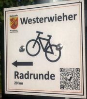 |
194 KB | {{Information | description=Westerwieher Radrunde außerhalb NRW-Radverkehrsnetz | source=own photography | date=2022-10-09 | author=segubi | permission= | other_versions= }} | 1 |