Uploads by Ve6srv
Jump to navigation
Jump to search
This special page shows all uploaded files.
| Date | Name | Thumbnail | Size | Description | Versions |
|---|---|---|---|---|---|
| 16:36, 6 April 2013 | Outline1.png (file) | 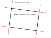 |
30 KB | Image showing how using GPS positions captured by extending the sightlines along buildings can then be used to draw the actual building outline. More GPS locations are required to be captured, but GPS position ambiguity is reduced due to being clear of... | 1 |
| 16:05, 6 April 2013 | Extension.png (file) |  |
20 KB | A visual depiction of how using a sight line along a building face can help to reduce the position ambiguity of a GPS unit. Standing close to a building blocks the GPS signal reception, degrading position accuracy even more than normal. Moving out away... | 1 |
| 16:25, 12 August 2012 | Yaac.png (file) | 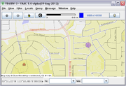 |
33 KB | Screenshot from YAAC | 1 |
| 16:01, 12 August 2012 | Aprsis32.gif (file) | 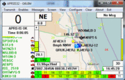 |
29 KB | Screenshot of APRSISCE/32 running on Windows 7. | 1 |
| 16:31, 11 July 2010 | PotlatchConvert.png (file) | 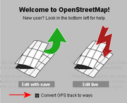 |
28 KB | Screenshot from Potlatch showing convert GPS trace to ways. | 2 |
| 16:29, 11 July 2010 | EditGPX.png (file) |  |
7 KB | Edit link on GPX file viewing page. | 1 |
| 16:23, 11 July 2010 | PotlatchUnlock.png (file) |  |
41 KB | Screenshot showing Unlock locked ways icon on Potlatch | 1 |
| 16:23, 11 July 2010 | PotlatchLockedWays.png (file) | 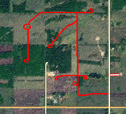 |
138 KB | Screenshot showing locked ways on Potlatch | 1 |
| 02:57, 26 April 2009 | OCH.png (file) |  |
2 KB | 1 | |
| 02:57, 26 April 2009 | NSSH.png (file) |  |
2 KB | 1 | |
| 02:56, 26 April 2009 | NLPH.png (file) |  |
2 KB | 1 | |
| 02:54, 26 April 2009 | QPH.png (file) |  |
2 KB | 1 |