Proposal:Tagging for complex junctions
| Tagging for complex junctions | |
|---|---|
| Proposal status: | Approved (active) |
| Proposed by: | sommerluk |
| Tagging: | junction=yes |
| Applies to: | |
| Definition: | The area of a junction |
| Statistics: |
|
| Rendered as: | Render the name of the junction (usually horizontally) |
| Draft started: | 2014-10-18 |
| RFC start: | 2014-10-18 |
| Vote start: | 2014-11-02 |
| Vote end: | 2014-11-16 |
Current status of junction mapping
We have yet a tag for junctions: junction=yes, which is applied on nodes. This works well for simple junctions (like T junctions or X junctions of simple roads). This tagging is widely used, for example in Korea. At openstreetmap.org (openstreetmap-carto) this feature is rendered. The current practice has clear rules for simple intersections: You will tag the node that connects the two ways. This is accepted by the community and works also well for software developers (both rendering engines and routing/turn-to-turn navigatin engines). No change is necessary for simple junctions.
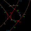
But we do not have a possiblity to map complex junctions well! Junctions can be quite complex, with many lanes, with many separated carriageways. Just consider the example at the right. Currently there is no clear tagging rule for this type of junctions.
Proposal
For simple situations, the current situation is fine.
To map complex junctions we draw an area (a closed way) around the junction area as found on the ground. The area is tagged with junction=yes. The area shares nodes with the the incoming and outgoing ways, so routing/turn-to-turn navigation engines can determine which ways are concerned. To define clearly what belongs to the area and what does not belong to the area, we require for the shared nodes (shared between the area and the incoming/outgoing highways)
- that they shall not have any tags themself.
- that they are shared between the area and only one highway, not multiple highways.
Rationale
The proposed tagging is a simple and intuitive approach. It is easy to create this tagging with iD or JOSM.
It gives information about the extension of a junction. This can be useful for routing/turn-to-turn navigation engines. Because they know now what exactly belongs to a junction, they could count them and say for example “Go to the left at the second junction.”
In some countries, people orient themselves in the local area using the names of road junctions (Korea) rather then the names of streets. While street names also exist, they are not important for orientation. See “Named spots instead of street names” for details. In other countries (Poland…) some big junctions (usually interchanges) are named. This feature is very important in some countries – even more important than street names! In these case the tagging is used together with name=*.
In these countries, routing/turn-to-turn navigation engines could say things like “Go to the right in the XYZ junction.”
Voting
Voting on this proposal has been closed.
It was approved with 11 votes for and 1 vote against.
 I approve this proposal. Sommerluk (talk) 07:56, 2 November 2014 (UTC)
 I approve and use this proposal. Mateusz Konieczny (talk) 08:29, 2 November 2014 (UTC)
 I approve this proposal. Javbw (talk) 08:34, 2 November 2014 (UTC)
 I approve this proposal. --Floscher (talk) 11:18, 2 November 2014 (UTC)
 I approve this proposal. Sdoerr (talk) 14:26, 2 November 2014 (UTC)
 I approve this proposal. AlaskaDave (talk) 15:10, 2 November 2014 (UTC)
 I approve this proposal. nyampire (talk) 23:15, 2 November 2014 (UTC)
 I approve this proposal. Fanfouer (talk) 09:59, 3 November 2014 (UTC)
 I oppose this proposal. The proposal has not been thought through at all, and completely ignores all arguments from similar proposals. Eckhart (talk) 17:29, 3 November 2014 (UTC)
- "all arguments" - for example? Mateusz Konieczny (talk) 13:05, 4 November 2014 (UTC)
 I approve this proposal. Janko (talk) 22:37, 4 November 2014 (UTC)
 I approve this proposal. Xxzme (talk) 08:34, 12 November 2014 (UTC)
 I approve this proposal. Though it might be a bit tough on some junctions with roads below/above them and differing layer=* --rayquaza (talk) 09:09, 16 November 2014 (UTC)


