Tag:highway=service
Jump to navigation
Jump to search
| Description |
|---|
| Generally for access to a building, motorway service station, beach, campsite, industrial estate, business park, etc. |
| Rendering in OSM Carto |

|
| Group: highways |
| Used on these elements |
| Useful combination |
| Status: de facto |
| Tools for this tag |
|
Generally for access to a building, motorway service station, beach, campsite, industrial estate, business park, etc.
This is also commonly used for access to parking, driveways, and alleys.
How to map
To map service ways nothing else than a simple way is required. Add the highway=service tag to it and a name=* if appropriate.
To define a service way in more detail, see Key:service.
Examples
| Picture/Description | Tags | Mapnik | Osmarender |
|---|---|---|---|
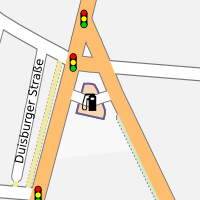
| service way for access to a fuel station | amenity=fuel name=Classic also an area with building=yes and a way as highway=service |
--- | 
|
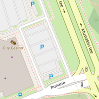
| service way for a parking lot. | area with amenity=parking and a way highway=service service=parking_aisle |

| |
| a driveway is a service road leading to a residence or business | highway=service service=driveway |
||
| a road between properties | highway=service service=alley |
See Also
- service=parking_aisle
- highway=services—not to be mixed up with!

