Key:parking:lane
| parking:lane | |
|---|---|
| Proposal status: | Draft (under way) |
| Proposed by: | kay_D, Nighto |
| Tagging: | parking:lane,parking:condition=parallel,perpendicular,diagonal,no_parking,no_stopping,residents,customers,private,free,fee |
| Applies to: | way |
| Definition: | In most streets, there are lanes specific for parking, in one or both sides. |
| Statistics: |
|
| Rendered as: | tagged together with highway=* but with a border marking the parking. Viewable at high zoom levels. |
Summary
(This page is currently a merger of Proposed_features/parking_lane and User:Kay_D/parking and thus work in progress.)
I propose we should mark whether or not the streets have parking, and in which side.
It should not be required or even encouraged that the ways would be split for short implicit parking prohibitions; that is just before and after a junction or a driveway.
Reasoning
Quoting Wikipedia:
"Many streets, especially side streets in residential areas, have an extra lane's width on either or both sides for parallel parking. Most minor side streets allowing free parallel parking do not have pavement markings designating the parking lane. Main streets more often have parking lanes marked. Some streets are too busy or narrow for parking on the side. Sometimes parking on the sides of streets is allowed only at certain times. Curbside signs often state regulations about parking. Some streets, particularly in business areas, may have parking meters into which coins must be paid to allow parking in the adjacent space for a limited time. Other parking meters work on a credit card and ticket basis or pay and display. Parking lane markings on the pavement may designate the meter corresponding to a parking space. Some wide streets with light traffic allow angle parking."
Lane Parking
There are some widely accepted tags for tagging parking lots, see Approved_features/Parking . E.g.
- amenity=parking
- keys: "parking", "fee" and "disabled_spaces"
Proposal
We propose the following extension to handle lane parking:
highway=x-- the proposal is currently thought only for highways.
Specifying the parking space
The parking:lane tag is used to describe the "physical" properties of the road. This means space properties.
The left and right hand side are differenciated by appending :left, :right, or :both to the parking:lane tag. It is intentional to use left and right instead of forward and backward, because parking space is about location, not direction. E.g. a one-way has sometimes parking space at the left and at the right hand side, but no "backward" parking.
Possible tag values are: parallel, diagonal, perpendicular, no_parking, no_stopping, fire_lane. Please note that the latter three are considered "physical" tags, this means: parking is not possible, so no parking:condition tag (see below) is required in those cases.
| Tag | Description |
|---|---|
highway=x |
Generic tag for the highway in question. |
parking:lane:side=type |
side is always left, right or both.type is |
Examples
parking:lane:both=parallel-- both on the left and right hand side parallel parking is possible.parking:lane:right=perpendicular-- on the right hand side you can park perpendicularly.parking:lane:left=fire_lane-- stopping is not possible on the left hand side due to fire considerations. (Normally there will be a sign for this.)
Possible Enhancements
Specifying the maximum capacity for a given stretch of parking (especially for parking:lane:side=perpendicular)
parking:lane:right:capacity=9parking:lane:right:capacity:disabled=2
Specifying the parking conditions (terms)
The parking:condition tag describes the legal properties of the parking space. The left and right hand side are differenciated by appending :left, :right, or :both.
Possible tag values are: free, ticket, disc, residents, private, (disabled?)
| Tag | Description |
|---|---|
highway=x |
Generic tag for the highway in question. |
parking:lane:side=type |
side: left, right or both.type is |
parking:condition:side=type |
side: left, right or both.type is |
Depending on the condition, some addtional information needs to be given:
free: No additional information is required.
ticket: To be discussed. Maybe add a parking:condition:side:fee_per_hour=1 € tag
disc: Add a parking:condition:side:maxstay=2 h tag. This means you may park here for upto 2 hours.
residents: Add a parking:condition:side:residents=A tag. This means "parking only for residents with permission A" (With A being the identification of the permission). 
customers: No additional information is required. This means you are only allowed to park here if you are a customer of the shop that owns this parking space (or a visitor of a site, or a guest of a hotel, or similar).
private: No additional information is required. This means you are only allowed to park here if you rented the parking space (or have a permission of the owner).
Possible Enhancements
Maybe add a
disabled=[yes,no]?
Specifying time intervals (optional)
In many occasions, parking conditions are time limited. I propose
to use the following tag:
parking:condition:side:time_interval=interval.
interval specifies both sets of weekdays and times, plus it can be multiplied.
It uses the same syntax for values as opening_hours.
The format is complicated to define technically, but easy to understand by examples:
12:00-14:00means: "every day from 12:00 until 14:00"Mo-Fr 00:00-24:00means: "every weekday (except Saturday and Sunday)"Su 20:00-06:00means: "Sunday night from 20:00 until (Monday) 06:00"
Intervals may be joined by semicolons with optional whitespace:
Mo-Fr 09:00-20:00; Sa-Su 09:00-12:00means: "Weekdays 9 to 20, and weekends 9 to 14"
This tag is applicable especially for disc and residents parking.
| Tag | Description |
|---|---|
parking:condition:side:time_interval=interval |
side: left, right or both.interval is something like |
Specifying maximum stay limits (optional)
Please use parking:condition:side:maxstay to specify maximum stay limits. Use it consistently with the format described here. This tag is applicable especially for disc parking.
Example tagging
| Sign | Tags |
|---|---|

|
parking:lane:right=parallelparking:condition:right=freeparking:condition:right:time_interval=18:00-10:00(Please see discussion about default rules) |

|
parking:lane:right=perpendicularparking:condition:right=discparking:condition:right:maxstay=1 hparking:condition:right:time_interval=Mo-Fr 09:00-18:00;Sa 09:00-14:00
|

|
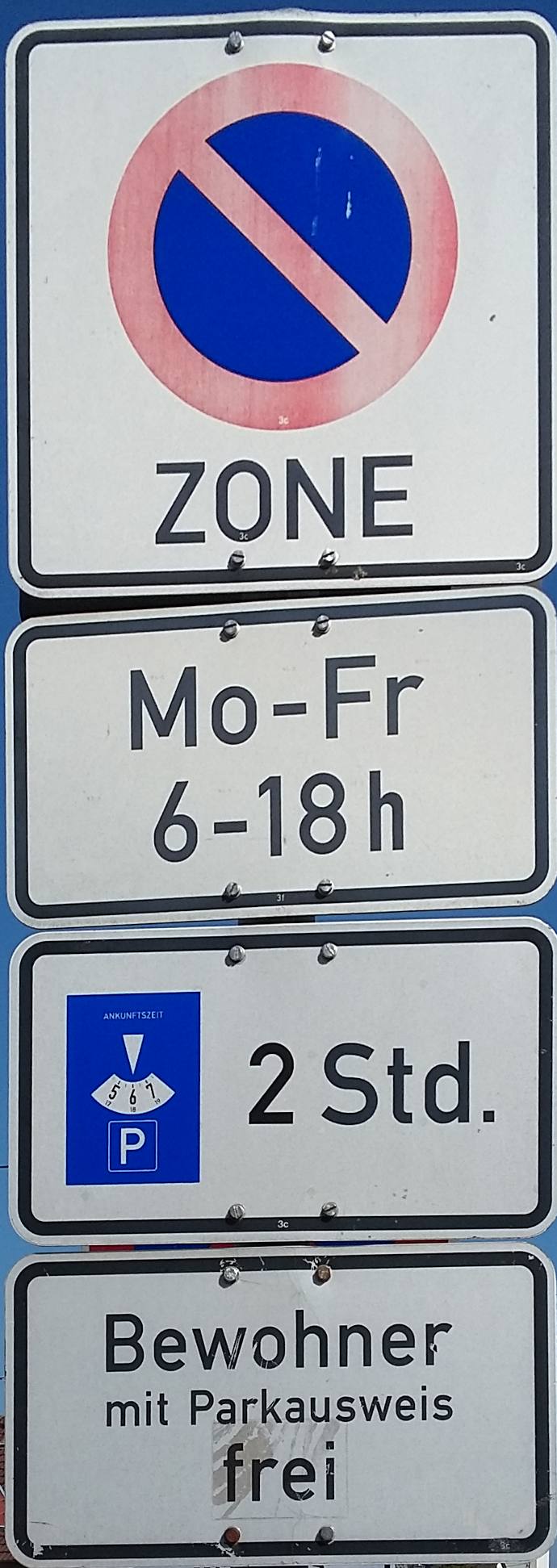
parking:lane:right=parallelparking:condition:right=residentsparking:condition:right:residents=S7
|

|
parking:lane:right=parallelparking:condition:right=residentsparking:condition:right:residents=S7parking:condition:right:time_interval=16:00-06:00
|

|
parking:lane:right=perpendicularparking:condition:right=customers
|

|
parking:lane:left=perpendicularparking:condition:left=private
|
parking:lane:left=no_parking(no parking:condition to be supplied)
| |

|
parking:lane:left=no_stopping(no parking:condition to be supplied)
|

|
parking:lane:left=fire_lane( fire_lane implies a "no stopping" parking condition, so no parking:condition to be supplied)
|

|
Discussed at the discussion page. --User:kay_D |
Example area with various tags and sample rendering
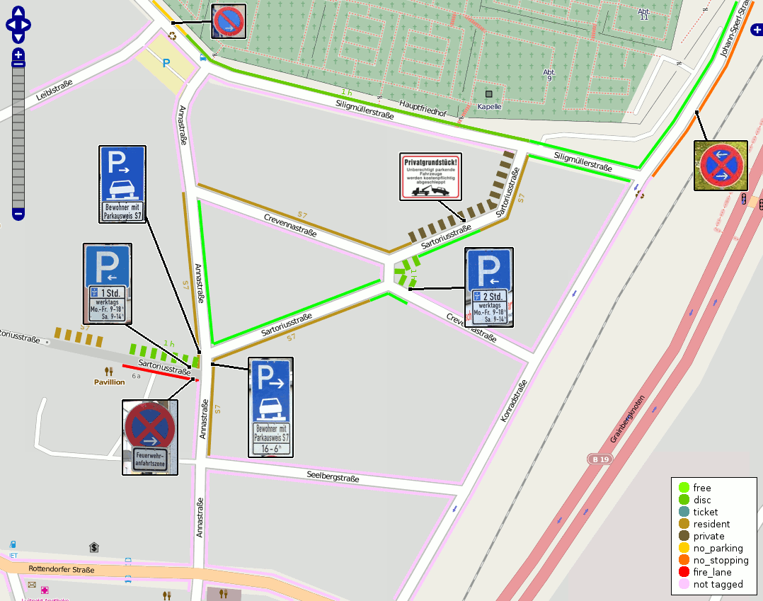
An example area with lots of those tagging already done is here: OSM (or Edit in JOSM); Wikimedia Toolserver.
The respective area could be rendered (possibly as a layer) like this:

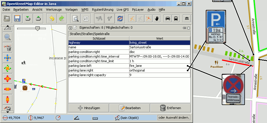
Please see one street tagged with a JOSM screenshot
Current progress
Kay D 11:49, 14 February 2010 (UTC): I managed to set up ProstgreSQL and Mapnik. A quick stylesheet hack that displays parking:lane:side parallel in green, no_parking in dark-yellow and no_stopping in orange.
Kay D 20:36, 28 February 2010 (UTC): brushed up the style sheet, added a transparent layer.
Live server
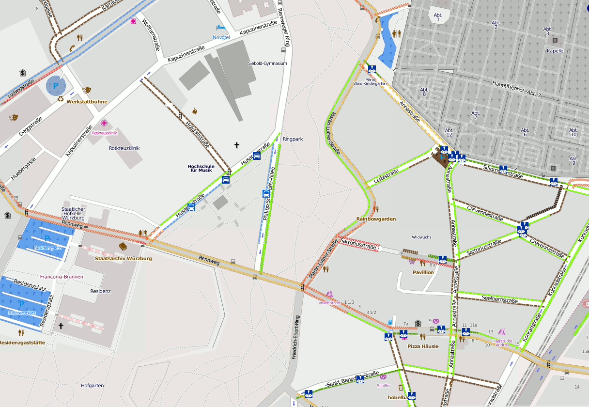
I put up a live server where you can see some areas with parking tags, e.g. Würzburg, Germany, Rio de Janeiro, Brazil and Helsinki, Finland.
Here's a list of other places with added parking information (please feel free to add yours):
- Bamberg, Bayern, Germany (very impressive coverage)
- Este, Italy
- Frankfurt-Sachsenhausen, Germany
- Gärtringen, Baden-Württemberg, Germany
- Gerstetten, Baden-Württemberg, Germany
- Giebelstadt, Bayern, Germany
- Glonn, Bayern, Germany
- Herrnhut, Sachsen, Germany
- Hilders, Hessen, Germany
- Ilmenau, Germany
- München, Bayern, Germany
- Orbassano, Italy
- Palazzolo sull'Oglio, Italy
- Quedlinburg, Sachsen-Anhalt, Germany
- Wiesbaden, Germany
- Zittau, Sachsen, Germany
- Torgau, Sachsen, Germany
- Salamanca, Spain
Please note that when you add parking information for your streets, the tiles are not automatically refreshed. So after upload, wait a few minutes, load the respective tile (use "Open image" in the browser), e.g. http://toolserver.org/tiles/parking-bw/17/74619/37909.png and manually add "/dirty" to the URL (e.g. http://toolserver.org/tiles/parking-bw/17/74619/37909.png/dirty. After the response that the image is submitted for rendering, go back and load the image(s) again (may take some seconds) and refresh your browser completely (use permalink). See here for an explanation.
Examples
Some pictures of different roads and how to tag them are in Proposed_features/parking:lane/Examples.
Using with JOSM
There a simple tagging preset and a style file for JOSM editor available. You can activate them in Preferences > Map settings.
Please be aware that JOSM map display (MapPaint) doesn't support direction dependent styles, so it basically shows the presence (more precisely: the most restrictive one) of parking lane tags rather than the side specific ones for each side of the way. The colours shown in JOSM match the ones on the parking map.
Discussion
Comments? Head to the discussion page. /code> and /code> in green, /code> in dark-yellow and

