Tag:aeroway=gate
Jump to navigation
Jump to search
| Description |
|---|
| The bounded space, inside the airport terminal, where passengers wait before boarding their flight |
| Group: aeroways |
| Used on these elements |
| Useful combination |
|
| Status: approved |
| Tools for this tag |
|
Airports can have bizarre systems to number their ![]() gates and it can be hard to find a map of the airport on-line. They can be mapped with help from bing imagery or even GPS when you stand by the window. For gates where you have to take a bus first, the place in the terminal where you wait for the bus should be mapped.
gates and it can be hard to find a map of the airport on-line. They can be mapped with help from bing imagery or even GPS when you stand by the window. For gates where you have to take a bus first, the place in the terminal where you wait for the bus should be mapped.
Note: This tag is for the gates used by passengers before entering aeroplanes. This should not be used for passenger pick-up/drop-off zones near roads.
How to map
Add aeroway=gate and ref=number or name to a node that represents the gate. These nodes are typically stand-alone, placed a short distance outside the terminal building; e.g., around the centre of the location where you take the airbridge to get onto the plane.
Rendering
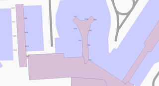
 Example rendering made by Kosmos, zoom 17, OSM |
See also
- aeroway=parking_position – Where the plane parks
| ||||||||||||||||||||||||||||||||||||||||||||||
