Tag:archaeological_site=church
Jump to navigation
Jump to search
| Description |
|---|
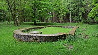
| An archaeologically excavated church |
| Group: historic |
| Used on these elements |
| Requires |
| Status: in use |
| Tools for this tag |
|
The feature archaeological_site=church is not restricted to excavations, but should also include all visible ancient monuments, most of which will not have been excavated. It is applied to old church ruins or their foundations.
