Tag:junction=jughandle

From OpenStreetMap Wiki
Jump to navigation Jump to search
Public-images-osm logo.svg junction = jughandle
Jughandle signage.jpg
Description
A type of ramp or slip road that changes the way traffic turns left at an at-grade intersection (in a country where traffic drives on the right). Show/edit corresponding data item.
Group: highways
Used on these elements
should not be used on nodesmay be used on waysshould not be used on areasshould not be used on relations (except multipolygon relations)
Useful combination
Status: in use

A jughandle is an at grade intersection which includes a type of ramp that takes traffic turning across the centreline (left in right-hand-drive countries) in the other direction before looping around. Because traffic cannot make the direct turn, a turn restriction needs to be added.

The ramp or local roads used to make the turn should be tagged junction=jughandle.

Examples

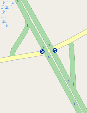
Jug1.png In both directions, all turning traffic must take the jughandle, and signs at the intersection read "no turns".
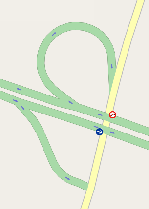
Jug2.png Westbound traffic can make a right turn directly, so only left turns are prohibited. (Note that signs may also prohibit U-turns, but since a U-turn is made by turning left twice, this is covered by the no left turn restriction.)
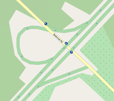
Jug3.png Careful! Here a separate ramp is provided for southbound traffic to turn right, and it too needs a restriction to ensure that routing software does not try to use it as a jughandle.
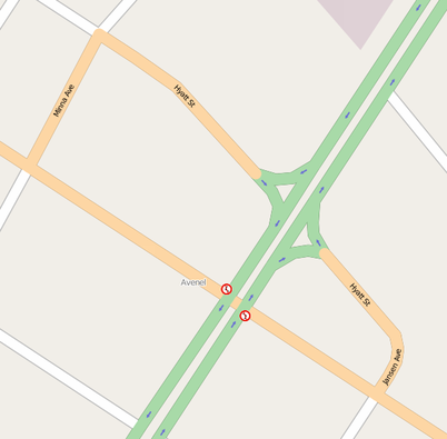
Jug4.png At this intersection, local streets form the jughandles. Generally these streets should not be tagged as links, but with the classification of the crossroad. Note that, even though the southbound jughandle leaves before the intersection, traffic is allowed to turn right at the intersection.

At more complicated junctions, simply make sure to map all restrictions that exist in real life.

See also

  • Michigan Lefts, are another common type of intersection with turn restrictions