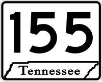
Tag:network=US:TN
| Description |
|---|
| State route superrelation in the U.S. state of Tennessee, or a state route relation waiting to be classified as primary or secondary |
| Group: properties |
| Used on these elements |
| Useful combination |
| See also |
| Status: de facto |
| Tools for this tag |
|
This tag indicates that a route relation is a superrelation for a Tennessee state route, containing both primary and secondary route segments, or that it has not yet been determined whether the route is a primary or secondary route.
Distinguishing primary and secondary routes
A given Tennessee state route may have two completely different shields along different segments of the route. A single route relation's ways can alternate many times between the two shields, based on the state's official highway functional classification for roads along the route. This classification does not necessarily match the criteria that mappers normally use to choose highway=* tags in OpenStreetMap. Occasionally, a driver may approach a junction where they have to choose between the primary and secondary legs of the same route – signs bear the same number on two different shapes. [1]
Tag the route according to its route classification:
If a single route has segments of both classifications, map the primary and secondary segments as separate relations with more specific network=US:TN:primary/US:TN:secondary tags, then make them all members of a superrelation with the more generic network=US:TN tag. The superrelation joins the segments into a coherent route.
History
Historically, mappers have taken two different approaches to distinguishing between the two shields:
- Tagging ways along primary routes as highway=motorway/trunk/primary and tagging ways along secondary routes as highway=secondary/tertiary, regardless of the usual criteria for highway=* tagging.
- Tagging ways along primary routes as ref=TN * and tagging ways along secondary routes as ref=SR *, even though in reality Tennesseans always use "SR" for both kinds of routes.
- Tagging ramps leading to primary routes with destination:ref=Primary SR * and ramps leading to secondary routes with destination:ref=Secondary SR *. [2]
Out-of-state mappers have muddled both approaches over the years due to a lack of awareness about the dual route signage system, so data consumers currently have no way to reliably choose the right shield.
In June 2022, OpenStreetMap Americana became the first OSM-based data consumer capable of displaying both the primary and secondary route shields, based on the network=US:TN:primary and network=US:TN:secondary tags. [3] Several dual primary/secondary routes have been upgraded to the new tagging scheme, but many entirely primary and entirely secondary routes still need to be retagged as of June 2022.


