Tag:place=archipelago
Jump to navigation
Jump to search
| Description |
|---|
| A named group or chain of closely related islands and islets. |
| Group: places |
| Used on these elements |
| Useful combination |
|
| See also |
| Status: de facto |
| Tools for this tag |
|
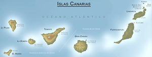
The tag place=archipelago is used to map an archipelago (also known as an island group or island chain): a named chain, cluster or group of closely related islands and islets.
How to Map
![]() Each island in the archipelago is added as a member of a relation:
Each island in the archipelago is added as a member of a relation:
- either a multipolygon relation (type=multipolygon, with all of the coastlines of the individual islands and islets as outer members.
- This is the most common option, used 643 times as of March 2020, and could be handled by most database users.
- or a grouping relation could be used. However, these are not rendered by the default OSM layer. At least two such relation types have been proposed:
Add the following tags to the relation: place=archipelago and name=<name of the archipelago>
Cautions
- Note that it is recommended to avoid creating relations with more than several hundred members Relation#Size. Because of this, extremely large archipelagos should not be mapped, especially if they can be represented in another way. For example, the Philippines Archipelago has over 7000 islands, and is similar in extent to the country of the same name.
- Widely dispersed, named collections of islands are not always an place=archipelago. For example, Macaronesia is a collection of 4 separate archipelagos in the Atlantic ocean. This should not be mapped as an archipelago. The islands in an archipelago should be closely related in space and form a clearly visible group or chain of islands.
- Historically, the word "archipelago" was the name of the Aegean sea. Sometimes the word "archipelago" is still used to collect every island within a sea or other large body of water. However, place=archipelago should not be used in this way, but should tag specific groups of islands.
- Some archipelagos are mapped with a single node, usually if the archipelago has been imported from external data or if the original mapper did not know the full extent of the archipelago.
- A few atolls (place=atoll) have been mapped with a single closed way around the islands, mostly in the Maldives, and also tagged with place=archipelago. The tag place=archipelago should be moved to multipolygon relations by selecting the coastlines of each island as members.

