Tag:power=line
| Description |
|---|
| High-voltage power lines used for power transmission, usually supported by towers or pylons |
| Rendering in OSM Carto |

|
| Group: power |
| Used on these elements |
| Implies |
|
| Useful combination |
| See also |
| Status: de facto |
| Tools for this tag |
|
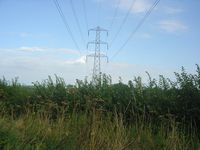
The tag power=line is used to map high-voltage overhead power lines (IEC 466-01-02) used for power transmission (IEC 466-01-13), usually supported by towers or pylons power=tower.
- For less massive lines (mainly part of the distribution system, from mains voltage to about 45 kV, depending on the country or area), usually carried on poles, use power=minor_line.
- For underground or underwater power cables use power=cable.
How to map
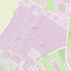
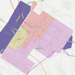
Draw one ![]() way for all circuits connected to one power tower and add the power=line to it. All lines forming the transmission system are one power=line. It is not necessary to tag power lines with a layer=* unless two lines cross over each other.
way for all circuits connected to one power tower and add the power=line to it. All lines forming the transmission system are one power=line. It is not necessary to tag power lines with a layer=* unless two lines cross over each other.
If the lines connect mid air at a crossing point without any ground support then use power=connection on the node connecting them.
| Key | Value | Comment | Recommendation |
|---|---|---|---|
| power | line | It's a power line, normally mapped as a |
Mandatory |
| voltage | <operating voltage> | The voltage at which the line is operated. May be semicolon-separated if there are multiple voltages. | Recommended |
| cables | <number of conductors> | The number of different phase conductors for this power line. Usually multiples of 3 (6, 9, 12) | Recommended |
| circuits | <number of circuits> | The number of separate electrical circuits carried by this power line. For the common 3-phase systems, it's no. of conductors/3 | Recommended if not implicit |
| operator operator:wikidata |
<line operator> | The name of the company which operates this power line | Recommended |
| owner owner:wikidata |
<line owner> | The name of the organisation that owns this power line | Optional |
| wires | <wire bundle per conductor> | The bundle form factor for each conductor of the power line | Optional |
| frequency | <operating frequency> | The frequency in hertz at which the power line is operating. May be semicolon-separated if there are multiple frequencies. | Optional |
| name | <name> | The name of this power line | Optional |
| ref | <reference> | The reference of this power line | Optional |
| line | bay, busbar or substation | Specifies that a line is a busbar or bay in a substation | Optional |
Line supports
The towers that support the power line can be mapped using ![]() power=tower and poles with
power=tower and poles with ![]() power=pole and you may find extensive information on each pages.
power=pole and you may find extensive information on each pages.
It is possible to connect power lines to power=portal inside power=substation using power=insulator on the connecting node. power=terminal is also used at the connection with buildings without a dedicated power tower or portal to support the end of the line.
The choice between towers and poles not only depends on the importance of the line but on the surrounding environnement as well. As transmission lines are usually massive, towers are preferred to support them and it also possible to find poles at appropriate locations. You are encouraged to check the shape of support: lattice or solid metal pieces assemblies for towers and single wooden or concrete parts for poles.
Since power lines conductors are high voltage and usually uninsulated, they can only be located overhead to protect them from grounding with external elements and actually insulated with air.
Additional tags
It is also possible to give some additional and advanced information about power lines:
- The number of wires=* per conductor.
- You may use cables=* for the number of power-carrying conductors (bundles of wires) the line is composed of.
- circuits=* corresponds to the number of electrical circuits (logical bundles of conductors). The tag may be used when the number of power-carrying conductors is unknown (often the case for underground cable connections) or when the number of circuits is different from cables=* divided by 3 (or by the number of phases of the line).
Lines carrying multiple voltages or frequencies
If a line has multiple circuits at different voltages, they should be listed individually, separated by semicolons. For example, if there are two circuits at 66 kV and one at 33 kV, the line should be tagged as:
If there are also multiple frequencies (only in the case of HVDC or traction power), the frequency=* tag should also be semicolon separated. In this case, the frequency=* tag should have the same number of semicolon-separated items as the voltage=* tag. For example, for a line carrying 220 kV and 110 kV at 50 Hz, as well as 110 kV at 16.7 Hz for traction power:
If a power line is technically designed for another voltage than it's operated, it was suggested that this may be tagged with construction:voltage=*, however this conflicts with the meaning of construction:*=*.
See also the discussion at power routing proposal.
Examples
| Picture/description | Tags | OSM Carto | Openinframap |
|---|---|---|---|
Electricity pylon and power lines
|
power=line wires=double cables=6 circuits=2 operator=(operator-name) voltage=380000 |

|

|

Three conductors correspond to one circuit (except traction power lines and high voltage direct current/HVDC). Every circuit has one voltage=* level on which it operate.
Rendering
In addition to rendering on power lines on OSM Carto the following services are also available:
- Open Infrastructure Map
- Power Grid Map
- Electricity grid map (Europe only)
- Maperitive power line rule set for rendering power lines, cables and substations in Maperitive.
See also
- Power_networks and associated local projects.
- Classification of power lines.
- Power transmission refinement proposal
- usage=transmission

