Tag:railway=subway
(Redirected from Tag:railway=Subway)
Jump to navigation
Jump to search
| Description |
|---|
| Rails used for city public transport that are always completely separated from other traffic, often underground. |
| Rendering in OSM Carto |

|
| Group: railways |
| Used on these elements |
| Useful combination |
|
| Status: de facto |
| Tools for this tag |
|
Type of railway track for a city passenger rail service, more generally called metros. The system should be completely separated from other traffic, including other kinds of rail traffic, in central areas often underground, sometimes elevated. Despite the name, some subway lines may run entirely above the ground. See ![]() Rapid transit.
Rapid transit.
Metro systems are generally considered heavy rail, although sometimes not as heavy as mainline railway. If a metro train runs on rails which are used by other mainline rail traffic, the rails should be tagged with railway=rail.
How to Map
Use this tag on a way ![]() representing the railway tracks of the rapid transit route.
representing the railway tracks of the rapid transit route.
Tags to use in combination
- bridge=yes - for sections running on bridges
- tunnel=yes - for underground sections and...
- tunnel=no - for overground sections (note that some people believe this is useful to set, to dispel any ambiguity in the case of railway=subway ways)
- layer=* the layer tag indicates vertical stacking order for overlapping map objects: the higher the layer value the higher the object on the stack. Default is 0 and should not be tagged. Take special care for long sections of underground subways to avoid their intersection (same layer) with other underground objects such as underground parkings or tunnels). Stacking is local (at the point of intersection). The layer does not imply any height=* (or level=* within buildings) which may be also needed on some sections, notably sections within subway stations, nor does it imply an overground or underground location.
- electrified=* - Indicates infrastructure to supply vehicles with electricity. See the key page for values.
- gauge=# - Gauge in mm (millimeters)
- frequency=# - Frequency in Hz (hertz)
- voltage=# - Voltage in V (volts)
To map the route of the subway
Rendering
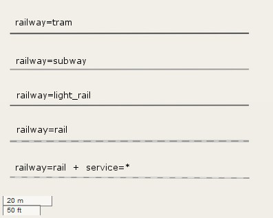
| In comparison to other railway bodies |
|---|

|
| ||||||||||||||||||||||||||||||||||||||||||||||
