Tag:waterway=brook
| Description |
|---|
| Tiny waterway, often, but not always, dry part of the year. |
| Group: waterways |
| Used on these elements |
| Useful combination |
|
| Status: deprecated |
| Tools for this tag |
|
Deprecation
Consider using waterway=stream. For larger natural waterways, which cannot be jumped across by an active, able-bodied person, use waterway=river. For a small man-made drainage see waterway=ditch.
See discussion and below and tagging mailing list thread for reasons why deprecation happened.
You can use intermittent=yes to mark that given stream is expected to be sometimes not flowing and dry.
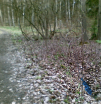
A brook is a tiny linear depression in the ground that carries water for at least some part of the year, although it may contain little water or even be dry for most of the year. Use intermittent=yes accordingly. It is always possible to jump or even step over a brook. Brooks are usually very shallow, say, 10–50 cm deep and are likely always less than 1 m deep. Brooks can vary from 10 cm to 1 m wide.
However, waterway=stream + intermittent=yes is the more widely accepted tagging for small natural waterways that flow for only part of the year, and width=* may be used to specify the width in meters, eg. width=0.5 - database users and map renders may choose to use this information to treat narrow streams differently.
Note
So far there are no exact criteria for deciding whether a feature is a stream or a brook. To instigate some discussion, there's a gallery of various very narrow waterways. In some dialects of English a brook is as large or larger than a stream.
For small waterways consider using waterway=stream. For larger natural waterways, which cannot be jumped across by an active, able-bodied person, use waterway=river. For a small man-made drainage see waterway=ditch.
Problematic name
Note that brook means "small stream", not "intermittent stream", so such meaning for tag is confusing at best[1].
