Tag:waterway=offshore_field
Jump to navigation
Jump to search
| Group: waterways |
| Used on these elements |
|---|
| Useful combination |
| See also |
| Status: undefined |
| Tools for this tag |
|
A center node ![]() or a closed way
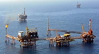
or a closed way ![]() representing an offshore oil or gas field.
representing an offshore oil or gas field.
The verifiability of this tag is disputed. Please see the discussion on the talk page. Please do not remove this message until the dispute is resolved.
Mapping offshore fields as an area is not verifiable, and the location of a node may not be possible for a mapper to confirm without using an external database.
