Talk:Michigan
October Meeting
- some folks are redoing the hwy classification system (again). active discussion between two folks in slack, see also
- https://wiki.openstreetmap.org/wiki/Michigan/highway_classification
- https://wiki.openstreetmap.org/wiki/United_States/2021_Highway_Classification_Guidance#State-specific_classification_standards
- "Wisconsin is a rigorous example of the process most states have gone through: identify the most important cities in and just outside the state and then figure out the best routes between them. NY happened to have a DOT-provided classification code that was able to directly map to motorway, trunk, and primary, but most states only have Functional Class which isn't a perfect mapping to OSM highway=* as it's purpose isn't to provide a routing graph. At a cursory glance most of the most important communities in Michigan look to be connected by highway=trunk in the UP and motorways in the LP, with the glaring exception of Traverse City. ... In the past there was much use of highway=trunk to mean enhanced expressway-type construction. The emerging consensus is to use expressway=yes to tag that improved physical infrastructure and use highway=trunk for the most important long-distance connections that aren't built to motorway/interstate standards as happens when low population densities don't demand such big roads, such as crossing the UP. ... The text on the Michigan page the OP linked to still uses highway=trunk to mean enhanced physical infrastructure "nearly a freeway" rather than the new connectivity-based usage of the tag." (quote from Adam Franco in #osmus Slack) --ChristopherGS (talk) 18:51, 11 September 2022 (UTC)
August Meeting
- Zoning in Greater Lansing. most of the city is not zoned with landuse=residential and such. what should be the sources for that? --Tuttiton
- Also there are named residential areas (e.g. https://www.openstreetmap.org/way/51775284) should the name belong to neighbourhoods instead?--Tuttiton
July Meeting
-Slack is talking about Michigan's approach to https://wiki.openstreetmap.org/wiki/United_States/2021_Highway_Classification_Guidance Can we organize around this? I know treestryder has done a lot of work in this area already--ChristopherGS (talk) 16:04, 29 June 2022 (UTC)
-Bike amenity classifications based on this video: https://www.youtube.com/watch?v=nsaiHhQvNSY&list=PLqjPa29lMiE0kc0pNa1px1RritclPgmvW&index=4 --ChristopherGS (talk) 16:04, 29 June 2022 (UTC)
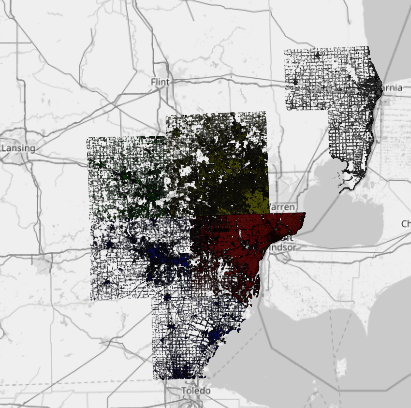
South East Michigan Council of Governments
--Rye (talk) 17:37, 27 December 2016 (UTC) Has anybody interacted with SEMCOG - South East Michigan Council of Governments? They have high quality building footprints with address information with a license that only requires attribution:
Michigan DNR Open Data
Could the DNR's Open Data be used for public land boundaries, park locations, forest campground locations, trails and the like? http://gis-midnr.opendata.arcgis.com/
--TreeStryder (talk) 04:46, 26 June 2017 (UTC)
Act 51 Maps
I'm not sure where to add this, but I found a list of city/county maps that the state maintains to show detailed ownership of roadways: https://mdotjboss.state.mi.us/SpecProv/act51.htm
--Davenport651 (talk) 15:48, 28 January 2022 (UTC)
Mapping Rivers
Should riverbanks be mapped using the technique shown here waterway=riverbank. If so, should the riverbank be a part of the river's relation? Should the rivers Name only exist on the Relation? Or, on the riverbank and every segment of river way? See the Grand River 10716343![]() 10716343 and the Huron River 12366431
10716343 and the Huron River 12366431![]() 12366431 as examples of the different riverbank mapping schemes.
12366431 as examples of the different riverbank mapping schemes.
The consensus formed during a monthly meeting was yes, riverbanks should be mapped using the technique shown here waterway=riverbank and they should be part of the river's relation.
Note that use of waterway=riverbank is now discouraged, see note on that page
--Emersonveenstra (talk) 14:34, 10 August 2022 (UTC)
Thank you Emerson, this is a note copied over from a meeting (I think in 2016?) it probably should be updated. To my knowledge there are no occurrences of waterway=riverbank in Michigan anymore, see https://taginfo.openstreetmap.org/tags/waterway=riverbank#map --ChristopherGS (talk) 14:48, 10 August 2022 (UTC)
The Centers of Michigan
How should three points that should be in the same location (two monuments points and the corner of the townships) be reconciled in the Meridian-Baseline State Park.
The consensus formed during a monthly meeting was to merge the mysterious and inaccurate survey marker with the historical marker and average the locations from GPS traces and Mapillary imagery.
Michigan History Center markers
Michigan has its own set of historical markers, provided by the Michigan History Center, that can be added to the map along with the ones provided by the NRHP.
Since "ref:mhc" has already been taken, I suggest "ref:mihc". I added the first marker, which shares a source with the HMDB, under this tag today (2023-04-19), but won't add any more until this tag (and the addition of these markers) has been approved.--Mecheye (talk) 18:15, 19 April 2023 (UTC)
