Template:FR:Map Features:highway
Jump to navigation
Jump to search
Route (highway)
Le tag highway=* est le tag principal pour toutes les voies de circulation terrestre. C'est le minimum pour voir apparaître ce type de voies sur une carte. Les conventions peuvent différer d'un pays à l'autre. Pour la France, cf. FR:France roads tagging.
| Clé | Valeur | Élément | Commentaire | Représentation | Photo | |
|---|---|---|---|---|---|---|
Routes | ||||||
|
This group lists the 7 main tags for the road network, from most to least functionally important for motor vehicle traffic. | ||||||
| highway | motorway | Autoroute Par défaut : lanes=2 (par direction), maxspeed=130 Ajouter ref=A xx + oneway=yes + int_ref=E xx si applicable. Voir aussi le Wikiproject E-road network + name=* (par ex. "Autoroute du Soleil") (optionnel) + maxspeed=* si <> 130 (optionnel) + lanes=* si <> 2 (optionnel) |
||||
| highway | trunk | Voie rapide ou voie express. Voie ayant les caractéristiques d'une autoroute. En général, une 2x2 voies avec séparation centrale. Par défaut : lanes=2, maxspeed=110 (sauf périph. Paris: 80km/h) Ajouter ref=N xx ou ref=D xx + oneway=yes + maxspeed=* si <> 110 (optionnel) + lanes=* si <> 2 (optionnel) |
||||
| highway | primary | Route majeure reliant des grandes villes. En France cela correspond à des routes nationales, des grandes routes départementales ou des artères principales en ville Par défaut : lanes=2, maxspeed=50 (agglomération) ou maxspeed=90 (hors agglo.) Ajouter ref=N xx ou ref=D xx + name=* nom de rue (en agglomération) ou nom de route (hors agglo.) s'il existe (optionnel) |
||||
| highway | secondary | Route faisant partie du réseau national sans être une "primary". En France cela correspond a des départementales ou des rues importantes en ville mais pas assez pour mériter "primary" Par défaut : lanes=2, maxspeed=50 (agglomération) ou maxspeed=90 (hors agglo.) Ajouter ref=D xx + name=* nom de la rue (agglomération) ou nom de route (hors agglo.) s'il existe (optionnel) |
||||
| highway | tertiary | Route reliant des villages ou des quartiers a l'intérieur des villes. En France cela correspond à des petites routes ou des rues présentant un trafic de transit inférieur à une "secondary" entre zones résidentielles, commerciales, industrielles, etc Par défaut : lanes=2, maxspeed=90 ou maxspeed=50 Ajouter ref=D xx (ou ref=C xx) + name=* nom de la rue (agglomération) ou nom de route (hors agglo.) s'il existe (optionnel) |
||||
| highway | unclassified | Voie de desserte locale, sans trafic de transit, ni en zone résidentielle (par ex. en zone commerciale, industrielle, hôpital, petite route de campagne, etc). Ne pas confondre avec highway=road utilisé pour les routes dont la catégorie "highway" est inconnue |
||||
| highway | residential | Route de desserte ou à l'intérieur d'une zone résidentielle qui n'a pas de nomenclature spécifique. Par défaut: maxspeed=50 en agglomération Ajouter maxspeed=* si <> 50 ou si hors-agglomération |
||||
Routes de liaison | ||||||
| highway | motorway_link | Bretelle d'accès ou de sortie d'une autoroute Par défaut : lanes=1 Ajouter oneway=yes + maxspeed=* (optionnel) Voir highway=motorway_junction ci-dessous pour le numéro de sortie |
||||
| highway | trunk_link | Voie d'accès à une voie rapide ou voie express Par défaut : lanes=1 Ajouter oneway=yes + maxspeed=* Voir highway=motorway_junction ci-dessous pour le numéro de sortie |
||||
| highway | primary_link | Voie d'accès à une route "primary" Ajouter oneway=yes si sens unique + lanes=* (optionnel) |
||||
| highway | secondary_link | Voie d'accès à une route "secondary" Ajouter oneway=yes si sens unique + lanes=* (optionnel) |
||||
| highway | tertiary_link | Voie d'accès à une route "tertiary".Les routes de liaison conduisant à une route tertiaire de / vers une route tertiaire ou vers une route de classe inférieure. | ||||
Types de routes spéciales | ||||||
| highway | living_street | Zone de rencontre, parfois appelée 'cour urbaine' ou, en Belgique, 'zone piétonne'. Voie goudronnée ou pavée en zone d'habitation où les piétons ont priorité absolue et n'ont pas l'obligation de circuler sur les trottoirs. Par défaut : maxspeed=20 |
||||
| highway | service | Route d'accès à un bâtiment unique, site industriel, plage, camping, à l'intérieur d'un grand parking, une allée, etc. Ajouter service=parking_aisle/driveway/alley (optionnel) + access=* si l'accès est restreint (privé ou riverains) |
||||
| highway | pedestrian | Rue piétonne. Rue réservée principalement ou exclusivement aux piétons en ville, en zone commerçante ou résidentielle. L'accès aux véhicules motorisés n'est autorisé que pour des périodes très limitées de la journée. Pour créer une place piétonne faire une trace fermé et Ajouter area=yes |
||||
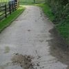
| highway | track | Chemin carrossable en principe sans revêtement (chemin rural, agricole, forestier, d'exploitation...) Ajouter tracktype=1..5 (optionnel) |
||||
| highway | bus_guideway | Voie réservée aux bus guidés (par rail, trottoirs, systèmes optique ou radio). Pour les voies réservées aux bus simples, utiliser access=no, psv=yes. |
||||
| highway | escape | Voie d'urgence située sur le côté dans les longues descentes pour que les camions et autres véhicules puissent s'arrêter en toute sécurité après une rupture de freins. | ||||
| highway | raceway | Piste de circuit automobile/moto. | ||||
| highway | road | Route ou voie dont la classification est inconnue. Permet d'ajouter une route sans en connaître la nature exacte (imagerie satellite, cadastre). | ||||
| highway | busway | A dedicated roadway for bus rapid transit systems | ||||
Chemins | ||||||
| highway | footway | Voie réservée aux piétons (en général par une signalisation particulière). Ajouter bicycle=yes si les vélos sont autorisés |
||||
| highway | bridleway | Chemin pour cavaliers. | ||||
| highway | steps | Escaliers | ||||
| highway | corridor | For a hallway inside of a building. | ||||
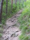
| highway | path | Chemin non carrossable, non spécifique ou partagé pour divers usages. | ||||
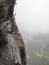
| highway | via_ferrata | A via ferrata is a route equipped with fixed cables, stemples, ladders, and bridges in order to increase ease and security for climbers. These via ferrata require equipment : climbing harness, shock absorber and two short lengths of rope, but do not require a long rope as for climbing. | ||||
When sidewalk/crosswalk is tagged as a separate way | ||||||
| footway | sidewalk | Sidewalk that runs typically along residential road. Use in combination with highway=footway or highway=path | ||||
| footway | crossing | Passage piéton Ajouter crossing=* en option |
||||
| footway | traffic_island | Passage piéton Ajouter crossing=* en option |
||||
Lorsque le trottoir (ou la chaussée) est taggué(e) sur la chaussée principale (Voir Trottoirs) | ||||||
| sidewalk | both | left | right | no | Specifies that the highways has sidewalks on both sides, on one side or no sidewalk at all | ||||
Lorsque la piste cyclable est dessinée en tant que sa propre voie (Voir Cyclisme) | ||||||
| highway | cycleway | Piste cyclable. Ajouter foot=yes si les piétons sont autorisés/tolérés |
||||
Lorsque la piste cyclable est taguée sur la chaussée principale (Voir Cyclisme) | ||||||
| cycleway | lane | Bande cyclable. Voie qui se trouve à l'intérieur de la chaussée. | ||||
| cycleway | Double sens cyclable. Voie avec oneway=yes où il est permis de faire du vélo dans les deux directions (seulement dans les pays où cela est légalement permis). Pas de marquage au sol à la différence de cycleway=opposite_lane. | |||||
| cycleway | Bande cyclable utilisable à contresens du flux du trafic normal. Nécessite obligatoirement une route avec oneway=yes. | |||||
| cycleway | track | Piste cyclable. Chemin qui est séparé de la route. Ajouter oneway=yes si nécessaire. | ||||
| cycleway | Route avec oneway=yes ayant une piste cyclable allant en direction opposée du flux du trafic normal. | |||||
| cycleway | share_busway | Voie de bus que les cyclistes peuvent emprunter. | ||||
| cycleway | Deprecated variant for ways with oneway=yes that have a bus lane that cyclists are also permitted to use, and which go in the opposite direction to normal traffic flow (a "contraflow" bus lane). Replaced by oneway:bicycle=no + cycleway:left=share_busway/cycleway:right=share_busway + cycleway:left:oneway=-1/cycleway:right:oneway=-1. | |||||
| cycleway | shared_lane | Voie partagée avec les véhicules à moteur. Elle possède des marquages au sol indiquant ce partage. | ||||
Busways tagged on the main roadway or lane (see Bus lanes) | ||||||
| lane | Voie de bus des deux côtés de la route. | |||||
| lane | Deprecated variant for ways with oneway=yes where buses are legally permitted to travel in both directions. Replaced by oneway:bus=no | |||||
| lane | Deprecated variant for ways with oneway=yes that have a bus lane which go in the opposite direction to normal traffic flow (a "contraflow" bus lane). Replaced by oneway:bus=no and lanes:bus=* / lanes:psv=*) / bus:lanes=* / psv:lanes=* | |||||
Street parking tagged on the main roadway (see Street parking) | ||||||
| parking:left / :right / :both (hereafter: parking:side) |
lane | street_side | on_kerb | half_on_kerb | shoulder | no | separate | yes | Bande cyclable. Voie qui se trouve à l'intérieur de la chaussée. | ||||
| parking:sideorientation=* | parallel | diagonal | perpendicular | Bande cyclable. Voie qui se trouve à l'intérieur de la chaussée. | ||||
Cycle de vie (see also lifecycle prefixes) | ||||||
| highway | proposed | Route en projet. À combiner avec proposed=* |
||||
| highway | construction | Route en construction. À combiner avec construction=* (voir ci-dessous) |
different colours | |||
Attributs | ||||||
| abutters | commercial | industrial | mixed | residential | retail etc. | La clé abutters s'applique uniquement aux voies portant déjà un tag highway=* lorsque l'usage du sol (landuse) ne peut être tracé avec un polygone (pour ceux qui ne disposent pas de vues aériennes par exemple). Voir le tag :abutters=* pour plus de détails. | ||||
| bicycle_road | yes | Une |
||||
| bus_bay | both | left | right | A bus bay outside the main carriageway for boarding/alighting | ||||
| change | yes | no | not_right | not_left | only_right | only_left | Specify the allowed/forbidden lane changes | ||||
| destination | <place name of destination> | Destination when following a linear feature | ||||
| embankment | yes | dyke | A dyke or a raised bank to carry a road, railway, or canal across a low-lying or wet area. | ||||
| embedded_rails | yes | <type of railway> | A highway on which non-railway traffic is also allowed has railway tracks embedded in it but the rails are mapped as separate ways. | ||||
| ford | yes | Gué. La route croise un ruisseau qui peut amener les véhicules à rouler dans l'eau | ||||
| ice_road | yes | Route empruntant des cours d'eau, lacs gelés. Cette route n'existe plus à la fonte des glaces. | ||||
| incline | Number % | ° | up | down | Route inclinée, où l'on peut rencontrer des véhicules lents (camions, caravanes, etc) à cause de la pente. | ||||
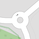
| junction | roundabout | Carrefour giratoire (abusivement appelé rond-point). Le sens de circulation est défini par le sens des segments. A combiner avec highway=* (prendre la catégorie de highway la plus élevée parmi les routes y arrivant). Ajouter name=* (uniquement si le giratoire porte lui-même un nom) Ne pas ajouter oneway=yes, ni ref=* ! |
||||
| lanes | nombre | Nombre de voies de circulation pour le trafic à usage général, également pour les autobus et les autres classes de véhicules spécifiques. | ||||
| lane_markings | yes | no | Specifies if a highway has painted markings to indicate the position of the lanes. | ||||
| lit | yes | no | Présence d'éclairage de rue | ||||
| maxspeed | <number> | Specifies the maximum legal speed limit on a road, railway or waterway. | ||||
| motorroad | yes | no | Balise utilisée pour décrire les routes soumises aux mêmes restrictions que les autoroutes, mais qui ne sont pas des autoroutes (dites Route à accès réglementé). | ||||
| mountain_pass | yes | Col, passe. Le point culminant d'un col de montagne. | ||||
| mtb:scale | 0-6 | S'applique en complément de highway=path et highway=track. Un schéma de classification pour les sentiers VTT (quelques inclinaisons et descentes). | ||||
| mtb:scale:uphill | 0-5 | Un schéma de classification pour les sentiers VTT allant vers le haut s'il y a inclinaison importante. | ||||
| mtb:scale:imba | 0-4 | Le IMBA Trail Difficulty Rating System doit être utilisé pour les parcs ou l'on peut pratiquer du VTT (descente, cross-country, trial, enduro...). Il est adapté au sentiers de VTT avec des obstacles artificiels. | ||||
| mtb:description | Text | S'applique en complément de highway=path et highway=track. Une clée pour saisir divers informations en relation avec le parcours à VTT sur une voie avec des mots. | ||||
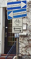
| oneway | yes | no | reversible | Oneway streets are streets where you are only allowed to drive in one direction. | ||||
| oneway:bicycle | yes | no | | Used on ways with oneway=yes where it is legally permitted to cycle in both directions. | ||||
| overtaking | yes | no | caution | both | forward | backward | Indications légales d'autorisation ou d'interdiction de dépassement pour des sections de routes. | ||||
| parallel | diagonal | perpendicular | marked | no_parking | no_stopping | fire_lane. | Spécifie l'espace du parking. Voir parking:lane=* pour plus de détails. | |||||
| free | ticket | disc | residents | customers | private | Spécifie les conditions de stationnement (termes). Voir parking:condition=* pour plus de détails. | |||||
| passing_places | yes | Route possédant de nombreux points de croisement. A placer sur une ligne (way) |
||||
| priority | forward | backward | Traffic priority for narrow parts of roads, e.g. narrow bridges. | ||||
| priority_road | designated | yes_unposted | end | Specifying roads signposted as priority roads. | ||||
| sac_scale | hiking | mountain_hiking | demanding_mountain_hiking | alpine_hiking | demanding_alpine_hiking | difficult_alpine_hiking | S'applique en complément de highway=path et highway=footway. Un schéma de classification pour les sentiers de randonnée. | ||||
| service | alley | driveway | parking_aisle etc. | Route de service se trouvant habituellement entre propriétés pour les accès utilitaires (poubelles, etc) A combiner avec highway=service |
||||
| shoulder | no | yes | right | both | left | Presence of shoulder in highway | ||||
| smoothness | excellent | good | intermediate | bad | very_bad | horrible | very_horrible | impassable | Specifies the physical usability of a way for wheeled vehicles due to surface regularity/flatness. See Key:smoothness for more details. | ||||
| surface | paved | unpaved | asphalt | concrete | paving_stones | sett | cobblestone | metal | wood | compacted | fine_gravel | gravel | pebblestone | plastic | grass_paver | grass | dirt | earth | mud | sand | ground | Voir la clé surface=*pour plus de détails. | ||||
| tactile_paving | yes | no | Équipement de voirie podotactile, qui sert de signalisation, de guidage et de repérage pour les non et mal-voyants. | ||||
| tracktype | grade1 | grade2 | grade3 | grade4 | grade5 | Pour décrire la qualité de la surface. Voir tracktype=* et surface=* pour plus d'informations. | ||||
| traffic_calming | bump | hump | table | island | cushion | yes | etc. | Désigne des éléments placés sur la route destinés à faire ralentir le trafic automobile. | ||||
| trail_visibility | excellent | good | intermediate | bad | horrible | no | S'applique en complément de highway=path, highway=footway, highway=cycleway et highway=bridleway. Une classification pour la visibilité des sentiers de randonnée. | ||||
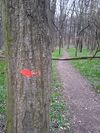
| trailblazed | yes | no | poles | cairns | symbols | Applies to highway=*. Describing trail blazing and marking. See Key:trailblazed for more information. | ||||
| trailblazed:visibility | excellent | good | intermediate | bad | horrible | no | Applies to trailblazed=*. A classification for visibility of trailblazing. See Key:trailblazed:visibility for more information. | ||||
| turn | left | slight_left | through | right | slight_right | merge_to_left | merge_to_right | reverse | The key turn can be used to specify the direction in which a way or a lane will lead. | ||||
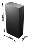
| width | <number> | The width of a feature. | ||||
| winter_road | yes | Route utilisable en hiver et qui ne peut probablement pas être utilisée en été. | ||||
Autres | ||||||
| highway | bus_stop | Arrêt de bus. Ne pas confondre avec amenity=bus_station pour les grandes stations de bus (gares routières). Voir public_transport=* pour un tagging plus complet et précis |
||||
| highway | crossing | A.k.a. crosswalk. Pedestrians can cross a street here; e.g., zebra crossing | ||||
| highway | cyclist_waiting_aid | Street furniture for cyclists that are intended to make waiting at esp. traffic lights more comfortable. | ||||
| highway | elevator | Ascenseur. | ||||
| highway | emergency_bay | An area beside a highway where you can safely stop your car in case of breakdown or emergency. | ||||
| highway | emergency_access_point | Panneau numéroté pouvant être utilisé pour indiquer sa position en cas d'urgence. N'existe pas en France. | ||||
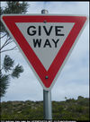
| highway | give_way | Panneau de "Cédez le passage". | ||||
| emergency | phone | Borne de communication spécialisée pour l'appel de secours. | ||||
| highway | ladder | A vertical or inclined set of steps or rungs intended for climbing or descending of a person with the help of hands. | ||||
| highway | milestone | Highway location marker | ||||
| highway | mini_roundabout | Mini giratoire dont le terre-plein central est franchissable ou absent (UK : panneau avec un cercle sur fond bleu). S'il y a surélévation centrale, elle ne dépasse pas 15 cm et le diamètre maximal extérieur est de 24 m. Voir junction=roundabout pour les carrefours giratoires classiques |
||||
| highway | motorway_junction | Indique une sortie d'autoroute ou de route pour automobiles. Ajouter ref=numéro de sortie |
||||
| highway | passing_place | Aire de croisement. Élargissement temporaire d'une route étroite pour permettre le croisement des véhicules. A placer sur un noeud (node) |
||||
| highway | platform | A platform at a bus stop or station. | ||||
| highway | rest_area | Aire de repos ou de stationnement, disposant uniquement un espace de pique-nique, parfois de toilettes. | ||||
| highway | services | Aire de services (souvent sur autoroutes), disposant de parkings, d'une station-service, d'une boutique, de toilettes, d'une aire de repos, parfois des restaurants, expositions ou aires de loisirs et de jeux. | ||||
| highway | speed_camera | Radar fixe sur le côté ou surplombant la route. Voir aussi la relation enforcement. |
||||
| highway | speed_display | A dynamic electronic sign that displays the speed of the passer-by motorist. | ||||
| highway | stop | Panneau de stop. | ||||
| highway | street_lamp | Lampadaire. Source d'éclairage surplombant une route et allumée tous les soirs à certaines heures. | ||||
| highway | toll_gantry | A toll gantry is a gantry suspended over a way, usually a motorway, as part of a system of electronic toll collection. For a toll booth with any kind of barrier or booth see: barrier=toll_booth | ||||
| highway | traffic_mirror | Mirror that reflects the traffic on one road when direct view is blocked. | ||||
| highway | traffic_signals | Feu tricolore. | ||||
| highway | trailhead | Designated place to start on a trail or route | ||||
| highway | turning_circle | Rond-point interne. Un petit élargissement au fond d'une impasse (pas forcément un cercle) pour faciliter les demi-tours de véhicules. | ||||
| highway | turning_loop | A widened area of a highway with a non-traversable island for turning around, often circular and at the end of a road. | ||||
| highway | User Defined | Consulter Taginfo[1] pour trouver d'autres valeurs. | ||||
