Template:Hr:Map Features:properties
Jump to navigation
Jump to search
This article is a translated version of the original article, but the content appears to be out of sync with the reference text in English. Please update this translation if possible.
| This table should not be a copy of a source of the English template! Only parameters are translated. See Template:Map Features:properties/doc for more information and a copyable version. |
Karakteristike
| Key | Value | Element | Comment | Rendering | Photo |
|---|---|---|---|---|---|
| area | yes | Znači da je objekt koji je inače linija sada područje (tj. površina). Ovo ne trebate dodavati značajkama koje su same po sebi definirane kao područje. Npr. korisno za trgove - okružite cestama i dodate area=yes. | |||
| motorroad | yes / no | Cesta rezervirana za motorna vozila; koristi se na cestama koje imaju pravila autoceste, ali nisu autoceste. | 
| ||
| bridge | yes / aqueduct / viaduct / swing / ... | Most, koristi se sa oznakom layer=*. Vrijednost bridge=yes je općenita, a možete specificirati vijatudukt, aquadukt i sl. | 
|

| |
| crossing | no / traffic_signals / uncontrolled | Pješački ili drugi prijelaz preko ceste | |||
| tunnel | yes | Tunel, koristiti s oznakom layer=*. | 
|

| |
| mountain_pass | yes | Prijevoj, najviša točka planinskog prijevoja. | 
| ||
| cutting | yes | Usijek u kojem je cesta ili pruga. Najčešće u brdovitim krajevima. Source | 
| ||
| embankment | yes | Nasip, izdignuta cesta, pruga na nasipu, obično preko niskih ili poplavnih područja. Source | 
|

| |
| lanes | Number | Total number of physical travel lanes making up the way. For a divided highway represented by two separate ways, each way will have one, or more, physical lanes | |||
| layer | -5 to 5 | Ova brojčana oznaka koristi se da bi odredili nivo nekog objekta. 0: površina zemlje; -1:ispod površine zemlje; 1 (not +1):iznad površine zemlje Ovo se koristi za stvarno fizičko stanje (npr. kod petlji - viadukti, preko ceste), a ne da bi utjecali na redosljed renderiranja. |
|||
| surface | paved / unpaved / asphalt / concrete / paving_stones / cobblestone / metal / wood / grass_paver / gravel / pebblestone / grass / ground / earth / dirt / mud / sand / ice_road | Označava od kakvog je materijala površina ceste/puta. Koristi se na svim cestama. Ako nema ove oznaka smatra se da je surface=paved, osim za pješačke staze highway=footway i highway=track. | |||
| smoothness | excellent / good / intermediate / bad / very_bad / horrible / very_horrible / impassable | Glatkoća/hrapavost koristi se na svim putevima. | |||
| ele | Number | Nadmorska visina (mean sea level) u metrima, bazirano na geoid model EGM 96 koji se koristi sa WGS 84 (GPS). (vidi i Altitude) | |||
| width | Number | Širina puta u metrima | |||
| est_width | Number | Gruba procjena širine puta u metrima | |||
| incline | Number% | Strmina uspona u postotcima. Pozitivne/negativne vrijednosti označuju uspon ili nizbrdicu prema smjeru puta. | |||
| start_date | Date | Datum kreiranja objekta | |||
| end_date | Date | Datum kada je maknut | |||
| operator | User Defined | The operator tag can be used to name a company or corporation who's responsible for a certain object or who operates it. | |||
| opening_hours | 24/7 or mo md hh:mm-hh:mm. (read described syntax) | opening_hours describes when something is open. | |||
| disused | yes | For features that are useful for navigation, yet are unused or abandoned. | |||
| wheelchair | yes / no / limited | Indicate if a special place can be used with wheelchairs. | |||
| narrow | yes | Relative indication that a way (waterway, highway, cycleway) gets narrower. | |||
| sac_scale | hiking / mountain_hiking / demanding_mountain_hiking / alpine_hiking / demanding_alpine_hiking / difficult_alpine_hiking | Applies to highway=path and highway=footway. A classification scheme for hiking trails. | 
| ||
| trail_visibility | excellent / good / intermediate / bad / horrible / no | Applies to highway=path, highway=footway, highway=cycleway and highway=bridleway. A classification for hiking trails visibility | |||
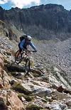
| mtb:scale | 0-5 | Applies to highway=path and highway=track. A classification scheme for mtb trails (few inclination and downhill). | 
| ||
| mtb:scale:uphill | 0-5 | A classification scheme for mtb trails for going uphill if there is significant inclination. | |||
| mtb:scale:imba | 0-4 | The IMBA Trail Difficulty Rating System shall be used for bikeparks. It is adapted to mtb trails with artificial obstacles. | |||
| mtb:description | Text | Applies to highway=path and highway=track. A key to input variable infos related to mtbiking on a way with human words | |||
| TMC:LocationCode | see description | An identifier in electronic traffic-messages. | |||
| wood | coniferous / deciduous / mixed | Applies to landuse=forest and natural=wood detailing the sort of trees found within each landuse. Makes most sense when applied to areas. | |||
| admin_level | Number | Applies to boundary=administrative and is usually in the range 1 to 10, except for Germany where it might be 11 - see boundary. | |||
| rtc_rate | A / B / C / D / F / XX | Scale rating the suitability of ways for cycling. Used by online bicycle trip planning algorithms. "A" indicates that cyclists should go well out of their way to use this route, while "F" indicates that cyclists should go far out of their way to avoid this particular way; "B" and "D" are lesser magnitudes of "A" and "F"; "C" indicates no basis of evaluation either way; and "XX" indicates ways onto which trip planning algorithms should never route cyclists. |
This table is a wiki template with a default description in English. Editable here.
