Template:IT:Map Features:basin
Se comprendi l'originale in Inglese aiuta a completare questa traduzione in italiano. Leggi le istruzioni su come tradurre questa wiki.
Sembra che nessuno stia lavorando a questa traduzione al momento, se vuoi puoi prenderla in carico tu.
Basin
Viene usato per specificare in modo più dettagliato gli oggetti di tipo landuse=basin.
| Key | Value | Comment | Photo | Rendering |
|---|---|---|---|---|
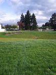
| basin | infiltration | Uno speciale bacino di infiltrazione per l'acqua piovana. Si tratta essenzialmente di un bacino artificiale poco profondo, concepito per lasciare infiltrare l'acqua piovana nella falda acquifera attraverso suoli permeabili. Durante la maggior parte delle precipitazioni i bacini di infiltrazione non scaricano nelle acque di superficie, ma sono previste strutture per gestire il traboccamento (tubazioni, dighe, ecc.) in caso di alluvione. | 
|

|
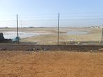
| basin | detention | Uno speciale bacino per il contenimento, per un periodo limitato, delle piene e delle acque piovane. In condizioni normali non è riempito di acqua. | 
|

|
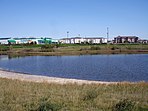
| basin | retention | Uno speciale bacino per il contenimento delle piene e delle acque piovane, che è riempito di acqua anche in condizioni normali. | 
|

|
| basin | evaporation | A basin containing water containing a dissolved substance (precipitate). These basins are used for harvesting precipitate, removing the water from hazardous waste, evaporating the precipitation that falls on a contaminated site, or preventing pesticides, fertilizers, and salts from agricultural wastewater from contaminating the water bodies they would flow into. | 
|

|
| basin | aeration | An aeration basin. | 
| |
| basin | cooling | An artificial body of water which was created to supply cooling water and/or store heat. | 
|

|
| basin | footbath | A basin containing water to clean the feet before entering a swimming pool. | ||
| basin | settling | A settling basin. Settling basins are used to treat wastewater by settling. | ||
| basin | water_regeneration | A basin with plants for the biological regeneration of water, e.g. at swimming pools. Example in OSM. |
This table is a wiki template with a default description in English. Editable here. Una traduzione può essere editata qui.
Note to editors: Please don't categorize this template by editing it directly. Instead, place the category in its documentation page, in its "includeonly" section.
Template for the basin table. Use the default English text or use the template arguments for your translations. The following parameters can also be used when inserting into the article namespace.
| Parameter | Description | Type | Status | |
|---|---|---|---|---|
| name displayed | name:displayed | With this switch the heading (‘name’) is shown.
| Boolean | suggested |
| description displayed | description:displayed | With this switch the introductory description (‘description’) is shown.
| Boolean | suggested |
Uso
{{Template:IT:Map Features:basin}}
o
{{Template:IT:Map Features:basin|name:displayed=yes/no|description:displayed=yes/no}}
Localizzazione
All parameters are optional (except name:displayed and description:displayed). By default, text is in English.
English writers shall write their comments in the template itself (avoiding double edition).
Other languages are translated in template arguments, not in the template itself.
Modello per copia/incolla (copy/paste)…
<noinclude>{{Languages|Template:Map Features:basin}}</noinclude>
{{Map Features:basin|name:displayed={{{name:displayed|yes}}}|description:displayed={{{description:displayed|yes}}}
|name=
|description=
|head:key=
|head:value=
|head:element=
|head:desc=
|head:rendering=
|head:photo=
|basin:key={{LL|1=Key:basin}}

|infiltration:value={{LL|1=Tag:basin=infiltration}}
|infiltration:desc=

|detention:value={{LL|1=Tag:basin=detention}}
|detention:desc=

|retention:value={{LL|1=Tag:basin=retention}}
|retention:desc=

}}<noinclude>
{{Documentation|Template:Map Features:basin/doc}}
</noinclude>