Template:Tr:Map Features:highway
Jump to navigation
Jump to search
| This table should not be a copy of a source of the English template! Only parameters are translated. See Template:Map Features:highway/doc for more information and a copyable version. |
| To add missing translations, go to Template:Map Features:highway/doc, copy missing parameters, paste into your language template and complete translations (the link to edit is at the bottom of the table). |
Yol
Bu etiket otoyol, bisiklet yolu, yaya yolu gibi her tür yol çeşidini haritada göstermek için kullanılır. Daha fazla bilgi için Highways sayfasına gözat. Restrictions kısmına gözatarak araç türü, zaman, ağırlık gibi sebeplerden dolayı yol kısıtlamaları hakkında daha fazla bilgi edin.
| Etiket | Değer | Uygulanabilecek Nesneler | Açıklama | Haritada Gösterilişi | Örnek | |
|---|---|---|---|---|---|---|
Anayollar | ||||||
|
Bu yollar haritadaki yol ağını oluşturan en önemli türlerdir. Önem sırasına göre yukarıdan aşağı sıralanmıştır. | ||||||
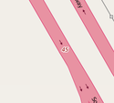
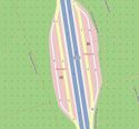
| highway | motorway | Otoyol. İki gidiş, iki gelişin yanı sıra emniyet şeridinin de parçası olduğu en az dört şeritten oluşan yol sistemi ya da otoyol. | ||||
| highway | trunk | Duble yol. İki gidiş, iki geliş şeridinden meydana gelir. Gidiş ve geliş yolları fiziki olarak (refüj gibi) birbirinden ayrı olmak zorunda değildir. | ||||
| highway | primary | Anayol. Genellikle şehirleri birbirine bağlayan, duble yol olmayan yollardır. | ||||
| highway | secondary | Yol. Genellikle ilçeleri birbirine bağlayan yollardır. | ||||
| highway | tertiary | Köy yolu. Küçük ilçeleri ve köyleri birbine bağlayan yollardır. | ||||
| highway | unclassified | Mezra/yayla yolu. Mezraları, en küçük yerleşim yerlerini birbirine bağlayan yol türüdür. Bu tür, yolun tanımlanamayan bir yol olduğunu göstermez. Yol türünden emin değilsen, highway=road türünü kullanabilirsin. | ||||
| highway | residential | Yerleşim Yeri Yolu. Yerleşim yerleri içerisinde, evleri, mahalleleri birbirine bağlan yollardır. | ||||
| highway | service | Servis Yolu. Endüstriyel bir alana, endüstriyel araç parkına giden yollar için kullanılır. service=* etiketi ile beraber kullanılarak, yolun ne amaçla kullanıldığı belirtilebilir. access=* etiketi ile yolu kimler kullanabilir ya da kullanamaz belirtilebilir. | ||||
Bağlantı yolları | ||||||
| highway | motorway_link | Otoyol Bağlantı Yolu. The link roads (sliproads/ramps) leading to/from a motorway from/to a motorway or lower class highway. Normally with the same motorway restrictions. | ||||
| highway | trunk_link | Duble Yol Bağlantı Yolu. The link roads (sliproads/ramps) leading to/from a trunk road from/to a trunk road or lower class highway. | ||||
| highway | primary_link | Anayol Yolu. The link roads (sliproads/ramps) leading to/from a primary road from/to a primary road or lower class highway. | ||||
| highway | secondary_link | İkincil Bağlantı Yolu. The link roads (sliproads/ramps) leading to/from a secondary road from/to a secondary road or lower class highway. | ||||
| highway | tertiary_link | Köy Bağlantı Yolu. The link roads (sliproads/ramps) leading to/from a tertiary road from/to a tertiary road or lower class highway. | ||||
Özel yol türleri | ||||||
| highway | living_street | living streets yayaların araçlara göre daha üstün olduğu, çocukların yolda oynamasına normal gözle bakıldığı yollardır. Türkiye'de buna en yakın gelen yol türü sokak olarak düşünülebilir. Fakat, bu tür tam olarak Türkiye'de mevcut olmadığından ötürü kullanılmaması daha uygundur. | ||||
| highway | pedestrian | Yaya Yolu. For roads used mainly/exclusively for pedestrians in shopping and some residential areas which may allow access by motorised vehicles only for very limited periods of the day. To create a 'square' or 'plaza' create a closed way and tag as pedestrian and also with area=yes. | ||||
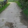
| highway | track | Tarım Yolu. Roads for mostly agricultural or forestry uses. To describe the quality of a track, see tracktype=*. Note: Although tracks are often rough with unpaved surfaces, this tag is not describing the quality of a road but its use. Consequently, if you want to tag a general use road, use one of the general highway values instead of track. | ||||
| highway | bus_guideway | Otobüs Yolu. A busway where the vehicle guided by the way (though not a railway) and is not suitable for other traffic. Please note: this is not a normal bus lane, use access=no, psv=yes instead! | ||||
| highway | escape | Rampa. For runaway truck ramps, runaway truck lanes, emergency escape ramps, or truck arrester beds. It enables vehicles with braking failure to safely stop. | ||||
| highway | raceway | Araç Yarış Yolu. A course or track for (motor) racing | ||||
| highway | road | Bilinmeyen Yol. A road/way/street/motorway/etc. of unknown type. It can stand for anything ranging from a footpath to a motorway. This tag should only be used temporarily until the road/way/etc. has been properly surveyed. If you do know the road type, do not use this value, instead use one of the more specific highway=* values. | ||||
Patikalar | ||||||
| highway | footway | Yürüyüş Yolu. For designated footpaths; i.e., mainly/exclusively for pedestrians. This includes walking tracks and gravel paths. If bicycles are allowed as well, you can indicate this by adding a bicycle=yes tag. Should not be used for paths where the primary or intended usage is unknown. Use highway=pedestrian for pedestrianised roads in shopping or residential areas and highway=track if it is usable by agricultural or similar vehicles. | ||||
| highway | bridleway | At Yolu. For horses. Equivalent to highway=path + horse=designated. | ||||
| highway | steps | Merdiven. For flights of steps (stairs) on footways. Use with step_count=* to indicate the number of steps | ||||
| highway | path | Patika. A non-specific path. Use highway=footway for paths mainly for walkers, highway=cycleway for one also usable by cyclists, highway=bridleway for ones available to horses as well as walkers and highway=track for ones which is passable by agriculture or similar vehicles. | ||||
|
Yaya yolu (Sidewalks'a gözat) | ||||||
| sidewalk | both / left / right / no | Kaldırım. Specifies that the highways has sidewalks on both sides, on one side or no sidewalk at all | ||||
|
Özel bisiklet yolu (Bicycle'a gözat) | ||||||
| highway | cycleway | Özel Bisiklet Yolu. For designated cycleways. Add foot=* only if default-access-restrictions do not apply. | ||||
|
Yolun parçası olan bisiklet yolları (Bicycle'a gözat) | ||||||
| cycleway | lane | Bisiklet Şeridi. A lane is a route that lies within the roadway | ||||
| cycleway | opposite | Her İki Yönde Bisiklet Şeridi. Used on ways with oneway=yes where it is legally permitted to cycle in both directions. Used together with oneway:bicycle=no. | ||||
| cycleway | opposite_lane | Ters Yönde Bisiklet Şeridi. Used on ways with oneway=yes that have a cycling lane going the opposite direction of normal traffic flow (a "contraflow" lane). Used together with oneway:bicycle=no. | ||||
| cycleway | track | Bisiklet Yan Yolu. A track provides a route that is separated from traffic. In the United States, this term is often used to refer to bike lanes that are separated from lanes for cars by pavement buffers, bollards, parking lanes, and curbs. Note that a cycle track may alternatively be drawn as a separate way next to the road which is tagged as highway=cycleway. | ||||
| cycleway | opposite_track | Ters Yönde Bisiklet Yan Yolu. Used on ways with oneway=yes that have a cycling track going the opposite direction of normal traffic flow | ||||
| cycleway | share_busway | Otobüsle Yolu Paylaşan Bisiklet Yolu. There is a bus lane that cyclists are permitted to use. | ||||
| cycleway | shared_lane | Diğer Araçlarla Yolu Paylaşan Bisiklet Yolu. Cyclists share a lane with motor vehicles, but there are markings indicating that they should share the lane with motorists. | ||||
| busway | lane | Otobüs Yolu. Bus lane on both sides of the road. | ||||
Planlama | ||||||
| highway | proposed | Planlanmış Yol. For planned roads, use with proposed=* and a value of the proposed highway value. | ||||
| highway | construction | Yapım Aşamasındaki Yol. For roads under construction. Use construction=* to hold the value for the completed road. | ||||
Özellikler | ||||||
| abutters | commercial/ industrial/ mixed/ residential/ retail etc. | See Key:abutters for more details. | ||||
| bicycle_road | yes | Bisiklet Yolu. A bicycle road is a road designated for bicycles. If residential streets get the status of bicycle roads, normally, by special signs, motor traffic is admitted with limited speed, often only for residents. | ||||
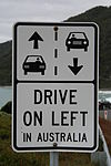
| driving_side | left/ right | Sürüş Yönü. Defines which side of the road vehicles must legally use. (must only be used on highways when they are an exception to the rule) | ||||
| ford | yes | Sığ Geçit. The road crosses through stream or river, vehicles must enter any water. | ||||
| ice_road | yes | Buz Yolu. A highway is laid upon frozen water basin, definitely doesn't exist in summer. | ||||
| incline | Number %/° | Eğim. Incline steepness as percents ("5%") or degrees ("20°"). Positive/negative values indicate movement upward/downwards in the direction of the way. | ||||
| junction | roundabout | Dönel Kavşak. This automatically implies oneway=yes, the oneway direction is defined by the sequential ordering of nodes within the Way. This applies on a way, tagged with highway=* already. | ||||
| lanes | number | Şerit Sayısı. The number of traffic lanes for general purpose traffic, also for buses and other specific classes of vehicle. | ||||
| lit | yes/no | Işıklandırma. Street lighting | ||||
| motorroad | yes/no | The motorroad tag is used to describe highways that have motorway-like access restrictions but that are not a motorway. | ||||
| mountain_pass | yes | Geçit. The highest point of a mountain pass. | ||||
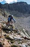
| mtb:scale | 0-6 | Applies to highway=path and highway=track. A classification scheme for mtb trails (few inclination and downhill). | ||||
| mtb:scale:uphill | 0-5 | A classification scheme for mtb trails for going uphill if there is significant inclination. | ||||
| mtb:scale:imba | 0-4 | The IMBA Trail Difficulty Rating System shall be used for bikeparks. It is adapted to mtb trails with artificial obstacles. | ||||
| mtb:description | Text | Applies to highway=path and highway=track. A key to input variable infos related to mtbiking on a way with human words | ||||
| overtaking | yes/ no/ both/ forward/ backward | Specifying sections of roads where overtaking is legally forbidden. | ||||
| parking:condition | free/ ticket/ disc/ residents/ customers/ private | Park Durumu. Specifying the parking conditions (terms). See parking:condition=* for more details. | ||||
| parking:lane | parallel/ diagonal/ perpendicular/ marked/ no_parking/ no_stopping/ fire_lane. | Park Yeri. Specifying the parking space. See parking:lane=* for more details. | ||||
| passing_places | yes | Sollama Şeridi. A way which has frequent passing places | ||||
| sac_scale | hiking / mountain_hiking / demanding_mountain_hiking / alpine_hiking / demanding_alpine_hiking / difficult_alpine_hiking | Applies to highway=path and highway=footway. A classification scheme for hiking trails. | ||||
| service | alley / driveway / parking_aisle etc. | Servis Türü. See Key:service for more details. | ||||
| surface | paved / unpaved / asphalt / concrete / paving_stones / cobblestone / metal / wood / grass_paver / gravel / pebblestone / grass / ground / earth / dirt / mud / sand | Zemin. See Key:surface for more details. | ||||
| tactile_paving | yes / no | Hissedilebilir Yüzey. A paving in the ground to be followed with a blindman's stick. | Not to be rendered on standard maps. | |||
| tracktype | grade1/ grade2/ grade3/ grade4/ grade5 | To describe the quality of the surface. See Key:tracktype for more information. | ||||
| traffic_calming | yes / bump / hump / cushion / table etc. | Trafiği Yavaşlatma. See Key:traffic calming for more details. | ||||
| trail_visibility | excellent / good / intermediate / bad / horrible / no | Görüş Durumu. Applies to highway=path, highway=footway, highway=cycleway and highway=bridleway. A classification for hiking trails visibility | ||||
| winter_road | yes | Kış Yolu. A highway functions during winter, probably can't be driven in summer. | ||||
Other highway features | ||||||
| highway | bus_stop | Otobüs Durağı. A small bus stop. Can be mapped more rigorously using public_transport=stop_position for the position where the vehicle stops and public_transport=platform for the place where passengers wait. See public_transport=* for more details. | ||||
| highway | crossing | Geçit. A.k.a. crosswalk. Pedestrians can cross a street here; e.g., zebra crossing | ||||
| highway | elevator | Asansör. Elevator | ||||
| highway | emergency_access_point | Acil Erişim. Sign number which can be used to define your current position in case of an emergency. Use with ref=NUMBER_ON_THE_SIGN | ||||
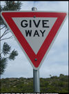
| highway | give_way | Yol Ver İşareti. A "give way," or "Yield" sign | ||||
| emergency | phone | Acil Durum Telefonu. A calling device can be used to tell on your current position in case of an emergency. Use with ref=NUMBER_ON_THE_SIGN | ||||
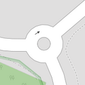
| highway | mini_roundabout | Küçük Dönel Kavşak. Similar to roundabouts, but at the center there is either a painted circle or a fully traversable island. In case of an untraversable center island, junction=roundabout should be used.
Rendered as anti-clockwise by default direction=anticlockwise. To render clockwise add the tag direction=clockwise. |
||||
| highway | motorway_junction | Otoyol Sapağı. Indicates a junction (UK) or exit (US). ref=* should be set to the exit number or junction identifier. (Some roads – e.g., the A14 – also carry junction numbers, so the tag may be encountered elsewhere despite its name) | ||||
| highway | passing_place | Sollama Yeri. The location of a passing space | ||||
| highway | rest_area | Dinlenme Alanı. Place where drivers can leave the road to rest, but not refuel. | ||||
| highway | speed_camera | Radar Kamerası. A fixed road-side or overhead speed camera. | [[
Speed Camera - geograph.org.uk - 399358.jpg|100px|center]] | |||
| highway | street_lamp | Sokak Lambası. A street light, lamppost, street lamp, light standard, or lamp standard is a raised source of light on the edge of a road, which is turned on or lit at a certain time every night | ||||
| highway | services | Dinlenme Tesisi. A service station to get food and eat something, often found at motorways | ||||
| highway | stop | Dur İşareti. A stop sign | ||||
| highway | traffic_signals | Trafik Işıkları. Lights that control the traffic | ||||
| highway | turning_circle | Dönüş Alanı. A turning circle is a rounded, widened area usually, but not necessarily, at the end of a road to facilitate easier turning of a vehicle. Also known as a cul de sac. | ||||
| highway | User Defined | All commonly used values according to Taginfo | ||||
