Track@Way
The given reason is: I don't see any significant impact on the historic development of OSM. The website is gone. Its only relation to OSM is that it supported tiled online maps. --Nakaner (talk) 08:58, 9 October 2024 (UTC).
| Track@Way | |
|---|---|
| Author: | Willy Gardiol |
| License: | GNU General Public License (free of charge) |
| Platforms: | Android, Symbian, maemo5 , and MeeGo |
| Status: | Broken |
| Version: | 2.1.5 (2014-05-29) |
| Languages: | German, English, eus, Dutch, French, Italian, Norwegian, Spanish, Russian, Finnish, Romanian, and . |
| Website: | |
| Source code: | Source available by email |
| Programming languages: | C, C++, C#, Python, and Java |
|
A fast and easy to use map and tracking software. Ability to export tracks in GPX including your recorded POIs. Different maps to choose (OSM, Mapquest etc.). Many options and a support forum. | |
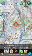
Track@Way (the former FreeTrack) is an easy to use and well done software for tracking, originally written for Nokia Symbian^3 and S60v5, but now available also for other platforms. Loads map data from the internet (you can choose between OSM-Tiles, Map Quest, Cloudmade, Opencyclemap or Wanderreitkarte). After the first start you have to get used to the oversized crosshair right in the middle of the screen and big buttons, but then everything works just more than fine. You can set the logging to every second and you have a huge POI-Button, which you can tap (don't forget to lock the map position to the crosshair before) and then enter your notes, so everything is ready for OSM use. You can record your tracks in different colors, so that after some walks in an area will not be confused. There are a lot of features like starting branches in a track, autostart tracking (triggered by your speed), using your own map scans, manual map calibration, export to gobreadcrumbs.com etc, which makes the map also useful for the advanced leisure use (which is the original goal). A very useful feature is the direct saving, so if your phone crashes or the battery is empty, the track wouldn't be lost.
The autor Willly Gardiol seems to be a enthusiastic programmer, he promised support to everyone who writes him. A supporter forum is also available. Ports to other platforms like Windows, Maemo and Meego are in the pipeline.
Note that there are some minor limitations in the free version like the number of maps you can load and the number of tracks you can have displayed (3), but that isn't a problem for the average user.
