Uk:Properties
Jump to navigation
Jump to search
Властивості
Якісні характеристики об'єктів.
| Ключ | Значення | Елемент | Пояснення | Фотографія |
|---|---|---|---|---|
| area | yes | Площа, майдан. Вживайте для позначення невластивої якості об'єкта, наприклад, коли відрізки шляху формують замкнену площину, якою можливе пересування. | ||
| brand | user defined | Brand of the feature. | ||
| bridge | yes / aqueduct / viaduct / cantilever / movable / covered / … | Міст — інженерна споруда над перешкодами шляху. Виконує ті ж самі функції, що й дорога, залізниця, водний шлях чи межигір’я, що ним проходять. | ||
| capacity | amount | Used for specifying capacity of a facility. | ||
| charge | amount | Used for specifying how much is charged for use/access to a facility. See toll=* or fee=*. | ||
| clothes | see key's page | Tagged on shops and other features to denote if they sell clothes or not and what type of clothes they sell. | ||
| covered | yes | Накриття одного об'єкта іншим (або ґрунтом). Цим тегом позначаються віднедавно арки у будинках. | ||
| crossing | no / traffic_signals / uncontrolled / island / unmarked | Перехід. Вживайте для детального позначення перетинів різних типів шляхів. | ||
| crossing:island | yes / no | Specifies whether a pedestrian crossing has a refuge island | ||
| cutting | yes / left / right | Виїмка — відрізок наземного шляху, побудований нижче від середнього рівня землі. | ||
| disused | yes | Покинуті об'єкти, якими більше не користуються, але вони залишаються орієнтиром для навігації. | ||
| drinking_water | yes / no | Describes whether a drinking water is available | ||
| drive_through | yes / no | Used to indicate if a pharmacy, bank, atm, or fast_food, or post_box offers drive_thru service. drive_through=* is different than drive_in=*} | ||
| drive_in | yes / no | Used to indicate if a cinema is a drive-in cinema or a restaurant offers drive-in service. drive_in=* is different than drive_through=* | ||
| electrified | contact_line / rail | Indicates infrastructure to supply vehicles with electricity on rail tracks | ||
| ele | Number | Вистота над рівнем моря (у метрах), за формою Геоїда моделі EGM 96, яка вживається у проекції WGS 84 (GPS). (див.також Altitude). | ||
| embankment | yes | Насип — відрізок наземного шляху, побудований вище від середнього рівня землі. | ||
| end_date | Date | Дата закриття (знесення, руйнації). | ||
| est_width | Number | Оціночна (приблизна) ширина в метрах. | ||
| fee | yes / no | Used for specifying whether fee is charged for use/access to a facility. See also toll=*. | ||
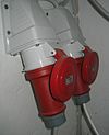
| fire_object:type | poo / szo | Potentially dangerous and socially significant objects | ||
| fire_operator | Name | Fire station, which serves the object | ||
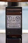
| fire_rank | 1bis / 2 to 5 | Rank fire, defined for a particular object | ||
| frequency | Number | Frequency in Hz | ||
| hazard | see hazard | Indicates of the hazards. | ||
| hot_water | yes / no | Describes whether a hot water is available | ||
| inscription | User Defined | The full text of inscriptions, which can be found on buildings, memorials and other objects. | ||
| internet_access | yes / wired / wlan / terminal / no | This tag is for indication that a map entity such as a building, a shop, restaurant, etc. offers internet access to the public, either as a paid service or even for free. | ||
| layer | -5 to 5 | Шар на мапі. Використовується для позначення рівня об'єкта у сукупності. За мовчання, звичайний об'єкт мапи має рівень layer=0. Від'ємні значення вживають для підземних об'єктів, додатні — для наземних.
Не використовуйте для «декоративних» цілей, тег має відповідати дійсності. |
||
| leaf_cycle | evergreen / deciduous / semi_evergreen / semi_deciduous / mixed | Describes the phenology of leaves | ||
| leaf_type | broadleaved / needleleaved / mixed / leafless | Describes the type of leaves | ||
| location | underground / overground / underwater / roof / indoor | Location | ||
| narrow | yes | Звуження відрізку шляху (з подальшим розширенням). | ||
| nudism | yes / obligatory / designated / no / customary / permissive | Indicates if the described object provides the possibility of nudism | ||
| opening_hours | 24/7 or mo md hh:mm-hh:mm. (read described syntax) | Години роботи. | ||
| opening_hours:drive_through | 24/7 or mo md hh:mm-hh:mm. (read described syntax) | opening_hours describes when something is open for drive-through services. | ||
| operator | User Defined | Оператор, експлуатуюча організація. | ||
| power_supply | yes / no | Describes whether a power supply is available | ||
| produce | User Defined | Describes a feature's agricultural output produced though a natural process of growing or breeding. | ||
| rental | see key's page | Tagged on shops and other features to denote if they rent something or not and what they rent. | ||
| sauna | yes / no | Describes whether a sauna is available | ||
| service_times | see opening_hours | Times of service of a given feature e.g. church service | ||
| shower | yes / no | Describes whether a shower is available | ||
| start_date | Date | Дата відкриття (заснування, побудови). | ||
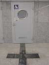
| tactile_paving | yes /no | Бруківка для сліпих — спеціальний різновид бруківки з певним рельєфом для полегшення пересування незрячих людей або для їх попередження про небезпеку поруч. | ||
| tidal | yes | Area is flooded by the tide | ||
| toilets | yes / no | Describes whether a toilets is available | ||
| topless | yes / no | Indicates if the described object provides the possibility of female topless practice | ||
| tunnel | yes | Тунель — інженерна споруда під поверхнею гірських порід, води або під іншими спорудами; шлях для пересування наземних видів транспорту, місце розташування ліній передач. | ||
| toilets:wheelchair | yes / no | States if a location has a wheelchair accessible toilet or not. | ||
| wheelchair | yes / no / limited | Режим доступу для інвалідів на візках. | ||
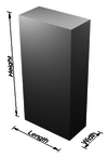
| width | Number | Ширина (шляху) в метрах. | ||
| Тип лісу: хвойний, листяний, змішаний. Вживайте разом з landuse=forest, або natural=wood. |
Редагувати український шаблон.
