User:Ekidd/Coastal Maine problems
Coastal Maine contains a lot of old, raw imports, and very few local edits. The map is ugly (because of incorrect county borders) and Nominatim is frequently unable to find street addresses.
The county lines are wrong
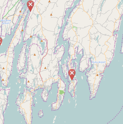
The existing county lines are based on a very old import. They attempt to trace the coast line, but they do so badly: They frequently pass through inland areas, chop off small peninsulas, and ignore mid-river islands.
Two of the three "notes" on the map are local editors complaining about the county border.
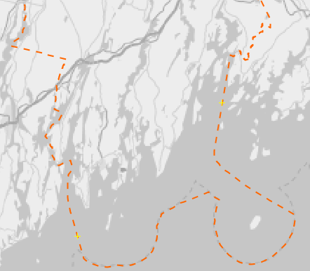
Here's the TIGER 2014 shapefile for the same county:
This is a much simpler border. It includes all the islands it should include, it omits all the things it should omit, and it runs down the middle of the river when it's supposed to do so.
The town hierarchy is confused
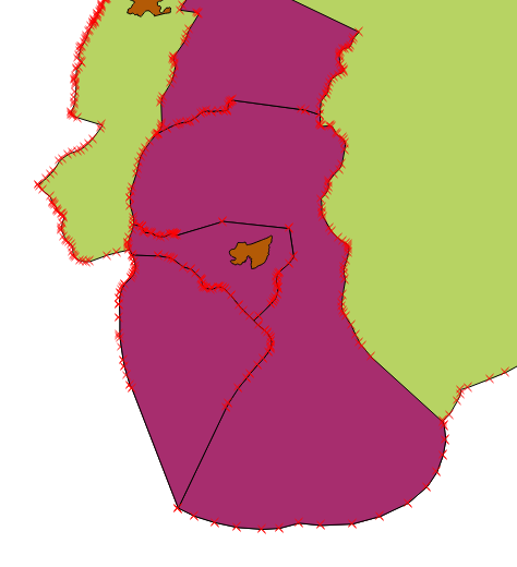
This is hard to explain using the existing map, so let's load some selected TIGER 2014 data into QGIS and take a look.
- Green: Lincoln county (from TIGER County). A bad version of these boundaries is one the map already, as mentioned above.
- Purple: Four selected towns (from TIGER County Subdivision). These are, from top to bottom, Edgecomb, Boothbay, Boothbay Harbor and Southport. All of the other towns are available; I'm just showing four for illustrative purposes.
- Brown: TIGER Place data. Only two places are available for this region. The brown blob in the middle of Boothbay Harbor is a subdivision of Boothbay Harbor, also known as "Boothbay Harbor". Other subdivisions (not shown) include "West Boothbay Harbor," etc. Similarly, Boothbay is divided into "Boothbay", "East Boothbay", "Trevett" (which may just be a Post Office) and "Bayville". As I understand it, these subdivisions date from a time before cars, when everybody wanted a Post Office within walking distance. A reasonable version of these boundaries is on the map already, but coverage so spotty as to be most useless.
I think the right solution here is to start with the purple towns. These are the actual town administrative boundaries, and we have comprehensive shapefiles for them. The brown places would be nice to have—and many of them have their own zip codes—but we usually only have GIS points.
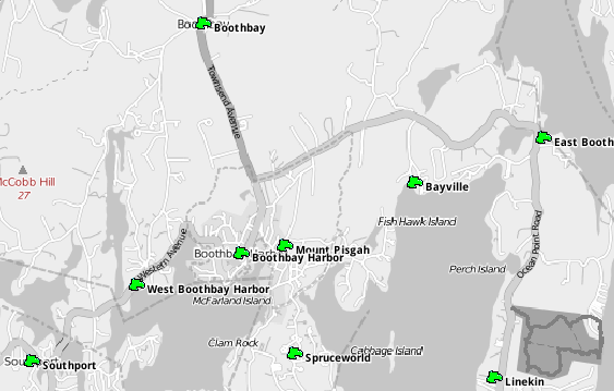
The towns are represented as GNIS nodes
Right now, the majority of the town information present on the map is actually gnis:Class="Popuplated Place" nodes. These correspond to the brown "sub-town" divisions shown on the map above, but they're far more complete.
Cleanup options
Here are some things which might help. Please note I have no intention to do all this on my own. At most, I'd be willing to tackle the Boothbay peninsula, or maybe Lincoln county.
- Replace the coastal county data with TIGER 2014. This will fix those county lines that swerve randomly over the the entire coast, and get all the offshore islands in the right county.
- Add in county subdivisions from TIGER 2014. As far as I can tell, these are the actual town boundaries.
- Leave the handful of existing "sub-town" boundaries from TIGER Places where they are, but maybe drop them to admin_level=9 or something.
This was proposed, but it doesn't seem to be needed:
- Try to figure out if there's any way to make the gnis:Class="Popuplated Place" nodes play semi-reasonably with Nominatim. Update: It looks like Nominatim is happy to prefer town boundaries over standalone GNIS points. This may still leave us with other issues (especially sub-towns with their own zip codes), but it's a good start.
Experimental edits 1: Fixing 4 towns in Lincoln County
Here are some changesets which try to improve this situation:
- Import TIGER County Subdivisions for 4 towns
- Drop boundaries inside town ("brown", above) to admin_level=9
Whoo-hoo! Nominatium is now returning semi-useful results!
Experimental edits 2: Fixing Lincoln County
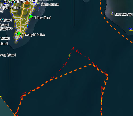
This required minimally touching up borders with Sagadahoc and Knox counties, and connecting the town/county lines to the 3-mile limit, which was already a near-exact match with the TIGER shapes. There was one noticeable difference near Monhegan Island.
Still, with any luck, this should be massive net improvement over the old Lincoln County data. IF YOU THINK THIS CHANGE NEEDS TO BE REVERTED, PLEASE GO AHEAD AND DO IT AND EXPLAIN WHY. I won't mind. I'm a newbie, especially with large scale work like this.
