User:FredrikLindseth/mapathonplanning
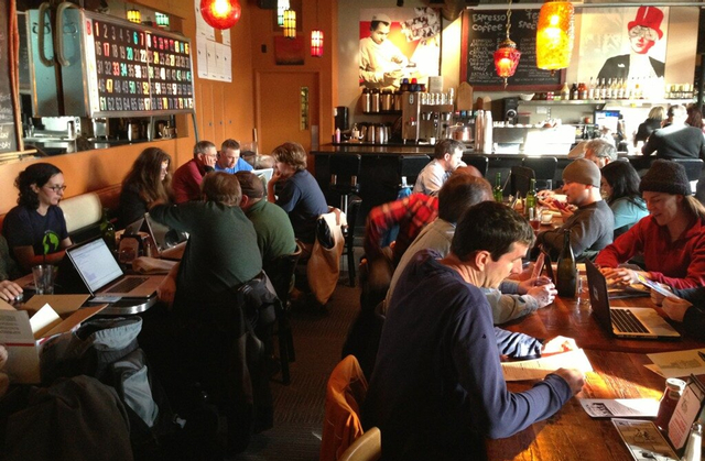
Mapathon in Bergen
How to come prepared
- Locate an editor to edit the map with for you favourite platform: ID (in browser), JOSM (all plattforms), Vespucci (android), maps.me (android, iOS)
- Create an OpenStreetMap user
- Try to map around your home, your workplace, the road in between
- Gather Mapillary images
- Take a walk/drive and survey for the Mapathon
Bergen is decently mapped, but no category is 100% complete, and usage of the map is still quite low.
It would be nice to get some people together and make the map better and thats what this mapathon is about!
What to map
This is a suggestion for a prioritised list of things to map (see below for details).
The points are prioritised after "what can be most useful to have completely mapped"
- Streetview-pictures for Bergenhus (see 1.4.1)
- Mapping for cars
- Buildings
- Mapping for bicycles
Mapping for cars
This point doesn't require a huge effort to get 100%. Most roads are already in Bergen. Many restrictions and speed limits are in place.
- Add missing speed limits in Bergen (overpass query) Major roads without speedlimits
- Bergenhus: Challenge link [1] http://overpass-turbo.eu/s/rVb
- Årstad http://overpass-turbo.eu/s/rVc
- Laksevåg http://overpass-turbo.eu/s/rVd
- Fyllingsdalen http://overpass-turbo.eu/s/rVe
- Ytrebygda http://overpass-turbo.eu/s/rVf
- Åsane http://overpass-turbo.eu/s/rVg
- Fana http://overpass-turbo.eu/s/rVh
- Arna http://overpass-turbo.eu/s/rVi
- Add turn-lane-restrictions, stop restrictions, roads with multiple lanes, public transport-lanes, surface to roads
- Parking places in Bergen centrum. Where are they. How long can you park. What's the price to park.
- Parking without access-tags http://overpass-turbo.eu/s/rVj
- Parking without any outline (only a node) http://overpass-turbo.eu/s/rVk
- Parking with only a parking-tag http://overpass-turbo.eu/s/rVp
Mapping buildings
- Add all outline of buildings in Bergen
Ortophoto-offset, building data from kartverket-data.
- Add building levels in for all buildings (~4200 buildings 2017 sept) Challenge link: [2] http://overpass-turbo.eu/s/rUU
- 3D-tagging of iconic buildings like churches, Grieghallen, Bryggen, Bergenhus fortress, etc. See Simple_3D_buildings for tagging-examples. The goal is this: New York San Francisco
- Add names to buildings that have names (Grieghallen), and remove name of those that dont (A building with only Narvesen in it is not name=Narvesen, but building without name and shop inside)
Mapping for bicycles
- Locate and map all bicycle parkings in Bergen. Map if they are covered/roofed, if they are supervised and who can access/use them.
- Map all bicycle lanes. Some new have popped up recently. Some other that are not mapped (The flat areas along Vestre Torggate, Olav Kyrres gate)
- Map the surface of highways and bicycle lanes
- Add mountain biking trails so MTBmap.no can be used. See No:Mountain_biking
Mapping for public transport
- ENTUR is using OpenStreetMap to route between public transport stops in their upcoming Nasjonal Ruteplanlegger. They don't use OpenStreetMap for the public transport routes or stops, but to get people to and between stops.
- Add bus stops from ENTUR-data
- Add bus-routes from ENTUR-data
Mapping for humanitarian efforts
- Humanitarian_OSM_Team
- Missing maps
Mapping points of interest / shops, restaurants etc
- Map all shops, hotels, restaurants, pubs, etc
If we have Mapillary we can look there, it not, out and walk around,
- Opening hours and details to all shops, hotels, restaurants, pubs, etc
- shops without opening hours. Challenge link [3] - http://overpass-turbo.eu/s/rUX
- restaurants without opening hours - http://overpass-turbo.eu/s/rV1
- bar, pub and nightclub without opening hours - http://overpass-turbo.eu/s/rV2
- assorted amenities without opening hours. Challenge link: [4] http://overpass-turbo.eu/s/rV4
- Many commercial centres around Bergen are in need of detailed mapping. One could add all shops, parking, footways.
For example Nesttun Senter, Laguneparken, Øyrane Torg, Åsane Senter, Sartor Senter, Osøyro, Oasen, Vestkanten
Map for the hiking map
- Add missing hiking trails in the mountains in Bergen/Hordaland
- Add details to already existing routes, see No:Map_Features#Turkart for examples of how to tag
- Add mountain peaks, names for areas/farms, bays, streams.
- Camping sites, fireplaces, bridges, kiosks and cafes that are hiking-friendly (hiking=yes)
Mapping for pedestrians
- Map your local Public Garden / Park / Playground
- Check that all roads have sidewalks
- Most roads in Bergenhus have a sidewalk=* tag, but not many roads outside this part of the city.
- Show sidewalks with JOSM map paint-style
- Draw separate footway=sidewalk
- Find roads that are missing sidewalks: (overpass query for roads without sidewalk=* or footway=sidewalk)
Development & other
Development task and other not directly mapping-related tasks
TODO on this page
- find/create poster to hang up
- have a userlist to invite and write the invitation
- find written and video guides to get people started
- invent hashtag to use on social medias
- Maybe invite local government to talk about GIS data and tell them about OSM
Location
Find a place to hold the mapathon.
Requirements:
- Tables to put laptops
- Power to charge laptops and phones
- WIFI coverage to connect to the internet
- Room for x people
When
Decide on a date
Invite people
- BLUG
- osm-no-mailing list
- #osm-no
- posters aroundd bergen, UiB, library, ???
- users who have mapped in Bergen, whodidit
- other: Meetup, eventbrite
