User:Leojth/Archive
Old stuff archived
Diary
2009
23 feb 2009: Skövde is now completed. I've also tracked the old railway Åsarp-Vartofta and Vartofta-Kälvene.
25 jan 2009: Skultorp village south of Skövde completed. Also walked the old railway line between Stenstorp and Dala.
2008
31 dec 2008: Merry Christmas and a Happy New Year!
23 nov 2008: Tibro completed.
23 oct 2008: Grästorp completed. Also started to work on the national and regional cycle network in my area (Sverigeleden and Västgötaleden).
2 aug 2008: I've got a MegaStar award :)
18 apr 2008: Nossebro completed.
31 mar 2008: More of the railway network complete, after a trip to Halmstad this weekend. Also mapped some towns: Herrljunga 75%, Nossebro 90% and Grästorp 50%.
12 feb 2008: Took a railway trip around lake Vättern, so now the main railway line between Stockholm and Malmö/Copenhagen is complete.
12 jan 2008: I was interviewed by the local newspaper Falköpings Tidning about the OSM progress in Falköping. The article was published jan 17th.
2007
24 dec 2007: Merry Christmas!
13 nov 2007: Lots of things has happened. Skara is now 100% covered and Tidaholm is about 75% covered. Also started to work on Skövde, but it's a bit larger then any town I've mapped so far. Someone living in Skövde who can help me? :)
I've also attended to the second mapping party in Sweden which took place in Västerås (see Västerås 2007-10-13 for details). Thank you all for a nice weekend!
1 sep 2007: Example page is published and now working on retagging some of the roads near Falköping according to the examples.
12 aug 2007: Currently working on an example page for tagging roads in Sweden.
6 may 2007: Finally, Västra Stambanan - the main railway line between Stockholm and Gothenburg is complete. There was a piece missing between Hallsberg and Katrineholm and I've tried to track it several times. But this wednesday I got it!
I have also spent time on mapping lake Vättern, the second largest lake in Sweden. The northern part however contains a great number of islands which I didn't had time to map so feel free to adjust the coastline.
10 apr 2007: Bohusbanan is now completed after a trip to Strömstad last weekend.
10 mar 2007: Vara is now completed.
18 feb 2007: Discovered a cool new feature in JOSM today: "Draw segment order numbers". Great for ensuring that street names are rendered correctly in osmarender.
11 feb 2007: Currently working on mapping the remaining public roads around Falköping. Has also covered about 80% of Vara, a small town nearby with 3800 inhabitants.
29 jan 2007: All villages with more then 200 inhabitants in the minicipality of Falköping are now mapped and the slippy map starts to look really nice. I've also so far covered about 60% of the railway network in Västra Götaland.
8 jan 2007: Continuing to map the municipality of Falköping and has covered almost all major villages now and about 50% of the public roads.
2006
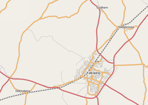
10 nov 2006: Falköping is now completly mapped, regarding car-streets anyway.
Projects
| Project | Percentage done | Comment | Map link |
|---|---|---|---|
| Cycle network Västgötaleden | 50% | Västgötaleden | |
| Herrljunga, car streets | 80% | Herrljunga | |
| The railway network in Västra Götaland | 90% | Missing: Lysekilsbanan | Västra Götaland |
Completed
| Project | Percentage done | Comment | Map link |
|---|---|---|---|
| Skövde, car streets | 100% | Skövde | |
| Skultorp, car streets | 100% | Skultorp | |
| Grästorp, car streets | 100% | Grästorp | |
| Nossebro, car streets | 100% | Nossebro | |
| Tidaholm, car streets | 100% | Completed by another user | Tidaholm |
| Skara, car streets | 100% | Skara | |
| Vara, car streets | 100% | Vara | |
| Public roads in the municipality of Falköping | 100% | Roads with blue destination signs | |
| Villages in the municipality of Falköping | 100% | Villages with 200 inhabitants or more | |
| Falköping, car streets | 100% | Falköping |
