User:Reneman
| This user is a Wiki-Administrator. |
| This user hails from Germany |
Mein Profil, meine Änderungen, meine Statistik und meine Nachbarn.
Read more on Wikipedia: ![]() reneman (de)
reneman (de)
or ![]() reneman (commons)
reneman (commons)
Links:
| Reneman submits data to OpenStreetMap using Potlatch 2. |
| Reneman uses a computer running Windows XP. |
Sonstiges:
- Gipfel-Panorama
- Steckeschlääferklamm
- letzter Urlaub
- openmapsurfer.uni-hd.de
- Stadtplan erstellen siehe auch: http://fieldpapers.org
- Luftbilder des Bundesamt für Kartographie und Geodäsie (BKG) Unfrei!!
- DE:Wiki Help
Lösung versteckt
{{Diskussion | Hier steht der unsichtbare Text}}
Zu diesem Thema gibt es eine Diskussion, beteilige dich hier im Diskussionsbereich
Hier steht Diskussion 1
- Hier steht Diskussion 2
- Hier steht Diskussion 3
(mit der Template:Lösung versteckt, die lediglich andere "Buttons" benutzt):
Das schreibt man:
{{Lösung versteckt|Dieser Text sollte zunächst versteckt sein.}}
PopUp
Inhalte 1
Inhalte 1.1
Hallo Überschrift
Teaser
div links und rechts
tooltip
HTML HTML HTML CSS CSS Wikipedia:de
<style type="text/css">
a.tooltip {outline:none; }
a.tooltip strong {line-height:30px;}
a.tooltip:hover {text-decoration:none;}
a.tooltip span { z-index:10;display:none; padding:14px 20px; margin-top:60px; margin-left:-160px; width:240px; line-height:16px; }
a.tooltip:hover span{ display:inline; position:absolute; border:2px solid #FFF; color:#EEE; background:#000 url(src/css-tooltip-gradient-bg.png) repeat-x 0 0; }
.callout {z-index:20;position:absolute;border:0;top:-14px;left:120px;}
/*CSS3 extras*/ a.tooltip span { border-radius:2px; -moz-border-radius: 2px; -webkit-border-radius: 2px; -moz-box-shadow: 0px 0px 8px 4px #666; -webkit-box-shadow: 0px 0px 8px 4px #666; box-shadow: 0px 0px 8px 4px #666; opacity: 0.8; }
</style>
<a href="#" class="tooltip"> Tooltip <img class="callout" src="src/callout_black.gif" /> Most Light-weight Tooltip
This is the easy-to-use Tooltip driven purely by CSS. </a> <a href="#" class="tooltip"> <img src="../img/demo/css-tooltip-image.gif" /> <img class="callout" src="src/callout_black.gif" /> CSS only Tooltip
<img src="../img/demo/css-tooltip-image.gif" style="float:right;" /> Pure CSS popup tooltips with clean semantic XHTML. </a>
weitere Vorlagen
- Allgemeines: Wiki organisation
- Template:Wikipedia
- Template:Ambox
- Template:Navigation bar
- Template:Popup
- Template:KeyDescription
- Template:ValueDescription
- Template:Please link images
- Template:Please link pages
- Template:welcome
Abandoned
- DE:Tag:amenity=nursing_home
- DE:Tag:amenity=emergency phone
- Tag:amenity=public_building
- Tag:amenity=firepit
Approved Proposols
- Special:WhatLinksHere/Template:Approved_feature_link
- Category:Proposals admin
- Category:Pages using the Proposal Page template
- Proposed features
other
{{Tag|name}} Kein Inhaltsverzeichnis: __NOTOC__
![]()
![]()
![]()
![]() Dr&mx Mattes191 Manfred
Dr&mx Mattes191 Manfred
Image-Kategorien
- Category:Icon
- Category:OpenStreetMap icon
- Category:Cycle routes
- Category:Trail markings
- Category:Road sign
- Category:Mapnik Rendering Examples
Backup für Proposed features/man_made=embankment
Information
You love another Language? Proposal's speak English. But you can add for you and all Users of your Language the same message in the template:
{{MyLang|Language-ISO-Code|statement}}. This simplifies creation of a future multilingual documentation. If you need to translate your statement into English, then save them in your original language. Read in German., Read in French.
Please support the proposal. Together we can find a solution for all. Read in German., Read in Italian.
| embankment values | |
|---|---|
| Proposal status: | Draft (under way) |
| Proposed by: | reneman |
| Tagging: | man_made=embankment |
| Applies to: | |
| Definition: | A embankment is a natural or artificial earth construction |
| Statistics: |
|
| Rendered as: | 
|
| Draft started: | 2013-03-08 |
Gedankenstütze:
Wikipedia
Initial Situation
Three different attributes for a embankment. Read in German.
- embankment=yes → In transportation an embankment is a raised bank to carry a road, railway, or canal. In use with highway=*. Read in German.
- man_made=embankment → Exactly as embankment=yes, but as a separate object
 . Read in German.
 - man_made=dyke → An artificial embankment built to restrict the flow of water or other liquids. Also known as a levee. Read in German.
What is a embankment
An embankment is a natural or artificial longitudinal rising ground. These are for example slopes or dams. Read in German.
Related Attributes
A broad overview of similar attributes. Read in German.
- natural=cliff → A cliff on the coast Read in German.
- natural=arete → A Arête is a thin, almost knife-like, ridge of rock. Read in German.
- natural=ridge → A ridge is a series of peaks Read in German.
- natural=dune → Rise of sand, which is fanned by the wind and deposited. Partially covered with grass. Read in German.
The Problem
- Many mappers seeking greater opportunities for different embankment types Read in German.
- Many mappers wish a uniform and practical documentation Read in German.
- Many mappers do not understand why there are three different attributes for embankments Read in German.
- Many mappers should not know how to draw a embankment Read in German.
- All three attributes are not Approved Read in German.
The problem is shown in Table: Read in German.
| Key | Value | Use count | one quarter later |
|---|---|---|---|
| embankment | yes | 45 656 | 48 660 |
| embankment | true | 121 | 134 |
| embankment | left | 159 | 328 |
| embankment | right | 94 | 117 |
| embankment | both | 27 | 28 |
| embankment | levee | 72 | 72 |
| embankment | Sichtschutzwall | 2 | 2 |
| embankment:right | yes | 87 | 66 |
| embankment:left | yes | 70 | 28 |
| right:embankment | yes | 2 | 2 |
| left:embankment | yes | 2 | 2 |
| embankment:type | sand_wall | 3 | 3 |
| embankment_type | noise_barrier | 2 | 2 |
| man_made | embankment | 2 673 | 3 702 |
| man_made | dyke | 4 424 | 4 467 |
| manmade | dyke | 6 | 6 |
| man_made | dike | 1 279 | 1 270 |
| man_made | levee | 24 | 28 |
| natural | embankment | 12 | 12 |
| natural | dike | 5 | 5 |
| barrier | embankment | 5 381 | 5 084 |
| barrier | dyke | 4 | 4 |
| waterway | dyke | 14 | 14 |
| waterway | dike | 12 | 10 |
| Sum | 60 131 | 64 046 | |
| Stand: | 08.03.2013 | 08.06.2013 | |
Proposal
This Proposal-Site to establish a uniform tagging scheme and will be used (by vote) as the basis for a detailed and comprehensive documentation. This includes agreeing on uniform Key's and the vote on the values to use (value). Finally, it should be documented with the use of examples. Read in German.
Example:
- man_made=embankment → Here is a embankment. Read in German.
- 2. embankment=* → The embankment is on the right/left/both. Read in German.
- 3. embankment:type=* → Type of embankment. Read in German.
Tags
embankment=*
| Key | Value | Beschreibung |
|---|---|---|
| embankment=* | right | Die Böschung befindet sich rechts vom Way |
| embankment=* | left | Die Böschung befindet sich links vom Way |
| embankment=* | both | Die Böschung befindet sich beidseitig |
| embankment=* | yes | Gleich setzen mit "both"?, yes sollte nicht verwendet werden, zu unspezifisch |
Die Ausrichtung orientiert sich an der Zeichenrichtung.
embankment:type=*
| Key | Value | Description | Picture |
|---|---|---|---|
| embankment:type=* | Levee / Dyke / Dike | Deich - Hochwasserdamm | 
|
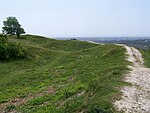
| embankment:type=* | rampart | Schutzwall, Grenzwall |    
|
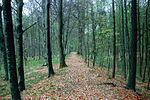
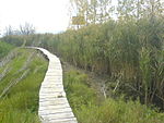
| embankment:type=* | Corduroy road | Knüppeldamm (siehe auch bridge=boardwalk) | 
|
| embankment:type=* | noise protection embankment | Lärmschutzwall | |
| embankment:type=* | railway | A Embankment for the railway. Read in German. |   
|
| embankment:type=* | transportation, causeway | Please Help! | |
| embankment:type=* | Your Idea | Please Help! |
Tags die in diesem Zusammenhang gebraucht werden
Rendering
aktuelle Situation
Osmarender: like embankment=yes (rendered using dark brown) using dark green color at z17 and z16
Comments
Ambox: Bitte ergänze deine Kommentare hier. Bitte unterzeichne mit --~~~~
Voting
Voting is not open yet, please take part you in the discussion.