User:UrSuS
I mostly draw Ventspils and Riga
In work:
- UrSuS Kosmos Rules icons project
- Ventspils
My devices:
- May 2007 - now: PDA Asus A636N (now hangs very often) with Noni GPSPlot(in car\pedestrian)
- October 2009 - now: Garmin Oregon 300 (offroad\bicycle\pedestrian)
- February 2010 - now: Motorola Milestone
Amenity
| OSM Tags | Description | Road signs | Photo | Road surface | |||
|---|---|---|---|---|---|---|---|
| Paved | Unpaved | ||||||
| highway=trunk | Main roads (Marked with A/E) |
|
surface=asphalt | N/A | |||
| highway=primary | Regional roads (Marked with P) |
|
surface=asphalt | surface=compacted or surface=gravel
Some "P" road sections might be gravel (for example P23) | |||
| highway=secondary | State Local roads (Marked with V) |
|
surface=asphalt | surface=compacted or surface=gravel | |||
| highway=tertiary | Main city roads (Sometimes marked with C (For example near Riga Airport and Mārupe)). | surface=asphalt | surface=compacted or surface=gravel | ||||
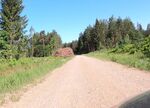
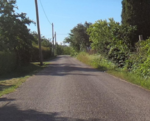
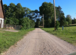
| highway=unclassified | Roads with local traffic outside city\town or inside city\town, but not in residential areas.
Usually wider than 1 lane (cars from different directions can pass each other) and intended for trucks ( Most common roads of this type are roads operated by LVM and marked with special sign. Cars usually drive with speed up to 80km\h. |
|
surface=asphalt | surface=compacted or surface=gravel | |||
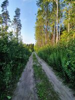
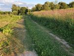
| highway=track | Usually roads in woods, countryside. But can also be present in Similar to "unclassified" but are 1 "lane" wide and as "track" name indicates usually have track from wheels with strip of grass (or dirt) in the middle. When two cars approach each other from opposite directions, each is expected to move away from the centre of the road and use only one strip until the other car has passed. Cars usually drive with speed up to 30km\h. tracktype=grade1 - Usually paved surface. Example: concrete plate roads built by soviet army to military objects. tracktype=grade2 - Unpaved surface. Similar to unclassified, but 1 lane wide. Does not have stipe of grass diving track from wheels. tracktype=grade3 - Unpaved surface. Most roads in countryside leading to place=isolated_dwelling. tracktype=grade4 - Unpaved surface. Most of the small roads in Latvian woods. |
|
Only applies to tracktype=grade1 | Applies to grade2-grade5 | |||
| highway=residential | Roads in town\city residential areas, usually with max speed 30-50km/h | ||||||
| highway=living_street | Roads in town\city residential areas marked with special sign, where max speed is 20km/h | ||||||
| highway=service | Generally for access to a building, gas station, service station, beach, campsite, industrial estate, business park, etc.
This is also commonly used for access to parking, driveways, alleys and inside industrial areas. Not used for "Thru traffic". service=driveway - Driveway to private houses, often marked with "private property"" signs. service=parking_aisle - A parking aisle is a service road that passes between one or two rows in parking (amenity=parking). |
surface=asphalt | |||||


