User:Waldhans/3D Buildings
current (08-Jul-2014), we have no solid base to display OSM objects in 3D. The problems:
Multiple tagging schema:
Different (online) render apps
and to make it more complex, some offline versions of an online render differ significantly.
The development on OSM2World seems to be restarted. The offline renderer works 'fine' now. Update of the online version is too slow for development, so download the java software!
Maybe the best online renderer for the following example is F4map. Try Burg Uda, quality and handling is ok.
Burg Uda
Due to a remark from User:GB Germany Vie, I took the castle as a first example. Bad idea, since it's a closed ring with different parts. Seem more the worst case to start. Since there is no documentation (false, there is a lot of it), I started by downloading a complex building (some hospital) and found following procedure:
- split object into parts (different height/material/roof)
- gather the outline to a single way
- build inner way(s) and create a unnamed multi-polygon
- now create a relation with type-building and add
- all building parts
- the multi-polygon inner/outer
Tagging
- the building parts get height/levels material/color
- the outer outline get all 'building' tags:
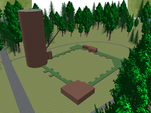
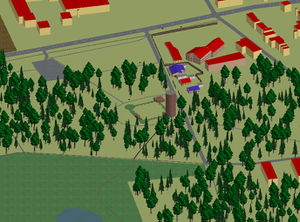
offline example:
input data: OSM
with some good will, you can see the real-world situation;
The updated osm2world delivers a acceptable picture (clipped):
online links
| name | online links |
|---|---|
| OSM Buildings | http://osmbuildings.org/?lat=51.32225&lon=6.37790&zoom=20 |
| OSM2World | http://maps.osm2world.org/?zoom=18&lat=51.32202&lon=6.37791&layers=B0TTFF |
| F4map | http://demo.f4map.com/#lat=51.3222714&lon=6.3775355&zoom=19 |
| OSM 3D | not tested, WebGL version missing (Sep-2014) |
Tag definitions
| Result | OSM Buildings |
|---|---|
| height | height, building:height, levels, building:levels |
| minHeight | min_height, building:min_height, min_level, building:min_level |
| wallColor | building:color, building:colour, building:material, building:facade:material, building:cladding |
| roofColor | roof:color, roof:colour, building:roof:color, building:roof:colour, roof:material, building:roof:material |
| shape | building:shape[=cylinder,sphere] |
| roofShape | roof:shape[=dome] |
| roofHeight | roof:height |
St. Cornelius in St. Tönis (currently broken)
http://www.openstreetmap.org/relation/3681796
Church is modeled nicely with 11 parts; building heights seems to be taken from plan. Problem: not rendered on F4map and OSM2World, broken on osmbuildings; maybe for some special application?

