User talk:Depci
SKENARIO BANJIR KELURAHAN DADOK TUNGGUL HITAM, KECAMATAN KOTO TANGAH, KOTA PADANG
NAMA
Depci Ardadi
Username OSM: Depci
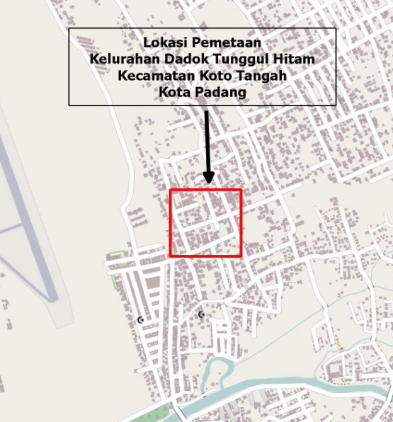
LOKASI PEMETAAN
Lokasi pemetaan berada di perbatasan tiga RT antara RT/2 RW/III dengan RT/5 RW/III dan RT/2 RW/IV Kelurahan Dadok Tunggul Hitam Kecamatan Koto Tangah Kota Padang.
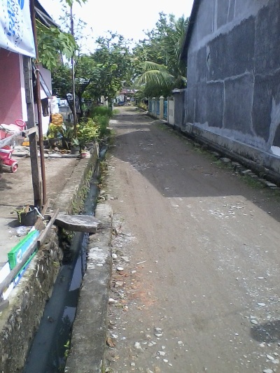
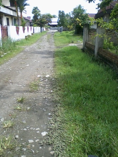
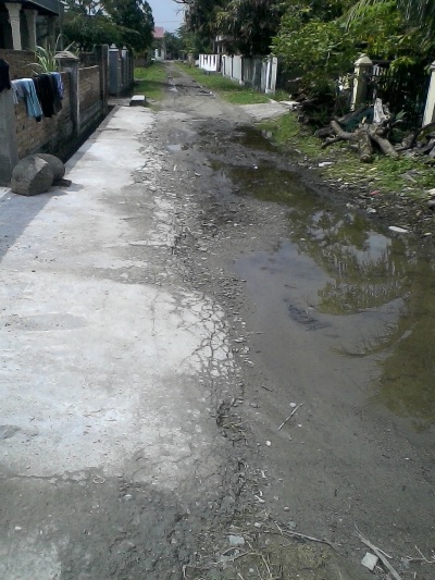
Di beberapa tempat dilokasi ini sering terjadi banjir genangan, dengan ketinggian air antara 30cm sampai 50cm, sehingga meredam beberapa rumah masyarakat.
Banjir ini disebabkan karena kurang bagusnya saluran air serta diperparah dengan terdapatnya cekungan (dataran rendah) yang dijadikan tempat pemukiman masyarakat.
Banjir genangan ini akan terjadi apabila hujan lebat turun lebih dari 3 jam, maka air akan menumpuk pada daerah cekungan dan terus akan naik serta meredam rumah yang berada didaerah cekungan tersebut.
Oleh karena itulah, daerah ini perlu untuk dilakukan pemetaan dalam rangka mempersiapkan masyarakat untuk penanggulangan bencana banjir di masa yang akan datang.
METODOLOGI PENGUMPULAN DATA
Pengambilan data dilapangan dilakukan selama satu hari dengan memakai GPS dan kertas walking papers.
Data yang akan diambil dilapangan berupa data fungsi bangunan, struktur bangunan, data jalan serta treck jalan yang ada pada daerah tersebut.
Setelah semua data yang dibutuhkan telah lengkap diambil, maka baru lah dimulai melakukan digitasi dengan memakai program JOSM.
HASIL PEMETAAN
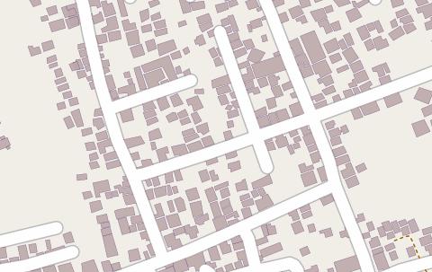
Setelah dilakukan digitasi dengan cara memasukan semua data, baik itu data jalan, fungsi bangunan dan struktur bangunan yang didapat pada saat survey lapangan,maka dapat dilihat terjadinya perubahan pada peta seperti sreenshoot diatas
Data yang telah diupload pada JOSM ini, nantinya akan didownload lagi pada Hot Export untuk dijadikan data Exposure untuk pembuatan skenario banjir pada program InaSafe.
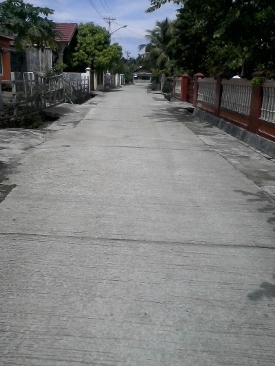
DOKUMENTASI PELAKSANAAN SURVEY
ANALISIS
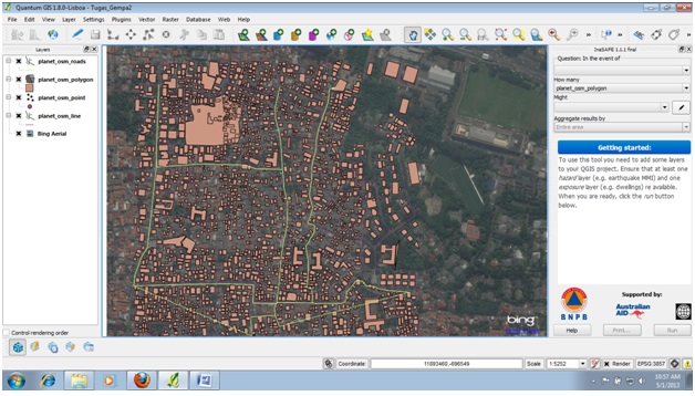
Analisis dilakukan dengan cara membuat plotting daerah yang terdampak banjir dengan memakai program Qgis, data daerah terdampak banjir ini nantinya yang akan dijadikan data Hazard,sedangkan data bangunan yang didownload pada Hot Export akan dijadikan data exposure.
Dengan telah adanya data hazard dan data exposure baru dibuat skenario banjir dengan memakai program InaSafe, yang hasil akan terlihat jumlah bangunan yang terdampak banjir dan yang tidak terdampak banjir.
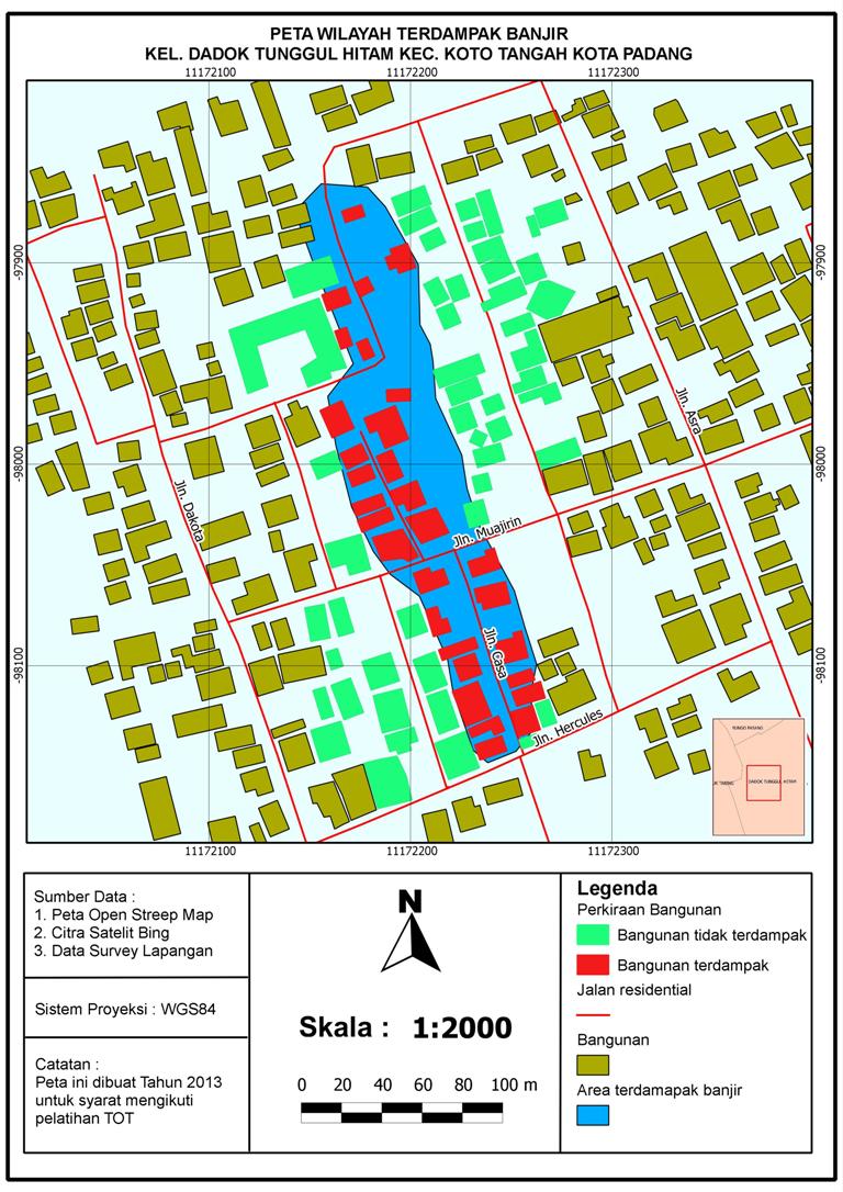
Berikut ini adalah hasil pemodelan dan perkiraan bangunan terdampak banjir dengan InaSAFE.
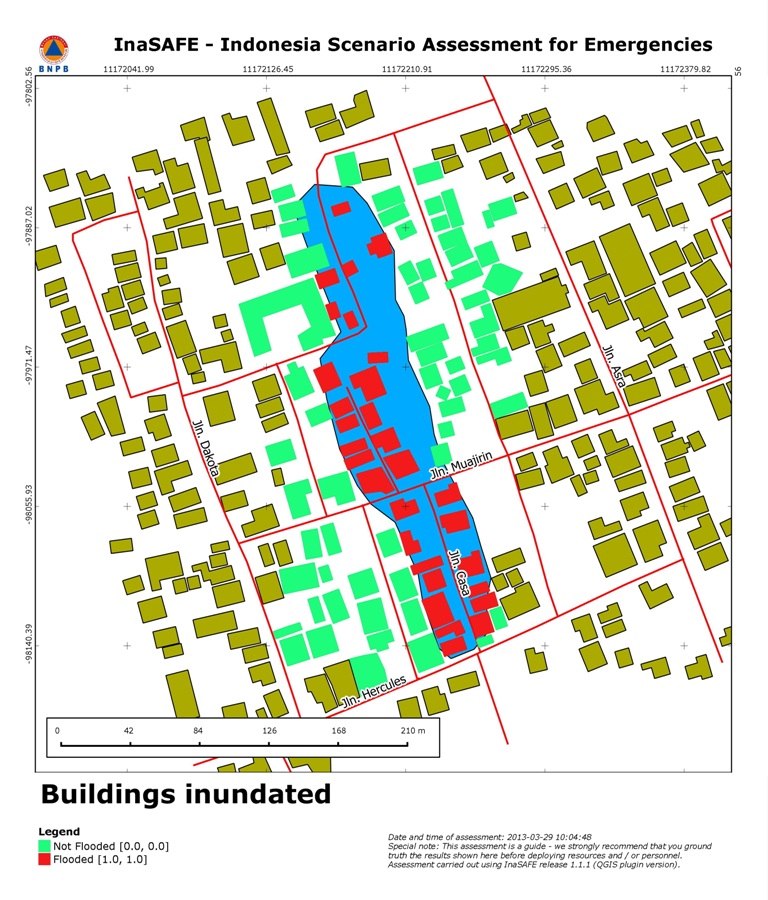
Dari 91 bangunan, terdapat 30 bangunan yang terdampak banjir (ditandai dengan warna merah), sedangkan 61 bangunan lainnya tidak terdampak banjir (ditandai dengan warna hijau).
Peta Wilayah Terdampak Banjir
Missing file information
Hello! And thanks for your upload - but some extra info is necessary.
Sorry for bothering you about this, but it is important to know source of the uploaded files.
Are you the author of image File:Dep.jpg ?
Or is it copied from some other place (which one?)?
Please, add this info to the file page - something like "I took this photo" or "downloaded from -website link-" or "I took this screeshot of program XYZ".
Doing this would be already very useful.
Licensing - photos
In case that you are the author of the image: Would you agree to open licensing of this image, allowing its use by anyone (similarly to your OSM edits)?
In case where it is a photo you (except relatively rare cases) author can make it available under a specific free license.
Would you be OK with CC0 (it allows use without attribution or any other requirement)?
Or do you prefer to require attribution and some other things using CC-BY-SA-4.0?
If you are the author: Please add {{CC0-self}} to the file page to publish the image under CC0 license.
You can also use {{CC-BY-SA-4.0-self}} to publish under CC-BY-SA-4.0 license.
Once you add missing data - please remove {{Unknown|subcategory=uploader notified March 2022}} from the file page.
Licensing - other images
If it is not a photo situation gets a bit more complicated.
See Drafts/Media file license chart that may help.
note: if you took screenshot of program made by someone else, screenshot of OSM editor with aerial imagery: then licensing of that elements also matter and you are not a sole author.
note: If you downloaded image made by someone else then you are NOT the author.
Note that in cases where photo is a screenshot of some software interface: usually it is needed to handle also copyright of software itself.
Note that in cases where aerial imagery is present: also licensing of an aerial imagery matter.
Help
Feel free to ask for help if you need it - you can do it for example by asking on Talk:Wiki: new topic.
Please ask there if you are not sure what is the proper next step. Especially when you are uploading files that are not your own work or are derivative work (screenshots, composition of images, using aerial imagery etc).
If you are interested in wider discussion about handling licencing at OSM Wiki, see this thread.
(sorry if I missed something that already states license and source: I am looking through over 20 000 files and fixing obvious cases on my own, in other I ask people who upladed files, but it is possible that I missed something - in such case also please answer)
--Mateusz Konieczny (talk) 08:57, 8 March 2022 (UTC)
Missing file information
Hello! And thanks for your upload - but some extra info is necessary.
Sorry for bothering you about this, but it is important to know source of the uploaded files.
Are you the creator of image File:Hasil Inasafe.jpg ?
Or is it copied from some other place (which one?)?
Please, add this info to the file page - something like "I took this photo" or "downloaded from -website link-" or "I took this screeshot of program XYZ" or "this is map generated from OpenStreetMap data and SRTM data" or "map generated from OSM data and only OSM data" or "This is my work based on file -link-to-page-with-that-file-and-its-licensing-info-" or "used file downloaded from internet to create it, no idea which one".
Doing this would be already very useful.
Licensing - photos
In case that you are the author of the image: Would you agree to open licensing of this image, allowing its use by anyone (similarly to your OSM edits)?
In case where it is a photo you have taken then you can make it available under a specific free license (except some cases, like photos of modern sculptures in coutries without freedom of panorama or taking photo of copyrighted artwork).
Would you be OK with CC0 (it allows use without attribution or any other requirement)?
Or do you prefer to require attribution and some other things using CC-BY-SA-4.0?
If you are the author: Please add {{CC0-self}} to the file page to publish the image under CC0 license.
You can also use {{CC-BY-SA-4.0-self|Depci}} to publish under CC-BY-SA-4.0 license.
Once you add missing data - please remove {{Unknown|subcategory=uploader notified 2022, June}} from the file page.
Licensing - other images
If it is not a photo situation gets a bit more complicated.
See Drafts/Media file license chart that may help.
note: if you took screenshot of program made by someone else, screenshot of OSM editor with aerial imagery: then licensing of that elements also matter and you are not a sole author.
note: If you downloaded image made by someone else then you are NOT the author.
Note that in cases where photo is a screenshot of some software interface: usually it is needed to handle also copyright of software itself.
Note that in cases where aerial imagery is present: also licensing of an aerial imagery matter.
Help
Feel free to ask for help if you need it - you can do it for example by asking on Talk:Wiki: new topic.
Please ask there if you are not sure what is the proper next step. Especially when you are uploading files that are not your own work or are derivative work (screenshots, composition of images, using aerial imagery etc).
If you are interested in wider discussion about handling licencing at OSM Wiki, see this thread.
(sorry if I missed something that already states license and source: I am looking through over 20 000 files and fixing obvious cases on my own, in other I ask people who upladed files, but it is possible that I missed something - in such case also please answer)
--Mateusz Konieczny (talk) 16:53, 17 June 2022 (UTC)
Attribution
Hello! And sorry for bothering you, but descriptions of files you uploaded need to be improved.
You have uploaded files which are licensed as requiring attribution. But right now attribution is not specified properly.
Please, ask for help if something is confusing or unclear in this message.
Please, fix that problem with this uploads - note that images with unclear licensing situation may be deleted.
Attribution may be missing completely or just be specified in nonstandard way, in either case it needs to be improved. Note that using CC-BY files without specifying attribution is a copyright violation, which is often unethical and unwanted. So clearly specifying required attribution is needed if license which makes attribution mandatory was used.
If it is applying to your own work which not based on work by others - then you can select own user name or some other preferred attribution or even change license to for example {{CC0-self}}
For your own work: ensure that it is clearly stated at file page that you created image/took the photo/etc
For works by others - please ensure that there is link to the original source which confirms license and that you used proper attribution, or that source is clearly stated in some other way.
Especially for old OSM-baded maps, made from data before license change on 12 September 2012 you should use "map data © OpenStreetMap contributors" as at least part of attribution
For old OSM Carto maps, which predate license change on 12 September 2012 you can use a special template {{OSM Carto screenshot||old_license}}
