Vectorisation software
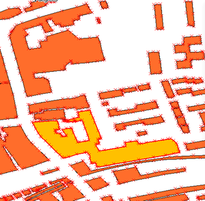
Vectorisation Software is software which caries out "The process of converting pixel-based images into vector data models" in an automated way. It's like OCR (Optical Character Recognition) but for maps.
Why vectors?
Maps can be generated from either vector or raster data, and both can be useful, though for many purposes vector-based images are more flexible and easy to use, particularly for "Geographical Information Systems". To take a simple example, suppose you want to point to a position on a map and have the computer tell you which streams and rivers on the map would potentially be contaminated by release of a suspect fluid dropped at this position. With a map that's just an image, this is virtually impossible; with a map where rivers, streams, and contour levels are represented by vectors with attribute data and feature codes, it can be quite easy.
Also, a vector map can be redrawn in virtually any style you want - different thicknesses and styles of lines, colours, texture fills, and so on.
Vectorisation is the process of putting in a picture at one end and getting "intelligent" information out of the other end; having a computer program recognise where the lines are, WHAT they are, and putting the information into a structured file or database in the form of vectors (lines defined as strings of coordinate pairs), feature codes (a code saying that this line is a road, this a contour, this a river, and so on), and attribute data (e.g. contour height).
bing road detecting service
A Bing road detect API was announced in 2011, and their intention was that OpenStreetMap could use it within the editors. This performs the vectorisation remotely as a service. See Bing road detect API for details
Software
Computer programs that do vectorisation do exist. Unfortunately, those which are generally available don't do a very good job for our purposes. Either they are general-purpose, more intended for handling illustrations, or they are proprietary, and are very expensive. In most cases they seem to provide fairly unsatisfactory results for mapping, or require a lot of manual input, or both. However we do have...
Scanaerial It is used instead of the obsolete:
- JOSM/Plugins/Lakewalker perform simple vectorisation of lakes (areas of very flat colour)
- JOSM/Plugins/Fuzzer is a newer one. Maybe better?
JOSM/Plugins/Tracer is for tracing buildings from cadastral (ie. line-art) maps.
Prototype Global Shoreline dataset was created worldwide by vectorising low-res landsat data.
Any other software with vectorisation capabilities? Add them here.
Liberating the UK Ordnance Survey
We have some pretty good Ordnance Survey maps in raster form because they're old Out-of-copyright_maps. Vectorisation used to be an interesting possibility for "liberating" the O.S. maps, since all vector data sets from the O.S. were crown copyrighted. That's now changed, but it could still be interesting to vectorise the old maps. We're doing this manually when we trace over them of course.
User:TomChance/VectorisingStreetView - Tom Chance's write up of the process of vectorising buildings from OS StreetView.
Mapseg is a software tool for converting OS street view tiles into OSM vector data. This output requires manual checking to ensure quality.
User:Michaelcalder gave a talk at State Of The Map 2007 (audio recording) about his work on vectorisation software to tackle this. His organisation was called "Geographica Kernow". No sign of them these days.
