Marikina Mapping Party/Planning
< Marikina Mapping Party(Redirected from WikiProject Philippines/Mapping Party/Marikina/Planning)
Jump to navigation
Jump to search
This page is for coordinating the planning, organizing, preparations, and logistics of the Marikina Mapping Party.
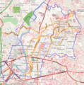
Planning maps
Before the event
Announcements
- We have a shorturl for the Wiki page: http://bit.ly/MarikinaMappingParty (case-sensitive!)
- http://bit.ly/marikinamappingparty works also
- Facebook. A Facebook event page was created at the OSMPH fan page. This will serve as the main RSVP page (since this Wiki is too geeky for newbies).
- Online announcements. This event was announced/posted online at the following places:
- Firefly Brigade yahoogroups - c/o maning
- Philippine Cycling Network yahoogroups - c/o maning
- waypointsdotph yahoogroups - c/o maning
- marikinavalley.com - c/o maning
- WebGeek Philippines Forum - c/o kzap
- SEO Philippines Forum - c/o kzap
- PHP User-Group Philippines Forum - c/o kzap
- Pinoy MTBiker Forum - c/o maning
- Skyscrapercity forums - c/o seav
- Please add links so that we can follow up questions or replies on those forums.
- Posters. A poster was prepared by seav and printed and posted on several barangay public bulletin boards by maning.
Sponsorships and marketing
- There is a potential sponsor (Garmin retailer) but nothing concrete yet. No response until today Maning 11:51, 11 March 2010 (UTC)
- UPDATE: NAVCO (a local GARMIN Nuvi retailer) will offer limited 30% discount to mappers who will attend the event.
During the event
- Schedule/programme
- Rough outline with times and venue already on the main wiki page.
- Materials
- Banner - looking for sponsorship; design not yet done
- Freebies? unofficial OSM license card? Looking for sponsorship
- Food and refreshments? Nothing will be served :( KKB
Morning briefing @ Blue Wave
- Venue. Jollibee
- Materials
- I think we should make simple pamphlets to give newbies a rough introduction to OpenStreetMap and the scheduled activities for the day. --seav 04:23, 9 March 2010 (UTC)
- I'll try to make one, time permitting. (Busy, busy!) --seav 05:31, 17 March 2010 (UTC)
- Done: File:OSM-PH Flyer 2010-03-19.pdf --seav 02:12, 19 March 2010 (UTC)
- I'll try to make one, time permitting. (Busy, busy!) --seav 05:31, 17 March 2010 (UTC)
- I think we should make simple pamphlets to give newbies a rough introduction to OpenStreetMap and the scheduled activities for the day. --seav 04:23, 9 March 2010 (UTC)
Field surveying
- Cake sliced already. See the main wiki page.
- GPS units available - 2 from the gpstogo, 3 etrex c/o Sorbi
- walking papers - maning will print
Online editing @ SM City
- Venue. SM City Marikina - sent an email request to use the Mall Activity Area. Will follow-up within the week. If request is denied, we can always use a cafe or the foodcourt to do the edits.
- Materials
- Laptops are needed
- Backup mobile internet? Is SM's wifi reliable?
Evening socials
- Venue. None yet.
- Activities. Anything goes. :-)

