Västergötland
| V・T・E |
| latitude: 58.3, longitude: 13.1 |
| Browse map of Västergötland 58°18′00.00″ N, 13°06′00.00″ E |
| Edit map |
|
External links:
|
| Use this template for your locality |
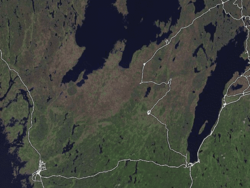
Västergötland is a province in Sweden at latitude 58°18′00.00″ North, longitude 13°06′00.00″ East.

This page contains information relating to mapping activity that is specific to the province Västergötland in south-western Sweden. This is a subproject of Sweden mapping project.
Important note!
Västergötland is a province ("landskap"), and should not be mixed up with the county ("län") Västra Götalands Län.
Goals
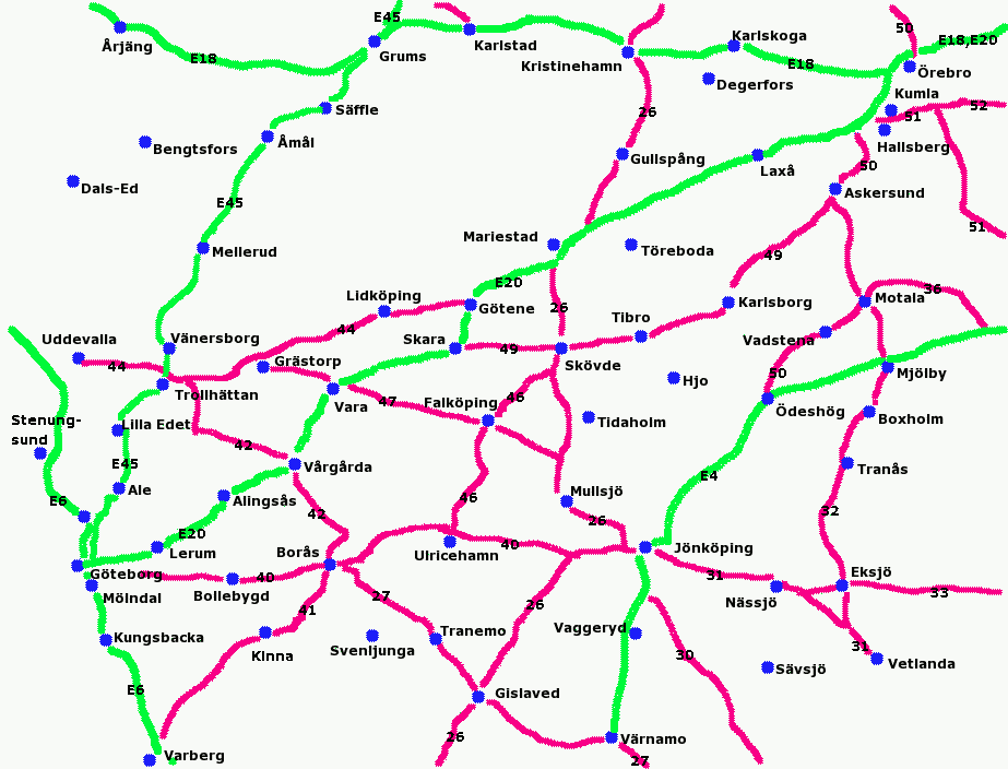
- Map the major roads (shown in green and red) - complete
- Map the towns.
- Map the railways (see Sweden/Railways)
Places
The following list of towns was taken from the Swedish Wikipedia, lista över tätorter i Sverige efter folkmängd:
| Ort Place |
Invånare Inhabitants |
Täckning Coverage |
Kommentar Comment |
|---|---|---|---|
| Göteborg | 495849 | Påbörjad | Juve82, Arvid, Kabbe, bengibollen, erikchristiansson, norpan, Dragonfly, Göteborg |
| Borås | 61929 | Påbörjad | |
| Trollhättan | 44046 | Påbörjad | |
| Skövde | 32505 | Bra | Leojth, bengibollen, Fischer |
| Lidköping | 25499 | Påbörjad | Leojth |
| Alingsås | 22361 | Påbörjad | moberg |
| Vänersborg | 21383 | Påbörjad | |
| Falköping | 15660 | Fullständig | LA2, Leojth Alla bilgator klara |
| Lerum | 15430 | Påbörjad | bengibollen |
| Kinna | 14620 | Genomresa | |
| Mölnlycke | 12820 | Påbörjad | see Härryda. bengibollen, startail |
| Skara | 10940 | Fullständig | Leojth Alla bilgator klara |
| Ulricehamn | 9170 | Fullständig | Leojth Alla bilgator klara |
| Mariestad | 8910 | Fullständig | Leojth Alla bilgator klara |
| Nödinge-Nol (Ale) | 8700 | - | |
| Tibro | 8520 | Fullständig | Leojth |
| Tidaholm | 8350 | Fullständig | Leojth |
| Floda (Lerum) | 8020 | Påbörjad | bengibollen |
| Torslanda | 8020 | - | |
| Kållered | 6570 | Påbörjad | erikchristiansson, bengibollen |
| Hjo | 6300 | Fullständig | Leojth |
| Habo | 6290 | Påbörjad | Leojth (Jönköpings län) |
| Mullsjö | 5640 | Fullständig | Leojth (Jönköpings län) |
| Surte | 5560 | - | |
| Landvetter | 5220 | - | see Härryda |
| Lilla Edet | 5180 | Genomresa | |
| Vargön | 5070 | Påbörjad | |
| Götene | 4970 | Fullständig | LA2, Leojth |
| Vårgårda | 4910 | Fullständig | Leojth |
| Fristad | 4770 | Genomresa | |
| Töreboda | 4630 | Påbörjad | Leojth |
| Karlsborg | 3940 | Fullständig | Leojth |
| Viskafors (Borås) | 3900 | - | |
| Herrljunga | 3890 | Fullständig | Leojth |
| Vara | 3790 | Fullständig | Leojth |
| Gråbo (Lerum) | 3760 | - | |
| Älvängen (Ale) | 3730 | - | |
| Svenljunga | 3680 | Most roads | mortenjc traces from Garmin GPS |
| Skultorp | 3460 | Fullständig | Leojth |
| Dalsjöfors | 3450 | - | |
| Tranemo | 3220 | Påbörjad | Leojth |
| Grästorp | 3120 | Fullständig | Leojth |
| Sandared | 2960 | - | |
| Fritsla | 2470 | - | |
| Östersjö (Partille) | 2250 | - | |
| Sjömarken (Borås) | 2210 | - | |
| Sjuntorp (Trollhättan) | 2200 | - | |
| Nossebro | 1774 | Fullständig | Leojth |
Roads
See Sweden
Cycle networks
Railways
See Sweden/Railways
Airports
Göteborg-Landvetter
Rivers
Incomplete list of rivers in Västergötland
| River/Stream | Mapping status |
|---|---|
| Flian | Done |
| Göta Älv | Done |
| Lidan | Done |
| Nossan | only from Herrljunga to Vänern |
| Säveån | only from Alingsås to Göteborg |
| Tidan | Done |
| Viskan | Missing: Lake Tolken-Nitta |
| Ätran | Missing: Ulricehamn-Östra Frölunda |
People involved
Useful Resources
Outline of the major roads and cities of the province Västergötland (and Dalsland, Bohuslän, Halland, Närke, Småland, Värmland, Östergätland) in Sweden, see current map]]


