"Home Disaster-Prevention Chart"and "Hazard Map" Aizu-Wakamatsu City
"Home Disaster-Prevention Chart"and "Hazard Map" Aizu-Wakamatsu City Fukushima, Japan
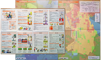
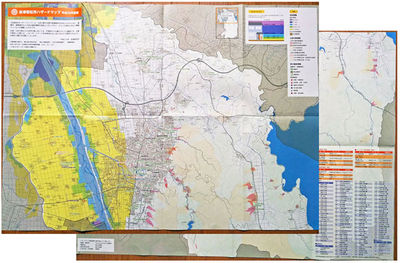
December 2014, Aizu-Wakamatsu City Crisis Management Division made "Home Disaster-Prevention Chart" and "Hazard Map".(Fukushima,Japan)
The "Home Disaster-Prevention Chart" and "Hazard Map" will promote citizen awareness of disaster (sediment disaster,flood,evacuation) and reduce disaster damage.
The base map of these maps has used road and building data of OpenStreetMap, and is made up in the form of overlapping the disaster information that is provided by the National and Fukushima Prefecture.
Editing of the map and overlapping the disaster prevention information on OSM data has been done using QGIS.
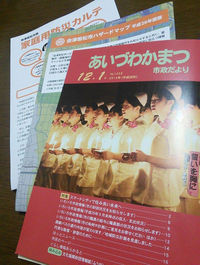
The "Home Disaster-Prevention Chart"and "Hazard Map" were enclosed in News of Municipal Government from Aizu-Wakamatsu City and distributed to all households of Aizu-Wakamatsu City December 1. (5 million copies)
"Home Disaster-Prevention Chart" (A1 594*841mm)
"Hazard Map" (A1 594*841mm)
"News of Municipal Government from Aizu-Wakamatsu City (December 1)"


