2010 Chile earthquake/Mapping coordination
Priority Areas
The table below contains 2 March 2010 information from ONEMI about what locales should be considered highest priority for OSM work. Places are ordered by priority, top priority first.
Values and Links in the table
- Place → OSM page for the location, containing Template:Place as the primary content.
- Priority Coord → This was provided by ONEMI; the link leads to a view in Potlatch.
- OSM Trace Matrix → Using the same coordinates, the link leads to OSM Trace Matrix centered on the coordinates.
- This link provides a .gpx-format OSM-matrix file for visualisation of the matrix in JOSM.
- Quality Checks → this is to indicate the status of OSM data as reported by a variety of QC resources
- For Keep Right!, see link on each of the individual place pages
- Imagery coverage → all locations are covered by Landsat imagery
| Place | Priority Coord | OSM Trace Matrix | Quality Checks | Imagery coverage |
|---|---|---|---|---|
| Constitución | 35°20′06.83″ S, 72°24′34.70″ E | (Dead link |
Keep Right! — OK | Eros-B |
| Dichato | 36°32′53.05″ S, 72°56′04.70″ E | (Dead link |
Keep Right! — OK | |
| Tomé | 36°36′52.56″ S, 72°57′15.01″ E | (Dead link |
Keep Right! — OK | RapidEye (southern margin) |
| Talcahuano | 36°43′02.32″ S, 73°07′19.49″ E | (Dead link |
Keep Right! — OK | G-MOSAIC; RapidEye (potentially) |
| Pichilemu | 34°24′30.60″ S, 72°00′47.34″ E | (Dead link |
Keep Right! — needs attention | |
| Llolleo | 33°36′54.76″ S, 71°36′37.66″ E | (Dead link |
Keep Right! — needs attention | |
| Concepción | 36°49′20.78″ S, 73°03′21.31″ E | (Dead link |
Keep Right! — needs attention | G-MOSAIC; RapidEye |
| Talca | 35°25′59.00″ S, 71°40′00.00″ E | (Dead link |
Keep Right! no errors | |
| Robinson Crusoe Island | 33°38′53.88″ S, 78°38′43.04″ E | (Dead link |
Keep Right! — needs attention |
Additional areas of interest for coordinated effort
| Place | Coordinates | OSM Trace Matrix |
|---|---|---|
| Santiago | 33°25′29.39″ S, 70°40′10.56″ E | (Dead link |
| Cauquenes | 35°57′42.48″ S, 72°18′42.84″ E | (Dead link |
| Chanco | 35°44′06.72″ S, 72°31′41.88″ E | (Dead link |
| Pelluhue | 35°48′56.88″ S, 72°34′14.52″ E | (Dead link |
| San Juan Bautista | 33°38′13.20″ S, 78°49′48.00″ E | (Dead link |
Reporting and responding to problems with OSM content
Notes

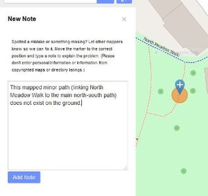
Errors in the map can be reported easily by using notes. Notes contain a text message for other users and they can reply to it. Notes are also available for users without an account.
FIXME
The FIXME key, fixme=*, may be added as data to OSM elements via Potlatch or JOSM. The value provided with the key should describe what problem should be investigated. Content tagged with FIXME can be found in JOSM via the search function, can be located using Query-to-map or can be viewed by value.
Coastline error checker
This provides a daily analysis of coastlines, targeting problem areas. The Chilean earthquake zone is shown in this view; a separate view for Robinson Crusoe Island.
User activity
- useractivity Concepción: HTML
- useractivity Concepción (warning: large image!): PNG
- OSM Mapper (way data only): OSM wiki article, Ito resource (login needed to access content)
- LiveMapViewer (node data only): OSM wiki article, Jar file download
| ||||||||||||||