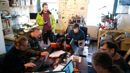
Aberdeen Mapping Party 2014
Introduction

This event is past - thanks to those who came along, it was a fun weekend
Mapping Party: An opportunity to learn how to map your area using OpenStreetMap. A chance to add your ideas and local knowledge to a shared online resource. Have you spotted a piece of land unused? Got an idea for a new allotment, green space or just fancy a ramble around your backyard with lots of interesting people? Join us!
Mapping Hackday: An opportunity to join other software developers and designers; bringing folks with a good knowledge of data sources, online mapping and spatial analysis tools, together with those with application ideas
When: 22-23 Nov 2014
Draft schedule - please chime in:
Sat 22nd Nov Mapping Party
| 12:00 Start/self-organise/intro |
| 12:30-13:15 Map local area |
| 13:15 - 14:00 Lunch |
| 14:00 - 15:00 More mapping of local area |
| 15:00 - 15:15 Tea break! |
| 15:15 - 17:00 Add features to map |
| 17:00 - 17:15 Tidy |
| 17:15 - 19:00 Food + drink |
| 19:00 - ...discuss Hack ideas |
Sun 23rd Nov Mapping Hackday
| Time | Overview | Detail |
|---|---|---|
| 10:00-10:30 | Start/self-organise/intro | |
| 10:30-11:30 | Hacking/demo/discussion | Possible topics:
1) How to use Humanitarian OSM Team's task manager and editing to help crisis management - Tim Foster |
| 11:30-12:30 | Full-on hacking | |
| 12:30-13:15 | Lunch | |
| 13:15-14:15 | More hacking! | |
| 14:15-15:00 | Show and tell | |
| 15:00 | Finish |
Where: 57 North Hacklab
- https://57north.co/ map[1] 57North Hacklab, 3rd Floor, 35a Union Street, Aberdeen, AB11 5BN,
- Tel: +441224583491
- Email: contact@57north.co
What will happen?
We'll meet at 57North Hacklab - rain or shine, see location here.[2] All welcome, any technical background or none. Strangers, newbies, new faces, interlopers - we look forward to meeting you! Bring lunch or prepare to purchase something locally. The start and end times have been set to encourage people from beyond Aberdeen to attend. Everyone will be welcomed and introduced and we will do a bit of self-organising on the day depending on what people would like to do and then follow the draft schedule above. Don't worry if you can't attend the whole event, just drop in and out as you please.
Things the Aberdeen map needs

Anything that exists on-the-ground can be mapped. Perhaps you have a particular interest or have been involved in creating a route, place, location in the city - now you can added. Here's some ideas:
- More building outlines
- Building heights/levels
- 3D mapping
- Parks and public gardens?
- Wikipedia monuments?
- Bus routes (and stops - note various pre-existing schemes/data)
- Bicycle lanes?
- Pubs/restaurants/shops/etc
Also, there are a lot of nearby notes which may well provide inspiration.
Things people would like to develop
- Bicycle infrastructure rating system by parliamentary constituency
- Green space map
- Neighborhood dashboard map
Who's going?
Please enter your name below and any interests or mapping ideas you would like to work. This is handy for organisers but not essential - just turn up and we will make room.
- Dave - Director @ 57North, Aberdeen Resident. Useful contact.
- Tim User:Hawkeyes - overnight - Youth Hostel?
- Jo
- Abi?
- Neil (neiljp) - 57North member, Aberdeen Resident, active OSM mapper.
- RobH - will drop in Sat pm I hope and poss Sun. Interest in preparing maps for urban orienteering events.
- kessss
spark- will be away from Aberdeen on business, hopefully will come to the next one
Overnight Accommodation
Nothing official planned. But if you are visiting Aberdeen and are intending to stay over - you can indicate in the above section.