Category:Featured images/2017
Jump to navigation
Jump to search
These are featured images, which have been identified as the best examples of OpenStreetMap mapping, or as useful illustrations of the OpenStreetMap project.
If you know another image of similar quality, you can nominate it on Featured image proposals.
See also: Category:Featured images/2016 and Category:Featured images/2018
Subcategories
This category has only the following subcategory.
/
Pages in category "Featured images/2017"
The following 5 pages are in this category, out of 5 total.
Media in category "Featured images/2017"
The following 52 files are in this category, out of 52 total.
- Mabel laser cutter.jpg 1,080 × 1,080; 131 KB
- Pic4Carto mapstats.png 1,024 × 768; 826 KB
- OSM-in-German-Tech-Museum.jpg 1,200 × 900; 166 KB
- Osmviz.jpg 632 × 702; 202 KB
- Ateljekartan.com green paris poster.jpg 934 × 664; 248 KB
- Ramani Huria STEM boot camp school students.jpg 1,991 × 1,693; 723 KB
- OSMLanduse.png 889 × 502; 565 KB
- OSM Mapathon in Albania 07.jpg 1,280 × 853; 237 KB
- Lauri Vanhala Helsinki map.jpg 1,280 × 639; 255 KB
- Taipei meet-up Discussing notes.jpg 2,048 × 1,426; 758 KB
- Osm-in-opendataday-2017.jpg 1,723 × 1,107; 461 KB
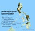
- Noahmapping-statsimage.jpg 957 × 865; 167 KB
- FOSSGIS 2017 group photo.jpg 3,888 × 2,592; 5.29 MB
- Hanshack aleppo destruction reprojected.png 761 × 546; 548 KB
- Cdr-cartosaixy-prototype.jpg 2,048 × 2,048; 1.96 MB
- Square-mile-street-networks.jpg 1,973 × 1,584; 898 KB
- Kampala-centre.png 882 × 565; 797 KB
- Monterey CA papercut.jpg 1,000 × 665; 521 KB
- Mapscii Berlin hack and tell.jpg 2,048 × 1,516; 383 KB
- London Mappers so far in 2017.png 1,257 × 943; 63 KB
- OpenStationMap-ScreenShot-München-Hbf.PNG 1,315 × 699; 420 KB
- Gardens of Ludwigsburg Palace.png 1,264 × 840; 358 KB
- San Juan Mapathon 2017 May (1).jpg 1,000 × 750; 108 KB
- State of the Map France 2017 - Group photo hands up.jpeg 2,048 × 1,536; 2.25 MB
- Mapillary road signs within iD.png 1,188 × 816; 1.68 MB
- Osm-furniture.jpg 1,536 × 2,048; 480 KB
- Drone panguan mapping.jpg 824 × 589; 108 KB
- The-sotm-map.png 1,024 × 600; 85 KB
- SOTM Africa 2017 balcony group photo.jpg 1,704 × 1,280; 613 KB
- Hlotse Community Council July Mapping Party.jpg 890 × 970; 211 KB
- Map cycle trailor.jpg 3,165 × 2,221; 1.04 MB
- WorldBloxer minecraft screenshots.png 1,386 × 1,090; 1.76 MB
- Akyatcon2017.jpeg 4,912 × 3,264; 4.67 MB
- SOTM 2017 outdoor group photo.jpg 2,000 × 1,330; 1.93 MB
- Buseireann-panels.jpg 1,200 × 675; 106 KB
- Barrington-Leigh C, Millard-Ball A Density and completeness.png 12,960 × 6,480; 14.53 MB
- Belorussian OpenStreetMap community.jpg 2,048 × 1,365; 398 KB
- CartoCamp Segou.jpg 1,024 × 768; 80 KB
- OSM dans ton smartphone v1.png 1,365 × 768; 673 KB
- Spectrum of urban development patterns - Vahid Moosavi.png 1,200 × 615; 494 KB
- SotM-Asia-2017.jpg 960 × 515; 163 KB
- CirioDeNazare.png 1,311 × 768; 793 KB
- SOTM US 2017 Group Photo.jpg 2,217 × 1,247; 883 KB
- Kharkiv dark wiki.png 2,007 × 2,007; 8.78 MB
- DINAcon 2017 award.jpg 2,912 × 4,368; 11.61 MB
- StolenRide.jpg 890 × 604; 108 KB
- Sotm-tanzania-cameroon.jpg 696 × 696; 165 KB
- Ribeirao-grande-map.jpg 950 × 565; 138 KB
- Malawi Red Cross hand.jpg 1,800 × 1,200; 267 KB
- OSMGirls Niger Togo.jpg 2,048 × 1,152; 342 KB
- IMG 1608.JPG 5,472 × 3,648; 4.55 MB
- Watercolour on Mapzen Sevilla map.jpg 1,923 × 1,581; 804 KB

