City of Basel Suburb Import
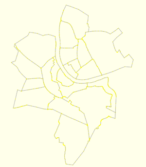
City of Basel Suburb Import is an on-time manual import of data provided by the local authorities, covering the city of Basel in Switzerland. The import took place on December 29th/30th, 2017.
Goals
The goal is to import suburb boundaries, which do not exist yet in OpenStreetMap at all (except for the city Basel itself).
Schedule
The import of the 19 boundaries will take place in the last quarter of 2017.
Import Data
Background
Data is provided by the authorities of the Canton Basel-Stadt (a Swiss "state", actually the smallest one, only 37km²).
Data source site: http://shop.geo.bs.ch/geoshop_app/geoshop/
Data license: http://www.geo.bs.ch/geodaten/nutzungsbedingungen.html
Type of license: Public Domain with Attribution
Link to permission: In http://lists.openstreetmap.ch/pipermail/talk-ch/2014-January/002517.html the responsible person states that mentioning the source in the contributors list fulfills the requirement of attribution
OSM attribution (if required): https://wiki.openstreetmap.org/wiki/Contributors#Canton_Basel_Stadt
ODbL Compliance verified: yes, see https://sosm.ch/de/projekte/swiss-open-addresses/
OSM Data Files
The processed data, ready to be uploaded:
- ViertelBasel.osm (from this raw data)
Import Type
This is a one-time import. The boundaries are not expected to change in decades.
Data Preparation
Tagging Plans
The following tags will be used for each relation representing a boundary:
- name={name}
- type=boundary
- boundary=administrative
- admin_level=9
- wikipedia=de:Basel-{name}
- wikidata={respective Wikidata identifier}, as listed here: https://www.wikidata.org/w/index.php?title=Special%3AWhatLinksHere&target=Q28539166&namespace=0
Every relation also has a label node having place=suburb and the same name/wikipedia/wikidata tags.
Changeset Tags
Every changeset will be tagged with the source="Geodaten Kanton Basel-Stadt" and description=https://wiki.openstreetmap.org/wiki/City_of_Basel_Suburb_Import.
Data Selection
We will import all 19 suburbs: Altstadt Grossbasel, Altstadt Kleinbasel, Am Ring, Breite, Bachletten, Bruderholz, Clara, Gotthelf, Gundeldingen, Hirzbrunnen, Iselin, Kleinhüningen, Klybeck, Matthäus, Rosental, St. Alban, St. Johann, Vorstädte, Wettstein.
We will not import the neighborhoods ("Wohnbezirke"), as some of their names are not familiar to the general public, but seem to exist for administrative statistical purposes only.
Data Merge Workflow
Team Approach
The import was discussed on the Swiss OSM local mailing list (talk-ch): http://lists.openstreetmap.ch/pipermail/talk-ch/2017-October/004311.html
Workflow
The workflow is done using the JOSM editor.
- Order the data from the Geodaten-Shop http://shop.geo.bs.ch/geoshop_app/geoshop/ under "Planung und Gebäude" / "Statistische Wohnviertel und -bezirke", as "Esri Shapefile" in coordinate system LV95, select datasets "Wohnviertel" (suburbs). Processing the data typically takes a few minutes, you will get an email with a download link. Unzip the received archive.
- Open Wohnviertel.shp to import the suburbs.
- For every way, change the tag "TYPE" to "name", and remove all other tags.
- Remove Riehen and Bettingen, as they are already contained as municipalities.
- Remove inconsistencies in the data.
- Zoom in to 10 steps but max (with "Zoom steps to get double scale" set to 2).
- Select all nodes and execute "Join node to way".
- Select all boundaries and execute "Simplify Area" provided by the respective JOSM plugin, with the plugin's default settings.
- Fix all parts of the boundaries that overlap, so they consist of the exactly same sequence of nodes.
- Factorize the boundaries. (The boundaries of the suburbs cover the city fully, except for the Rhine river.)
- Split the boundaries into the minimum number of parts such that every boundary is expressed as set of parts, and all parts are disjoint globally.
- Convert the boundaries to become relations of such parts, where all parts have role=outer in the relation. Add the tags as described above.
- Manually factorize the outer boundaries with the city/canton/country boundaries.
- Upload the boundaries.
Conflation
Conflate the to-be imported boundaries with the existing boundary of the city, which touches three countries.
