Community Updates/2011-02-28
Community Update from 28 February 2011 to 06 March 2011 (week 2011-09)
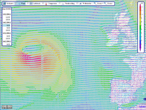
Image Of the Week 2011-09OpenSeaMap showing a storm in the North Atlantic. Data provided by US and rendered by bluewater-info.net. |
Project Of The Week : Stationery
A stationery shop may seem outdated in a paperless, electronically connected world. But there is something more formal about getting a card or letter in the mail, something joyful in the anticipation of opening an envelope, thick with greetings and dreams, from an old friend. Let's put the local stationery shop on the map.
News Of The Week
- Milestone: 1 Billion Nodes in the Database
- Map of Libya with bi-lingual labels for HOT http://libya.osm-tools.org/
- Looking for an OSM-related job? https://lists.openstreetmap.org/pipermail/talk/2011-March/056984.html
- Mapping Christchurch for the HOT: An export of ITO World http://yfrog.com/h3gpybp
- Remembered to the free aerial imagery of Virginia [1]
- How to patch flickr to use OSM tiles in background [2]
- Some stats about the active wiki usage. An encourage note to take part in small jobs [3]
- Severe load on the tile server caused some downtime in the past few days, and also wiki downtime (it shares a server with the tile proxy). The load came from a popular iPhone app called "tripwolf" which introduced a new off-line maps feature. This entailed mass tile downloading from our main tile server in breach of our tile usage policy. It was also noted that they had failed to comply with the OpenStreetMap License. The OSM sysadmin team was forced to blocked their app for a while to bring load under control and limit disruption to mappers. tripwolf pro-actively worked to rectify the issues and a soon to be released version of their app will use their own or 3rd party tile server. tripwolf has apologised for the disruption caused.
Software Updates
- Hikingbook.pl creates hiking books
- OpenTrail A new Android app for walkers
- Want a tool to map addr:housenumber=* along your traces? Check KeypadMapper
- Nice Map showing how far you can get in Paris by subway [4]
- OSM History Viewer got repaired [5]
- ITO World is working on a rendering services with a lot of interesting overlays: ITO Map
Events
- Steve hold a talk at the Web & Wireless GIS 2011 at Kyoto
Voting on Designation
This proposition comes from a problem in some countries where your tagging can't reflect the exact legal designation of a highway. Naturally, the proposal is to add the official classification of an object as a tag.
Check the proposition and add your vote on it.
MapQuest addresses
MapQuest has released on the mailing list a file with a lot of addresses and coordinates to be imported in OSM. While some users are already busy mapping those addresses, be aware of potential errors or duplicates. You may also want to add mapquest_critical_addresses in the source tag of you new object.
Another week another import
There is no week without an import going wrong somewhere. This week, a mass import of this Big fast food restaurant chain has been made without discussion or announce. The user has been blocked until a reasonable solution is found.
Please, if you think about importing things, send a mail to the talk list first!
MapQuest Updates Again
MapQuest has just release the new version of his routing service with support of pedestrian and bikes. Elevation factor and profile of the route are coming soon...
Check this blog post for more infos

