DE:Featured images/Apr-Jun 2014
Hier sind die vorgestellten Bilder zu sehen. Die Bilder wurden als Vorzeigebeispiele des OpenStreetMap-Projektes auserwählt.
Wenn du ein Bild hast, welches als Bild der Woche sein könnte, dann kannst du es hier auf der (en) Vorschläge des ausgewählten Bildes-Seite vorschlagen.
| ← von April bis Juni 2013 | ← von Januar bis März 2014 | von Juli bis September 2014 → | von April bis Juni 2015 → |
Galerie der vorgestellten Bilder, von April bis Juni 2014
Details und Beschriftungen
Woche 14 (von Montag, 31. März 2014 bis Sonntag, 6. April 2014) [Edit]
- English : OpenStreetMap has been awarded the Document Freedom Day UK Award Brian Prangle accepted the award on behalf of OSM.
- Deutsch : OpenStreetMap wurde mit dem Document Freedom Day UK Award ausgezeichnet. Brian Prangle nahm die Auszeichnung im Namen von OSM an.
Woche 15 (von Montag, 7. April 2014 bis Sonntag, 13. April 2014) [Edit]
- English : HOT is coordinating mapping efforts for the Ebola outbreak in West Africa.
The map shows all changesets with #HOT in and around Guinea. The tool visualises changesets of the last seven days with a certain comment.
- Deutsch : Das Humanitarian OSM Team (HOT) koordiniert Kartierungen für die Hilfe nach dem Ebola-Ausbruch in Westafrika.
Die Karte zeigt alle Änderungssätze mit #HOT in und um Guinea. Das Tool visualisiert Änderungssätze der vergangenen sieben Tage mit einem bestimmten Kommentar. Eine Beschreibung hinzufügen
Woche 16 (von Montag, 14. April 2014 bis Sonntag, 20. April 2014) [Edit]
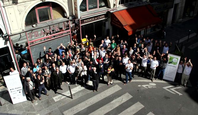
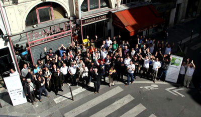
- English : State of the Map France 2014 took place a week ago in Paris with more than 250 attendees
- Deutsch : Die State of the Map France 2014 fand vor einer Woche in Paris mit über 250 Teilnehmern statt.
Woche 17 (von Montag, 21. April 2014 bis Sonntag, 27. April 2014) [Edit]
- English : 492 people attended State Of The Map U.S. 2014 in Washington DC. You can watch video recordings of the presentations.
- Deutsch : 492 Personen nahmen an der State Of The Map U.S. 2014 in Washington DC teil. Von den Präsentationen sind auch Video-Mitschnitte verfügbar.
Woche 18 (von Montag, 28. April 2014 bis Sonntag, 4. Mai 2014) [Edit]
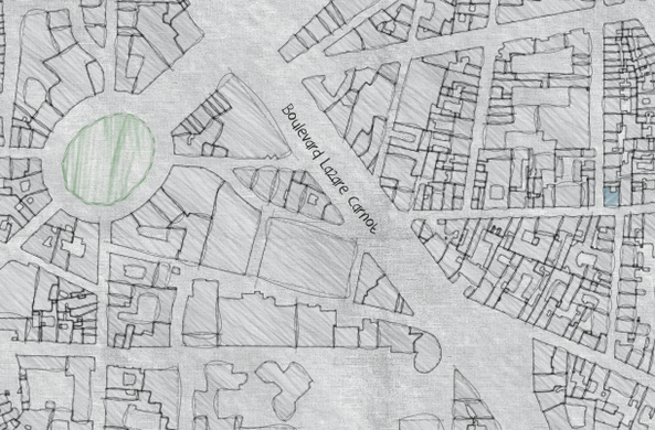
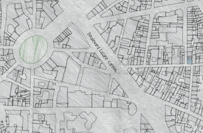
- English : Although this map looks distinctly hand-drawn, it is a data-driven rendering created using TileMill and GIMP, and available as a slippy map covering Toulouse
- Deutsch : Obwohl diese Karte wie von handgezeichnet aussieht, ist sie unter Verwendung von TileMill und GIMP gerendert worden. Sie ist als sehenswerte slippy map von Toulouse verfügbar.
Woche 19 (von Montag, 5. Mai 2014 bis Sonntag, 11. Mai 2014) [Edit]
- English : The London HOT Congo Mapathon event was run by HOT and MSF this weekend, to map the city of Lubumbashi using Field Papers notes gathered by local people.
- Deutsch : Der London HOT Congo Mapathon wurde dieses Wochenende vom HOT und MSF veranstaltet, um die Stadt Lubumbashi auf Basis von Field Papers-Notizen, erstellt von Leuten vor Ort, zu kartieren.
Woche 20 (von Montag, 12. Mai 2014 bis Sonntag, 18. Mai 2014) [Edit]
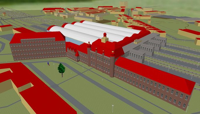
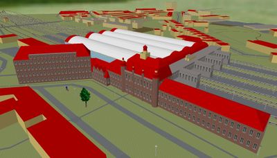
- English : Lübeck Hauptbahnhof has been modelled in 3D within the OpenStreetMap data (using the Simple 3D Buildings tags), allowing tools like OSM2World to render this image. (slippy map)
- Deutsch : Der Lübecker Hauptbahnhof wurde in 3D mithilfe von OpenStreetMap-Daten modelliert. (mit den einfachen 3D-tags)
OSM2World hat dieses Bild gerendert. (Slippy-Map) Eine Beschreibung hinzufügen
Woche 21 (von Montag, 19. Mai 2014 bis Sonntag, 25. Mai 2014) [Edit]
- English : For the past few months the community in the Netherlands have been carrying out a manual merging BAGimport of open address and buildings data, using a special JOSM import plugin (dutch), and this site to monitor the progress uploading areas of data
- Deutsch : In den vergangenen Monaten wurden in den Niederlanden beim BAGimport freie Adress- und Gebäudedaten manuell importiert. Hierzu wurde ein extra JOSM Import Plugin und diese Seite zur Überwachung des Fortschrittes genutzt.
(die verlinkten Seiten sind auf Niederländisch) Eine Beschreibung hinzufügen
Woche 22 (von Montag, 26. Mai 2014 bis Sonntag, 1. Juni 2014) [Edit]
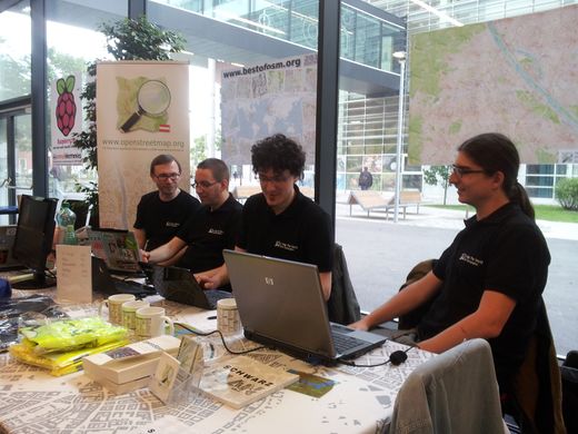
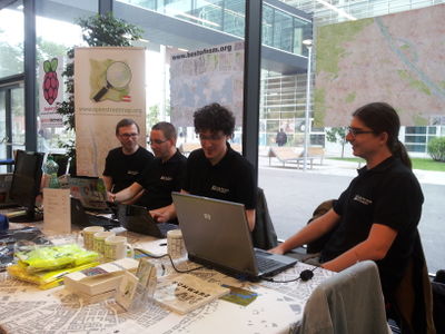
- English : Austrian OpenStreetMappers at Linuxwochen 2014 in Vienna, offering T-shirts, tablecloths, posters, books, cups, and notebooks!
Woche 23 (von Montag, 2. Juni 2014 bis Sonntag, 8. Juni 2014) [Edit]
- English : Trying out the iD editor for the first time. Sixteen test subjects went through the process and gave their feedback as part of a "Civic User Testing Group" event in Chicago
Woche 24 (von Montag, 9. Juni 2014 bis Sonntag, 15. Juni 2014) [Edit]
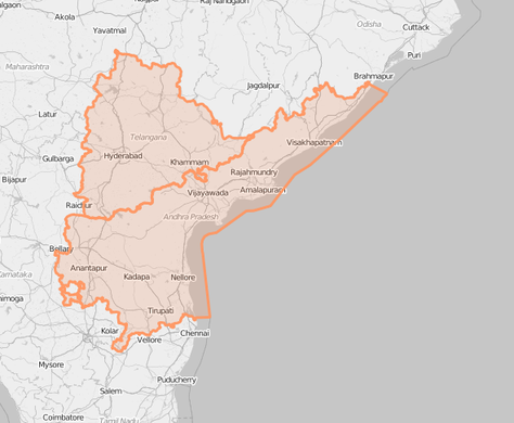
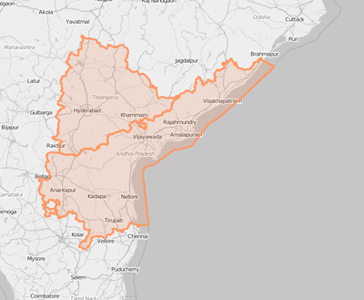
- English : The new Indian state of Telangana which was created by an order of the Indian government, has been incorporated into the map by OpenStreetMap volunteers. Telangana was created by partitioning the state of Andhra Pradesh into two. Read more on dalek2point3's diary
- Deutsch : Der indische Bundesstaat
![Wikipedia [W]](/w/images/2/24/Wikipedia-16px.png) Telangana, der durch die indische Regierung neu geschaffen wurde, wurde auch in die OpenStreetMap-Datenbank eingearbeitet. Telangana wurde durch die Aufteilung des Bundesstaates Andhra Pradesh geschaffen. (siehe auch dalek2point3's Blog)
Telangana, der durch die indische Regierung neu geschaffen wurde, wurde auch in die OpenStreetMap-Datenbank eingearbeitet. Telangana wurde durch die Aufteilung des Bundesstaates Andhra Pradesh geschaffen. (siehe auch dalek2point3's Blog)
Woche 25 (von Montag, 16. Juni 2014 bis Sonntag, 22. Juni 2014) [Edit]
- English : With more than 200 participants State Of The Map Europe 2014 was hosted in Karlsruhe last weekend.
- Deutsch : Mit über 200 Teilnehmern fand am vergangenen Wochenende die State Of The Map Europe 2014 in Karlsruhe statt.
Woche 26 (von Montag, 23. Juni 2014 bis Sonntag, 29. Juni 2014) [Edit]
- English : This event in Natori, Japan, was an OpenStreetMap mapping party as part of a LocalWiki initiative to describe city neighbourhoods, and promote community building in an area struck by the 2011 tsunami. Read more on the localwiki blog


