HistOSM
Jump to navigation
Jump to search
| HistOSM | |
|---|---|
| License: | OpenStreetMap and contributors CC BY-SA and ODbL |
| Platform: | Web |
| Version: | (2024-11-23) |
| Language: | English |
| Website: | https://histosm.org |
|
Show POI with historical background on an OSM map | |
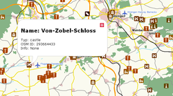
HistOSM (histosm.org) is a WebGIS application and a map to visually explore historic objects stored in the OpenStreetMap database: historic information/sites. It's a WMS service run by the University of Heidelberg GIScience (Geoinformatics) Research Group
Histosm.org
Features highlighted:
- Archaeological sites
- Monument
- Memorial
- Battlefields
- Ruins
- Castles
- Wrecks
Further reading
- Auer, Michael; Fees, Magnus; Zipf, Alexander (2010). “HistOSM.org – ein Webportal zu historischen und archäologischen Stätten und Sehenswürdigkeiten auf Basis der nutzergenierten Daten von OpenStreetMap (OSM) [HistOSM.org – a Web portal of historical and archaeological sites and sights based on user-generated data from OpenStreetMap (OSM)]” (in German). Journal für Angewandte Geoinformatik: 720-725. Archived from the original on 30 October 2018.
