Key:localizer
Jump to navigation
Jump to search
| Description |
|---|
| Localizer of an ILS system |
| Group: aeroways |
| Used on these elements |
| Requires |
| Status: in use |
| Tools for this tag |
|
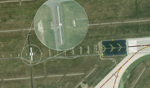
Localizer of an ILS system
How to map
Set a node ![]() where the transmitter is and add
where the transmitter is and add
The localizer is located in the extension of the runway a few hundred metres away, depending on how much space is there.
On accurate satellite images you can see a row of white dipole antennas.
See also
- ILS localizer on Wikipedia

