Key:traffic_intervention
| Description |
|---|
| Traffic interventions are specific types of road restrictions that aim to reduce the prevalence of certain vehicles. |
| Group: highways |
| Used on these elements |
| Useful combination |
| Status: in use |
| Tools for this tag |
|
The traffic_intervention=* key can be used to mark traffic interventions, especially in the UK. These mainly target "school streets", which limit motor vehicles between certain times of the day (i.e. school times), and "modal filters", which are physical barriers that prevent the entry of certain types of vehicle.
Description
Traffic interventions are specific types of road restrictions that aim to reduce the prevalence of certain vehicles.
The traffic_calming=* tag covers use cases where the road is open but something physical has been added to slow down traffic. Sometimes however, the highway traffic authority goes further and closes a road to through traffic for some or all kinds of vehicle, and this tag is used to record that. Mappers should ensure that all normal tags are still applied to the relevant road segment, this tag is intended to be used in addition to existing tags.
Values
A modal filter is a road closure that is designed to allow certain modes of transport through, typically bicycles and pedestrians. It is intended for short sections of road that were previously open to general traffic.
To apply the tag, ensure that there are one or more ways on the map connecting those parts of the highway network still open to general traffic. Those ways should be tagged with traffic_intervention. The tagging is correct if a router could take those ways tagged with traffic_intervention, replace all tags with highway=unclassified, and get a functional highway network where vehicles could move across the traffic intervention.
The common case is conversion of part of a road to use by bicycles and pedestrians only. In this case there would be a single highway=cycleway way with traffic_intervention=modal_filter as well as other tags like name=* and surface=*.
A barrier, such as a planter or bollard, is typically added by the highway authority to block the road. This should be added as a node in the middle of the way, for example barrier=planter, foot=yes, bicycle=yes.
Note that the barrier is not tagged with traffic_intervention.
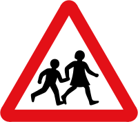
A school street is a section of road near a school that is closed to general traffic, often only at certain times of day.
The access restrictions are normally mapped using motor_vehicle:conditional=*.
Simply use traffic_intervention=school_street to add the additional meaning.
In addition to the main tag, mappers may additionally specify the year, month or full date when the road was restricted, if known.
- traffic_intervention:date=<year>
- traffic_intervention:date=<year-month>
- traffic_intervention:date=<year-month-day>
In addition to the main tag, the official source describing the intervention can be referenced. For example, in the UK this is The Gazette.
See also
- hazard=children - A place where children are known to play in the roadway, presenting a collision hazard to children and motorists.
- Original post in the Talk-GB mailing list https://lists.openstreetmap.org/pipermail/talk-gb/2021-April/026740.html
