List of featured images/2010

From OpenStreetMap Wiki
Jump to navigation Jump to search
Star image.
edit

These are featured images, which have been identified as the best examples of OpenStreetMap mapping, or as useful illustrations of the OpenStreetMap project.

If you know another image of similar quality, you can nominate it on Featured image proposals.

2010

Week 1
(4–10 Jan.)
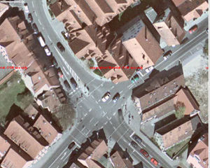
DOP Lauf Kreuzung.jpg
English 15 cm high res aerial imagery with 0.5 m positional accuracy, of Lauf in Germany (map) donated by the local municipality. See DE:Luftbilder aus Lauf. edit
Week 2
(11–17 Jan.)
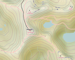
Cyclemap hill shading.png
English The cycle map now has hill-shading edit
Week 3
(18–24 Jan.)
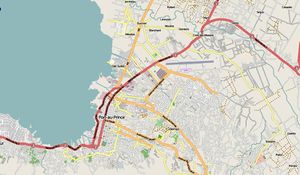
Portauprince.jpg
English Earthquake Response WikiProject Haiti. edit
Week 4
(25–31 Jan.)
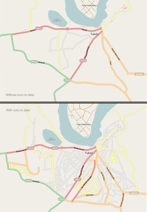
Tulcea norc.png
English Based on the second batch of tracks and panoramic images from norc.ro, the Romanian contributors organized Virtual Mapping Party Romania 2009 (still in progress). In the image you can see the progress in Tulcea after a few days work. edit
Week 5
(1–7 Feb.)
UndergroundPipelinesExample.jpg
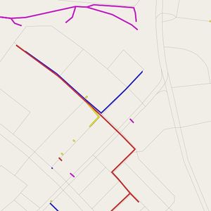
English Nothing left to map? Try underground pipelines, deduced from manholes, wall markers and open pit construction work. edit
Week 6
(8–14 Feb.)
World Bank Haiti Situation Room.jpg
English Large printouts of OpenStreetMap on the walls of the World Banks Situation Room for the Haiti Earthquake response.[1] These maps are serving as the basic infrastructure information for response and rebuilding activities. edit
Week 7
(15–21 Feb.)
Screenshot-wmsracer.png
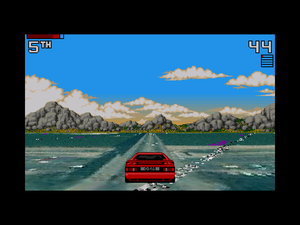
English A JOSM plugin lets you record GPS traces by driving an early 90s sports car in WMS imagery land. edit
Week 8
(22–28 Feb.)
OpenOrienteeringMap of Ayala Center, Makati 2010-01-29.png
English OpenOrienteeringMap rendering of Ayala Center edit
Week 9
(1–7 Mar.)
Mapgen004Hofheim.png
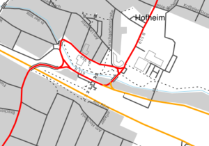
English mapgen.pl is a simple renderer written in Perl that can be used to create maps in SVG, PNG and PDF format. edit
Week 10
(8–14 Mar.)
Tah heatmap june2009.jpg
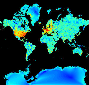
English Map detail throughout the world (red = more complex maps) edit
Week 11
(15–21 Mar.)
London map updates 2009 2010.jpg
English Map showing parts of London that have been updated in the last year (from OSM Mapper) edit
Week 12
(22–28 Mar.)
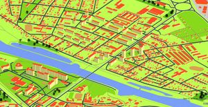
Iso3DMap.jpg
English Isometric 3D Map of Czech Republic – screenshot of Kralupy nad Vltavou (see the same place by OSM Carto). edit
Week 13
(29 Mar. – 4 Apr.)
OSM Workshop at FEATI University 1.jpg
English OpenStreetMap Workshop at FEATI University in Manila, Philippines. An OSMer is teaching geodetic engineering students how to operate the GPS units and the cake slices for the field mapping is in the foreground. edit
Week 14
(5–11 Apr.)
OSM By Night Helsinki 2010-03-12.png
English Helsinki by night – Hike & Bike Map (http://hikebikemap.de) with "By Night" overlay showing Helsinki, Finland. edit
Week 15
(12–18 Apr.)
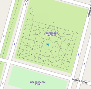
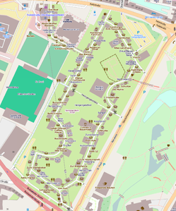
PGardens.png
English Promenade Gardens in Georgetown, Guyana. The paths among the trees and flowers in the public garden. edit
Week 16
(19–25 Apr.)
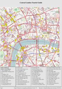
Example2 london.png
English TownGuide will render PDF maps with street & POI indexes edit
Week 17
(26 Apr. – 2 May)
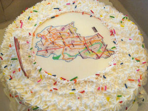
Marikina Cake.jpg
English The OSM test of "free"-ness – can you bake it on a cake? Shown here: map from the Marikina Mapping Party edit
Week 18
(3–9 May)
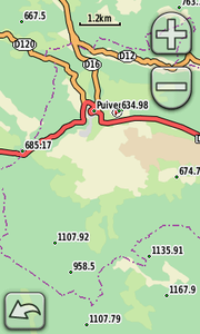
Oregon 300 survey points.png
English Survey points and topology, one of many map styles available for Garmin edit
Week 19
(10–16 May)
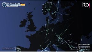
ItoWorld flightRadar.jpg
English A frame from itoWorld's visualisation of flights after the volcano edit
Week 20
(17–23 May)
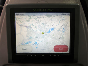
OSM GWT train SC.jpg
English Simon Clayson sends word that OSM now powers the route-map on Great Western Trains edit
Week 21
(24–30 May)
Ricajimarie mapkibera IMG 5608.jpg
English Mappers in the Kibera area of Nairobi. Mikel Maron is running a project called mapkibera there. edit
Week 22
(31 May – 6 Jun.)
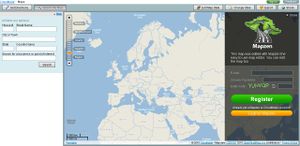
Cloudmade mapzen.JPG
English Maps from Cloudmade.com with Housenumber-search and various maps-styles edit
Week 23
(7–13 Jun.)
BrixtonPinMap.JPG
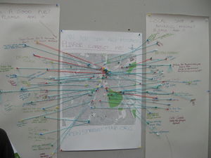
English Encouraging locals to contribute local POI information. Pins on a map at Spacemakers Brixton mini mapping party edit
Week 24
(14–20 Jun.)
Indian Railway Network Coverage on OSM.png
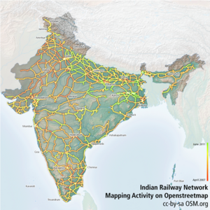
English Visualization showing the edits on Indian Railway Network lines on OSM edit
Week 25
(21–27 Jun.)
Green Point Common OSM.svg
English Green Point Common in Cape Town, including the new Cape Town Stadium, one of the venues of the 2010 FIFA World Cup. See also the 2010 World Cup mapping project. edit
Week 26
(28 Jun. – 4 Jul.)
Osmit2010.JPG
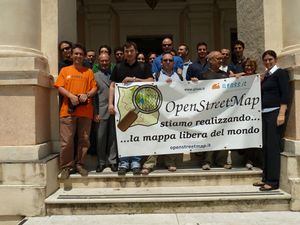
English Participants of OSMit2010, the second Italian meeting on OSM held in Genoa from 3rd to 5th June edit
Week 27
(5–11 Jul.)
Gpsdrive 2.12svn cycle.png
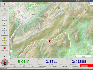
English GpsDrive showing OpenCycleMap tiles of Balearic Islands edit
Week 28
(12–18 Jul.)
SOTM10 Chris Fleming.jpg
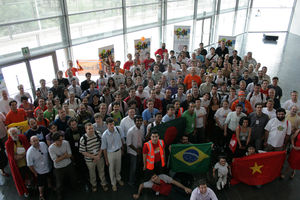
English State Of The Map 2010 in Girona edit
Week 29
(19–25 Jul.)
Kosice-bus stop.jpg
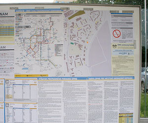
English Kosice bus/tram stop using OSM maps edit
Week 30
(26 Jul. – 1 Aug.)
Participants graian alps mp.JPG
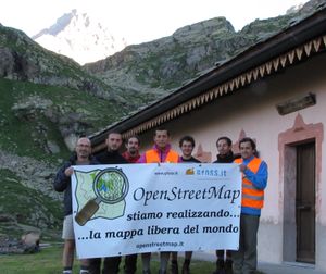
English Participants of Graian Alps Mapping Party, the second event on Italian mountain. We were guest of Gran Paradiso National Park at the hunting lodge of King edit
Week 31
(2–8 Aug.)
Tree-density.png
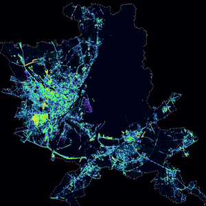
English Distribution of natural=tree nodes in Szczecin obtained from the city's cadastre bureau. (Project of the week/2010/Aug 01 is to add more) edit
Week 32
(9–15 Aug.)
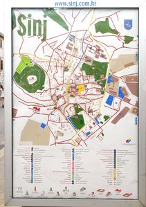
Sinj osm map 800px.JPG
English Jhabjan's map of Sinj in Croatia, printed for tourism office. Aerial images were donated by local aerial club. edit
Week 33
(16–22 Aug.)
British isles osmarender August 2010.png
English 6 years after OSM was started, the British Isles are finally starting to look mapped edit
Week 34
(23–29 Aug.)
Hamburger Sommerdom 2010 Mapnik.png
English Hamburg has a large carnival three times a year for each 4 weeks. User mbuege maps all the attractions and fast food stands. edit
Week 35
(30 Aug. – 5 Sep.)
OSM VE oagosto.jpg
English OpenStreetMap Merida, in Venezuela, meeting August 2010 edit
Week 36
(6–12 Sep.)
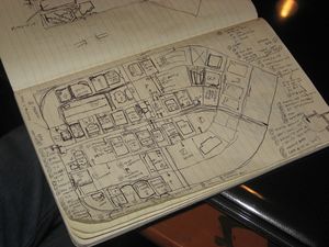
4636578697 6e85855407.jpg
English You don't need fancy gear to do mapping for OSM. Sometimes, all you need is a sketchpad, pen and some attention to detail. Here's seav's sketchpad of the Ortigas slice during the Ortigas-Mandaluyong Mapping Party. edit
Week 37
(13–19 Sep.)
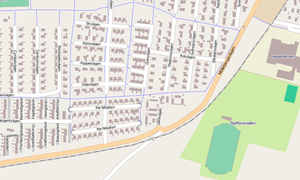
Staffanstorp 1.png
English Building outlines in Staffanstorp, Sweden courtesy of the town council GIS. edit
Week 38
(20–26 Sep.)
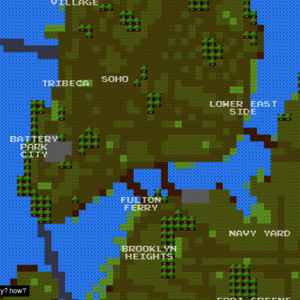
8bit cities.png
English An 8bit-game-like map of New York City based on OSM data. http://8bitnyc.com/ edit
Week 39
(27 Sep. – 3 Oct.)
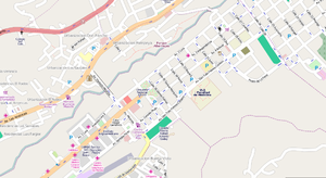
MeridaVenezuela.png
English OSM map of Merida[2], Venezuela. Data by Fundacion GeoHorizontes de Venezuela. Data collected by HernanRamirez. edit
Week 40
(4–10 Oct.)
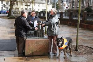
Marburg blind mapping.jpg
English Mapping Party in Marburg, Germany: Blind and seeing mappers discover a tactile model of Elisabethkirche with accessible GPS devices. edit
Week 41
(11–17 Oct.)
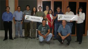
VLMW Group Photo.jpg
English Великие Луки Mapping Weekend banner: "We've come from different cities of Russia and Belarus to create the best map of Velikiye Luki in the world" edit
Week 42
(18–24 Oct.)
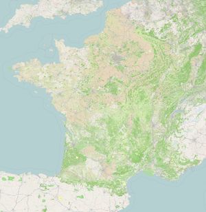
France10-1year.jpg
English One year after the French land cover import, 69% of the country is informed in land cover [3] edit
Week 43
(25–31 Oct.)
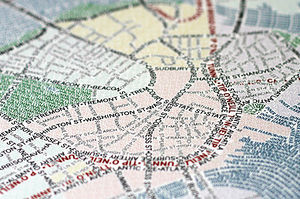
Axismaps closeup.jpg
English Typographic maps manually traced from OSM data edit
Expression error: Unexpected < operator.Expression error: Unexpected < operator.Expression error: Unexpected < operator.Expression error: Unexpected < operator.Expression error: Unexpected < operator.Expression error: Unexpected < operator.Expression error: Unexpected < operator.Expression error: Unexpected < operator.Expression error: Unexpected < operator.