Ljubljana
Jump to navigation
Jump to search

| V・T・E |
| latitude: 46.0548, longitude: 14.5057 |
| Browse map of Ljubljana 46°03′17.28″ N, 14°30′20.52″ E |
| Edit map |

|
|
External links:
|
| Use this template for your locality |
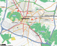
Ljubljana is a City in Slovenia at latitude 46°03′17.28″ North, longitude 14°30′20.52″ East.
Results

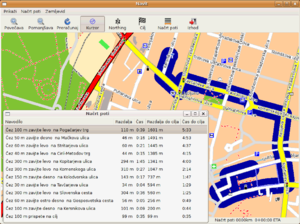
Routing in Ljubljana with Slovenian Navit
- Routing in the maps (screenshot on right)
- Name search for prešernova, tavčarjeva, slovenska, ljubljana, parking near ljubljana, restaurant, šiška, benetke,...
- Browse current map of Ljubljana, as rendered by distributed Tiles@Home rendering program using Osmarender and presented with OpenLayers.
- Many raw GPS tracks
- Had the 1st Ljubljana Mapping Party
Aerial imagery
List of available aerial imagery for Ljubljana, sorted in order of preference (resolution, most up-to-date).
| Imagery | Scope | Imagery date | Res. | Link | Distortions of high objects | Leaves on (deciduous) trees | Comments | OSM contact point | Available in JOSM since | Available in iD since |
|---|---|---|---|---|---|---|---|---|---|---|
| WMTS orthophoto | Ljubljana | 2023 | 10cm | metaview | no | yes | martianfreeloader, StefanB | 2023-09-18 | ||
| 2022 | metaview | yes | 2023-03-16 | - | ||||||
| 2021 | N/A | never went online | - | |||||||
| 2020 | metaview | no | 2021-03 | - | ||||||
| 2019 | metaview | yes | 2023-03-16 | |||||||
| GURS orthophoto | Slovenia | ? | 25cm | moderate | ? | ? | ? |
ToDo
- Environmentally (and financially) friendly gathering of GPS tracks from various sources:
- Trucking, bus and taxi companies (which have GPS logging besides LPP?)
- Mobile operators (Mobitel and SiMobil get data from their mobile navigational service)
- Borrow your GPS logger to someone driving for other reasons (eg to driving schools, giving them a hint of unmapped areas)
- Dig out your existing, not too old logs
- minor detours on your daily commute
- cycling...
- Look into legally obtaining reliable data (if any) from local authorities (amenities...)
- Agree on local Sl:Map_Features
Schools
Martianfreeloader started homogenizing mapping of schools and kindergartens in 2021 using this scheme:
- Map the outline of the whole property, including buildings, yards, sport pitches, playgrounds, etc.
- All amenity tags go on this outline (amenity=*, name=*, website=*, email=*, phone=*, main address, etc.).
- The building itself only gets a building=school or building=kindergarten tag. Perhaps a postal address.
- The name=* tag gets the full spelt out name (e. g. Osnovna šola Vodmat)
- An additional short_name=* tag can be used for common abbreviations (e. g. OŠ Vodmat).
Bus lines
As of November 2021, most bus lines still need to be updated to PTv2. Here is a description how to do that. Bus routes are found on the LPP website. Routes can be seen in Bus routes in Ljubljana page.
Resources
- GPS traces in Ljubljana
- List of roads and streets in Ljubljana on SL wikipedia with links to OpenStreetMap
- Urbanism of Ljubljana category on SL wikipedia
- Ljubljana map links on Ljudmila wiki
- http://turizem.gis.ljubljana.si/
- http://urbinfo.gis.ljubljana.si/
- Virtual Ljubljana - 3D VRML of the centre
- Current and previous street names and their etymology: https://www.ljubljana.si/sl/o-ljubljani/ulice-parki-in-trgi-v-ljubljani/zemljevid-ulic-v-ljubljani/ (was https://gis05.ljubljana.si/LjubljanskeUlice/ )
- https://www.ljubljana.si/sl/o-ljubljani/ulice-parki-in-trgi-v-ljubljani/seznam-ulic/
- https://www.ljubljana.si/assets/Uploads/Ljubljanske-ulice.pdf
- GIS OpenData of Ljubljana: https://mol-ljubljana.hub.arcgis.com/
- OpenData Roads in Ljubljana https://podatki.gov.si/dataset/obcinske-ceste-v-mestni-obcini-ljubljana
- Ljubljana traffic information: https://prominfo.projekti.si/web/
- OpenStreetBrowser maxspeed map
- https://gis06.ljubljana.si/arcgis/rest/services/Podloge/
