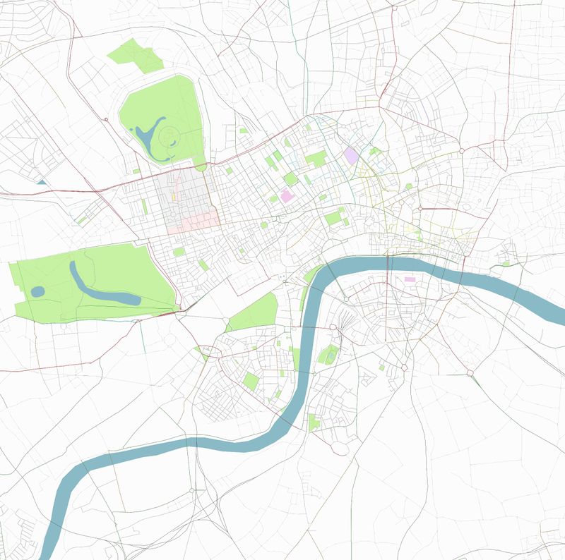
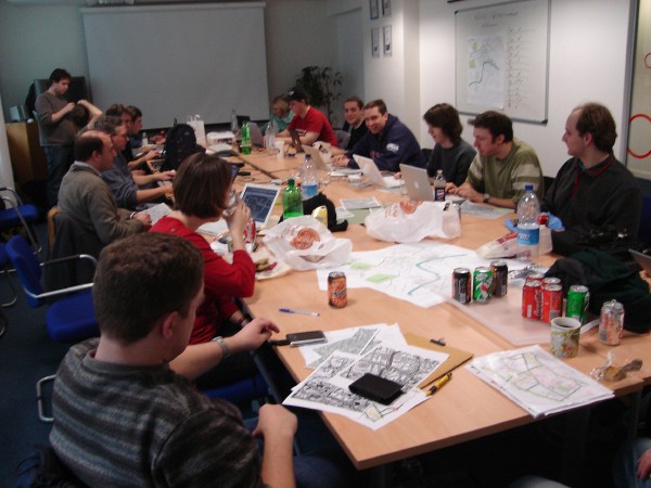
London mapping party Jan 2007
The London Mapping Party of January 2007 was historically quite important. At this stage of the project London, despite being the birthplace of OpenStreetMap, was still looking bizarrely incomplete. A large number OSMers were living close by, but the task of mapping London or even Central London seemed massive. But a Mapchester event a few months earlier, was a sign of things to come, and on 27-28th January 2007 we finally got together face-to-face and organised a massive mapping weekend extravaganza.
Office space was kindly sponsored by multimap and after-drinks by nestoria!
Results
|
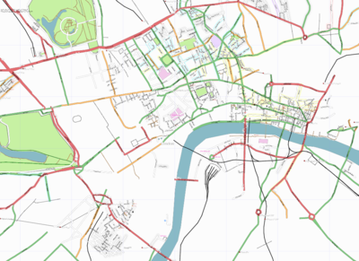
Before Map of the central London congestion charge zone prior to London mapping weekend |
|
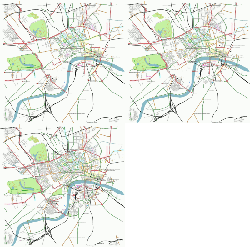
27 + 28 January Animated London map with data from Saturday and Sunday efforts added. |
Who was there
- User:Steve
- Ojw will do 3a on Saturday. Not there on Sunday
- Steve8 now definite for the Saturday and 50% for Sunday - confirm later
- User:robert was planning on making an appearance at some point.
- User:Mikel
- User:Edward
- TomChance will be there on Sunday
- Grant Slater
- User:80n definitely Saturday, but not Sunday
- User:LastGrape could do, will await more details.
- User:Randomjunk
- User:NickH I have some familiarity with section 8 and have lived in that area, I'll start getting more segments in.
- User:Mcknut is hoping to be there for both days, already has somewhere to stay.
- TomH is hoping to make at least one day
- User:Mattwestcott is hoping to make both days
- User:Colm is hoping to make both days
- Joto will be there the afternoons and maybe part of mornings
- Jess Hodge will be coming on Sunday
- User:Nickb will be there
- Richard is hoping to be there on Saturday
- User:Freyfogle hoping for Saturday and definitly be at the John Snow on Sunday
- User:Ludwig is hoping to be there on Saturday
- User:Artemp is planning to be there on Sunday
- User:DarylLloyd is coming along on Saturday and will try to make Sunday as well
- Harry Wood possibly will make it at some point
- Steve Ratcliffe will be there both days.
- Frankie Roberto Saturday only.
- Ten Yen did a part of 1a on Sunday. See profile.
Old organisational info
Map London without a GPS
The Yahoo! Aerial Imagery negates the need for a GPS in London (urban canyon effects make it pointless anyway). The idea will be to map all of central london using the imagery for geometry and going round finding street signs. No GPS required!
Richard has streetmaps of central London from 1949, that can probably be used to find street names for many of the roads.
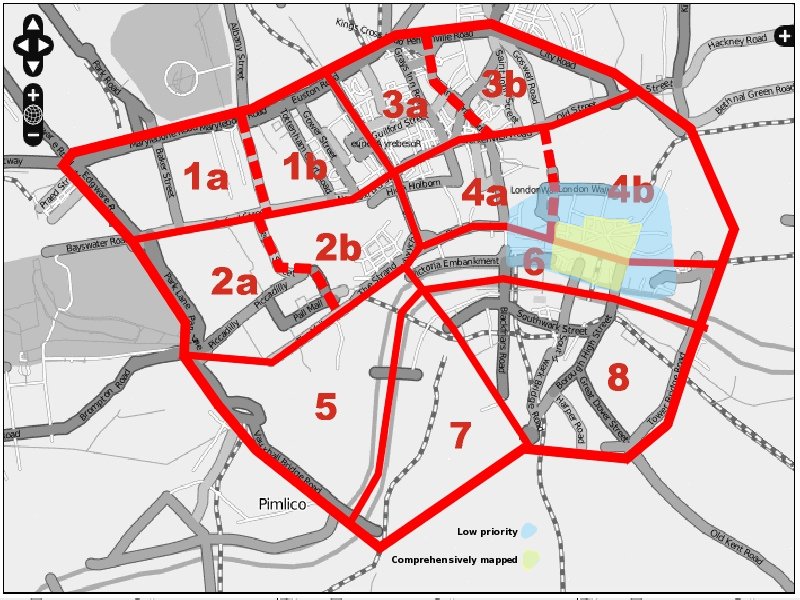
Plan is to try to fully map the area of the existing congestion charge zone (see current map) The following screenshot shows the area and is divided into sectors for coverage by individuals, pairs or groups on each day. (eg: Sector 1a - Marylebone Rd to Oxford St, Edgware Rd to Great Portland St). Each sector will have a map of the existing OSM coverage, and an out-of-copyright street map to help with street naming, and a printout of the Yahoo imagery overlain with the existing data (see illustrations). Sectors 5 and 7 are pretty sparsely mapped and could do with someone working on them who has a GPS unit that gets a very good signal in urban canyons to work on them.
Scans of out-of-copyright street maps have been prepared for each sector, but they are too large to launch on wiki. Download them here
Areas
| |||
| Area | Maps | Description (needs checking) |
Who mapped this area? |
|---|---|---|---|
 Sector 1a |
Slippy map Printable map 1 Printable map 2 Out-of-copyright |
Edgeware Road, to Great Portland Street | The half to the east of Baker Street is complete and fully tagged, with the exception of a few Mews which don't have name tags. The block of streets immediately to the north of Oxford street could do with double checking for completeness 80n. |
 Sector 1b |
Slippy map Printable map 1 Printable map 2 Out-of-copyright |
Area around north half of Tottenham Court Road | Steve Ratcliffe the part to the west of TCR. |
 Sector 2a |
Slippy map Printable map 1 Printable map 2 Out-of-copyright |
Picadilly, american embassy area, back of park lane | Frankie and Dave
West of New Bond Street is done in this sector |
 Sector 2b |
Slippy map Printable map 1 Printable map 2 Out-of-copyright |
Soho | User:Ludwig
The eastern end (east of Covent Garden, parrallel to Kingsway), has been mapped, as has the western part, north of Shaftesbury Ave and west of Charing Cross Road. I don't have time on Sunday, but a good area to map is east of Haymarket, south of Shaftesbury Ave User:Mcknut I mapped the section St Martin's Lane and Covent Garden Piazza, and between Monmouth Street and Endell Street to the North West. Didn't have the aerial for the West but I think someone else did that area. |
 Sector 3a |
Slippy map Printable map 1 Printable map 2 Out-of-copyright |
University of London area, around Guildford street | Ojw and family. Believed to be 100% complete (all roads, paths, alleys, parks, pubs and oneway systems) |
 Sector 3b |
Slippy map Printable map 1 Printable map 2 Out-of-copyright |
NE, between City Road and Old Street | Edward |
 Sector 4a |
Slippy map Printable map 1 Printable map 2 Out-of-copyright |
East of Kingsway, across to Covent Garden | steve8 did area bounded by Kingsway, Theobalds Rd, Farringdon Rd and Fleet St on Saturday
TomH did area bounded by Farringdon Road/Street, Ludgate Hill/Canon Street, St Martin's Le-Grand/Aldersgate Street and Clerkenwell Road on Saturday |
 Sector 4b |
Slippy map Printable map 1 Printable map 2 Out-of-copyright |
City (stay north of Cheapside) | |
 Sector 5 |
Slippy map Printable map 1 Printable map 2 Out-of-copyright |
Pall Mall south to the river (and north of Pimlico) | User:Mikel 99.99%. Detail within St James Park left for others for later. |
Sector 6 |
Slippy map Printable map 1 Printable map 2 Out-of-copyright |
South Embankment | User:Richard and Anna - completed Blackfriars Bridge-Southwark Bridge
User:Mcknut completed section between London Bridge and Tower Bridge. Also section between Aldwych and the Thames. Believe the rest was completed by John Fagan. |
 Sector 7 |
Slippy map Printable map 1 Printable map 2 Out-of-copyright |
Lambeth to Vauxhall | Grant Slater, User:Mattwestcott robert, TomChance and Jess Hodge covered most roads, Spring Gardens and the city farm in the subsection of this sector we walked around. I think we missed a few little roads, and more detail in the housing estates would be good. |
 Sector 8 |
Slippy map Printable map 1 Printable map 2 Out-of-copyright |
Southwark | NickH. Jochen Topf mapped a strip along the Thames between Waterloo Bridge and London Bridge Tube station, mostly north of the railway line. Some streets are still missing in that area, though. |
Printable maps
- Further printable sector maps (London_mapping_party/sector_maps) which show segments that need tagging (paper copies available from meet)
